Out There and Behond Wellington: Oruaitu Reserve

 We are very lucky to have a number of  areas that can be enjoyed. These vary from the small to the large and wild.Oruaitu is no exception.
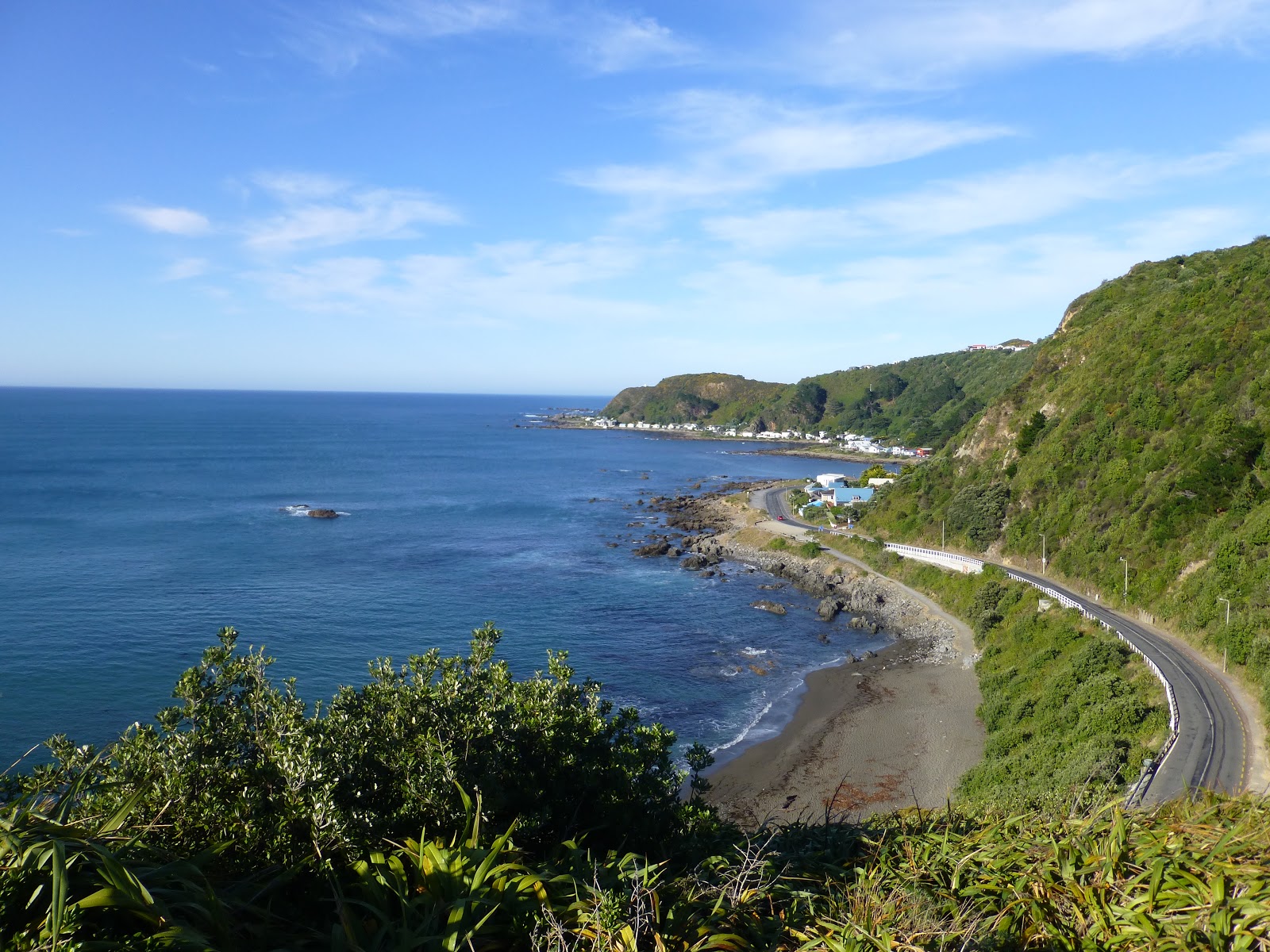
  Quietly sitting at the end of the Miramar Peninsular is The Oruaitu Reserve (formally Point Dorset) and for many people who drive around this coastline they will not as much as give it a second glance.
 There is nothing that really stands out that shows how nuch history there is on this small section of coastline.
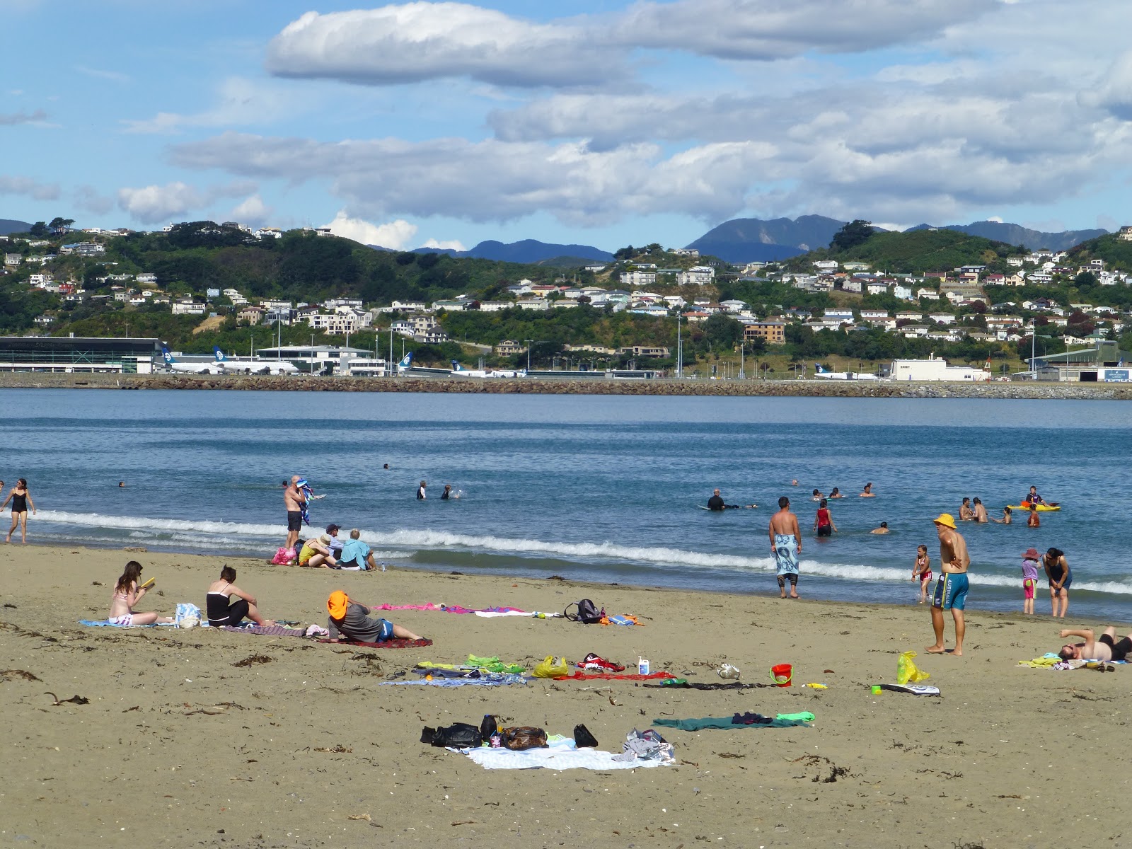
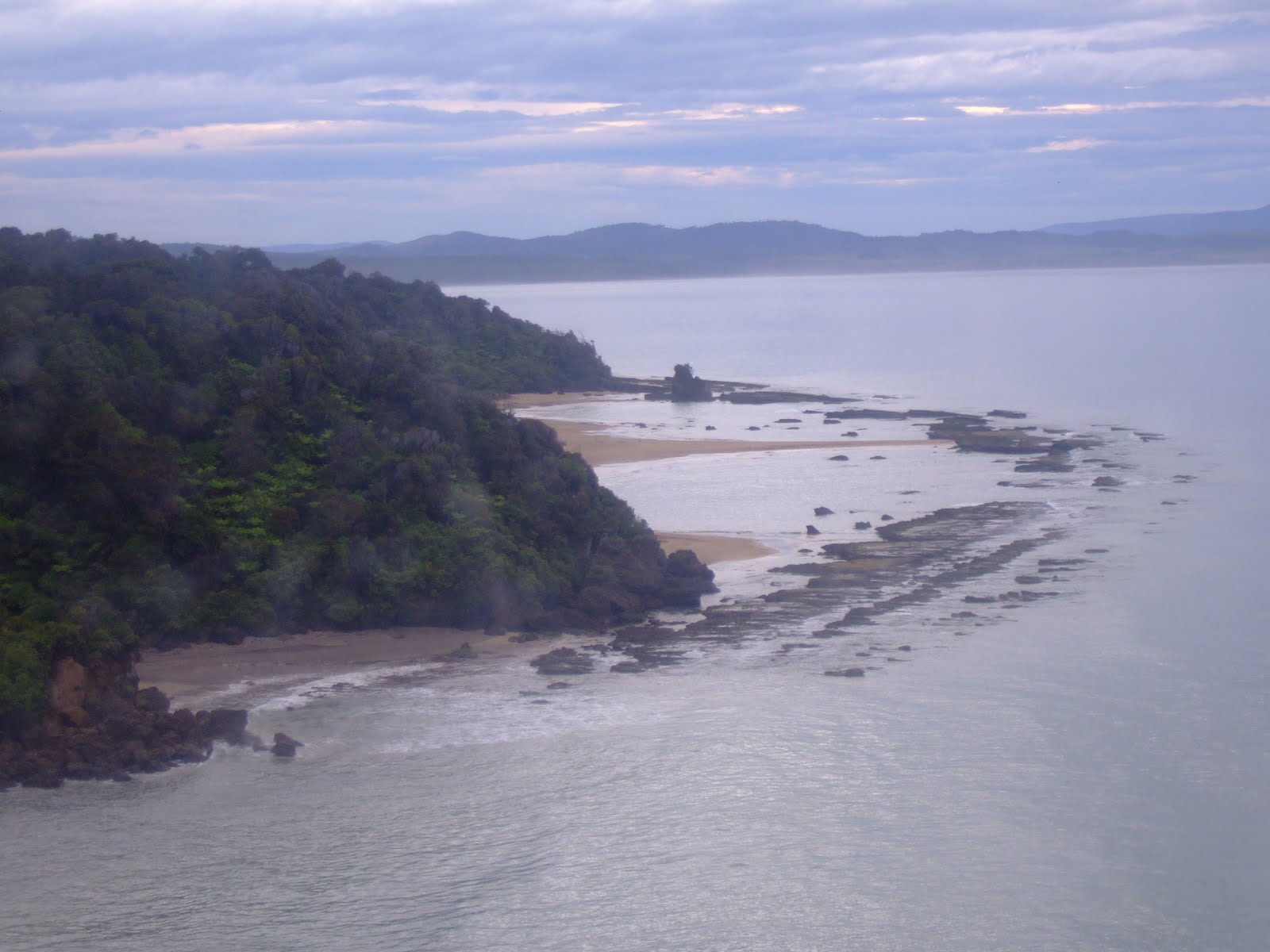
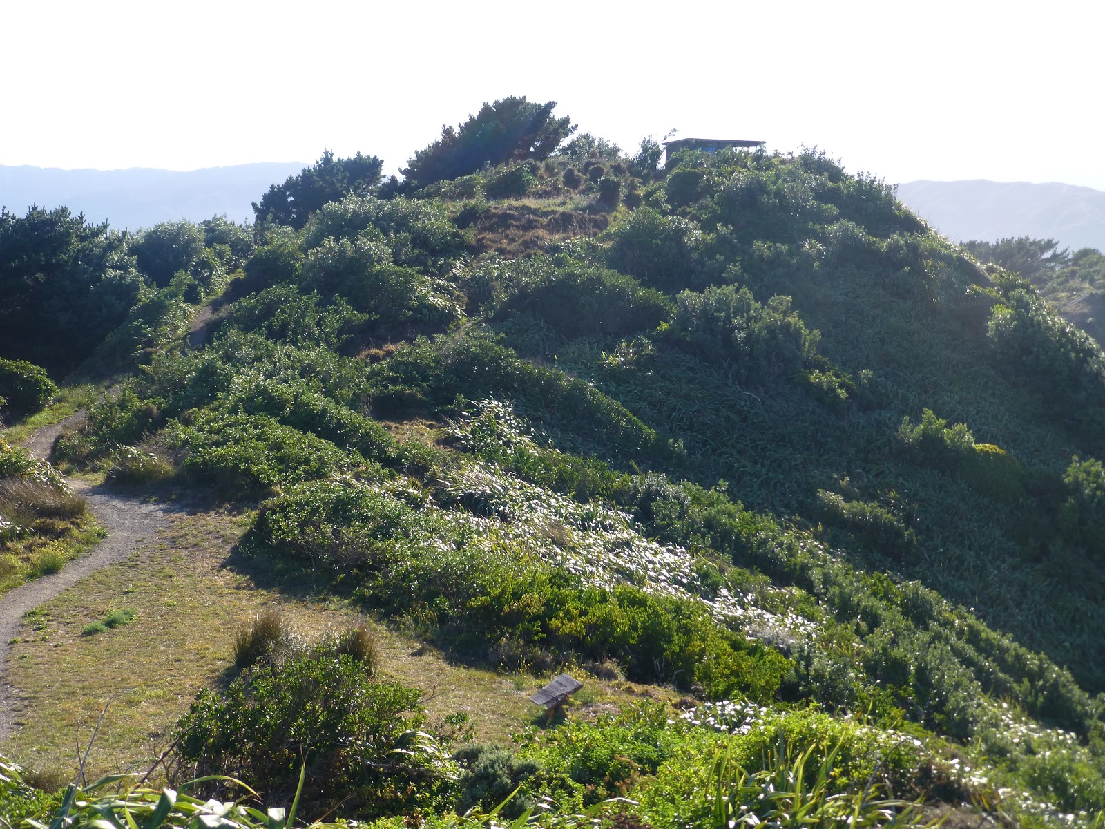
 Oruaitu Reserve sits proudly above and between Seatoun with great views of Wellington Harbour on one side and Breaker Bay with views of Pencarrow light houses,the Cook Straits and if you are luck you may  even catch a glimpse of the South Island.
 The reserve extends up a small ridge from Churchill Park in Seatoun and covers the headland over to Breaker Bay.

 A  Brief History:

 The first resident in the area was James Coutts Crawford  who bought the deeds from the NZ Company in the 1840’s, who then  established a quary to the west of Breaker Bay.
 Point Dorset itself was named afer a early European settler called Dr John Dorset who was a local politician and surgeon
 As the point sat above the entrance to the harbour it was used by both the Maori and the Euopeans tp protect the entrance.
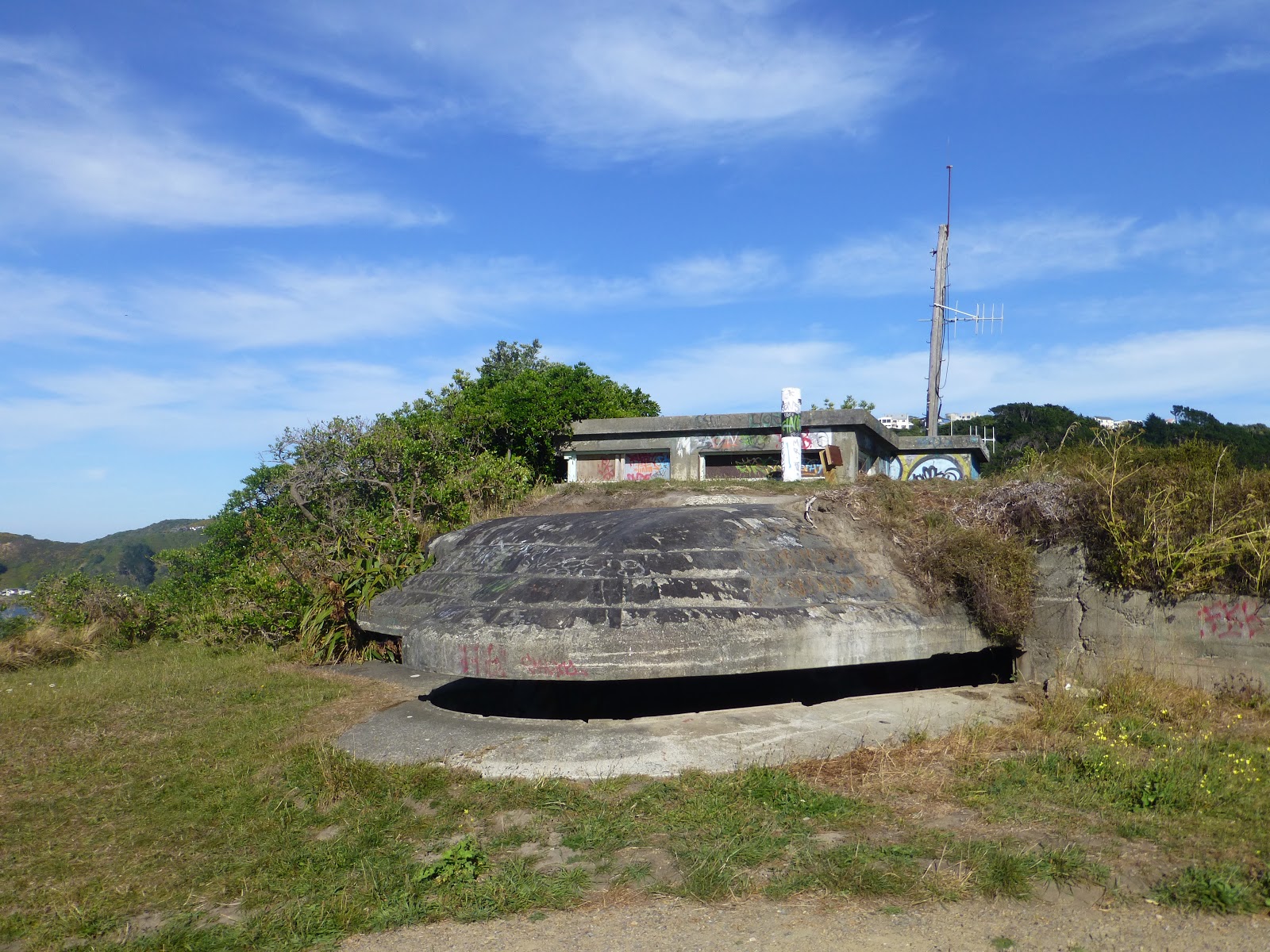
 During 1905 and 1991 the area was used by the NZ Defence Force as part of its coastal defence and training.

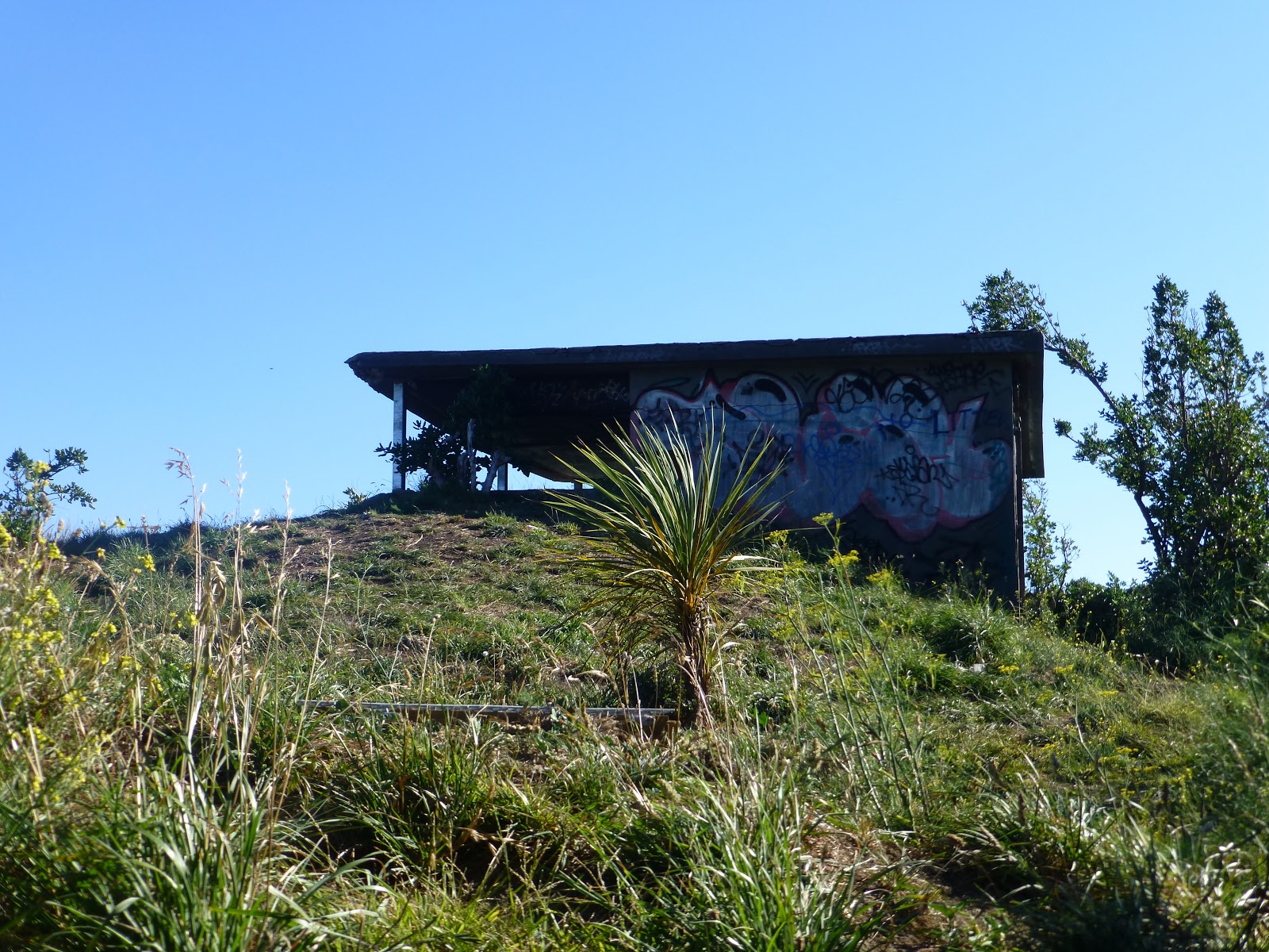
 Remains of the military bunkers and assorted building can still be seen and these can be explored giving a idea of what the military were living and working and why this area was well suited for the purpose.

 In 2000The Department of Conservation took over the management of the coastal so that it could protect the access for the public as well as the historic and the eco system.
 Then in 2009 the area was transfered to the Trust via the Port Nicholson Block as part of the Clains Settlement Act 2009.
 Wellington Council took over the control and management of the land as a Recreation Reserve ( section 26 of the 1977 Reserve Act)

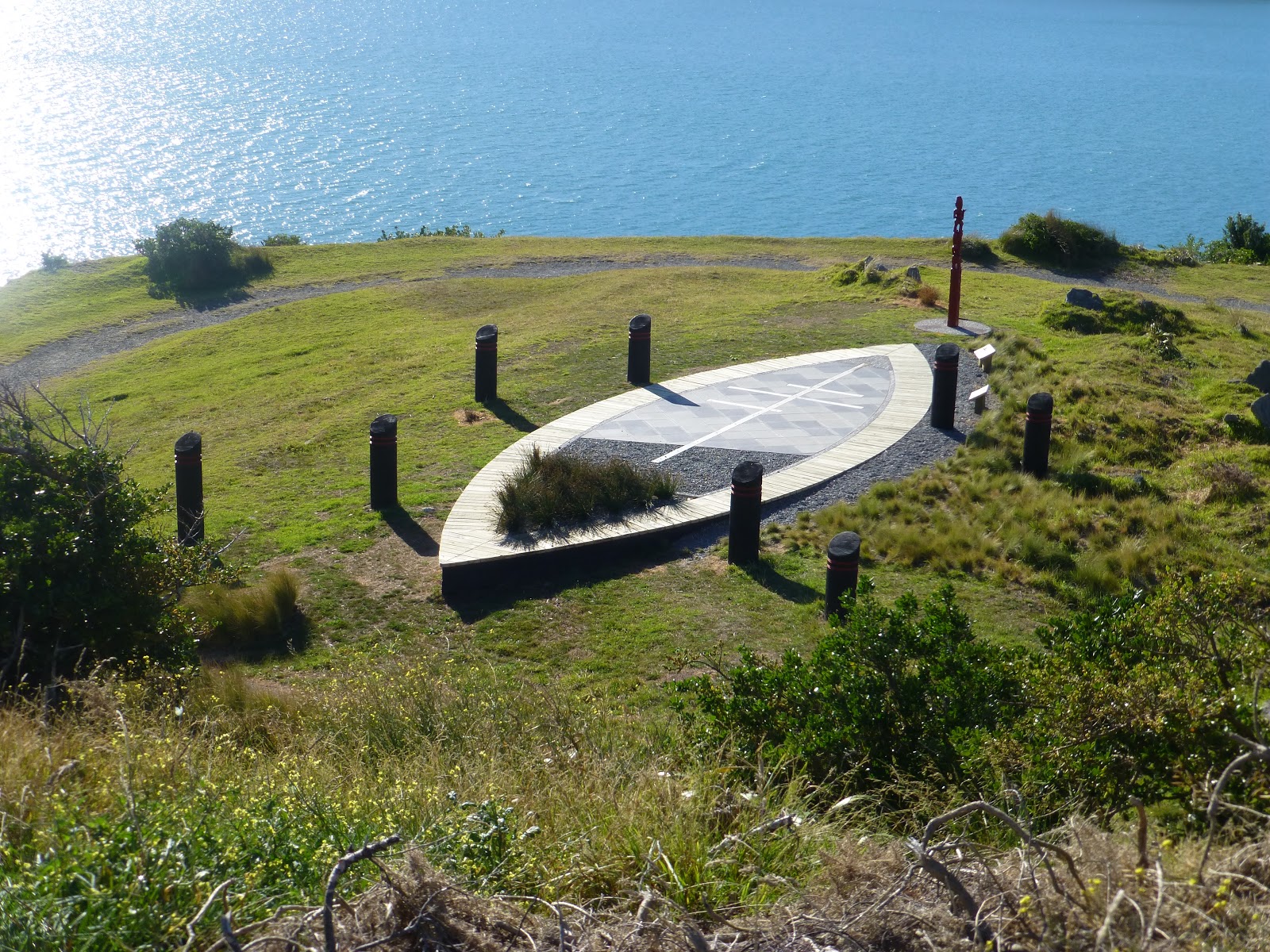
 Note: The Reserve has a cultural and spirituallu significant to Taranaki Whanui and contains a old Oruaiti Pa.


As part of the improvements to the area a grant of $400000 from the Plimmer Bequest Fund which helped to upgrade the tracks, install steps and signage.


 Some 3000 plants were also planted by  mayor Celia Wade-Brown and volunteers in June 2012 as part of Arbor Day followed by another 2000.
 Also part of this upgrade work was done to improve and protect the habitat of the Little Blue Penquins that breed in the area.
 The Oruaiti Reserve is one of only a few sites on the coastline of Wellington that is not containtained by roads or sea walls. This haelped many native plants including Pingao and the thick leaved Mahoe to survive.
 The track signage is to help maintan the plants and the remaining dunes that surrounds the area.

 The centre piece of these impovements was the installation of a 17 metre long Waka structure which symbolises the arrival of a Waka into Wellington’s Harbour.


 A dawn blessing was conducted on Wednesday 21st November at 06.00am to celebrate the completion of the new walkway and other work on the reserve.


  Take care around the reserve as it is exposed and the cliffs are steep and dangerous.

 Getting There:
 There is parking in Seatoun near Chrurchill Park and also in Breaker Bay. Both have access to the Reserve and are well signed.
 The #11 bus from Wellington via Kilbirnie to Seatoun. The last stop is near Churchill Park.

Oruatiu Reserve Map
Port Dorset Management Plan.

Taranaki Whanui.

Waka

Metlink Timetable.

Military History
james/wildbaynz/windyhillflying club.

Out There in Wellington: Newtown Fair 2013

A Short History.

 It was back in 1997 that the Carrara Park Carnival moved to Riddiford Street as part of the celebration for the tree planting and street improvements.
 The Newtown Street Fair was so successful that the local Residents Association continued to run the annual event.

 The same people have been planning the event with many volunteers helping which have made the event as popular as it is. It is also the largest event of its type in New Zealand.
 Back in 2008 no fewer than 2008 a crowd of 60000 attended and a staff of 132 help to keep the day running smoothly.

 The even is not for profit. The aim has been to showcase Newtown and its community. Any money made from the event goes towards all future events

 Many months goes into planning which involves everyone from the Council, Business and those living in the area.

Newtown Fair 2013 3rd March 2013

   Although cloudy it was a wonderful 18c. By lunch time Riddiford Street and the side streets were humming.

 The streets were full of people enjoying the weather and all were taking time to check all the stalls out and tasting the food and drink that were on offer.

 The stalls were selling a wide selection of goods including clothes, hand made goods, pictures as well as food.
 The local shops and restaurants were also open providing them with the opportunity to showcase their wares.

 The different sound stages gave different groups the chance to show their skills to those who attended. The most popular interms of crowd was the main stage when Newtown Rocksteady who got the crowd up and dancing.

 A lot of different street preformers were out and about entertaining the crowds as they walked between the streets and stalls.


The Box of Curious Delight produced a smile to all those that took a look.
Otherwise there were the Storm Troopers and a man on a bike with a portable music device or people blowing bubbles.

                                                                                            
 Even the MC of the main stage got into the grove whilst Latin Aotearoa was on stage. Even a couple got up to dance away.

 Even if the locals did not want to take a stroll they could enjoy the event with a birds eye view
james/wildbaynz/windyhillflyingclub.

Out There and Behond: Lower Hutt’s Artesian Water.


 Back in September 2012 a new Fresh Pure Artesian water fountain was opened in  Lower Hutt. It is complements the original one located on the junction of Jackson Street and Buick Street in Petone.
 In every way the design differs. Where the Petone Site has Sculptures to represent water vessels the one in Lower Hutt is minimalist in comparison.
 It is located at The Dowse Square and is located of Laings Road, Lower Hutt.

 A large concrete square is the main feature with the section running along the main road being planted within water, then on the opposite side are planted grass squares and trees.


 On one of the 2 remaining sides is the Dowse Museum and the 4th side is the I-Site and a water sculpture.


 There are 4 points of collection which are located either side of the path that enters from the main road.


 Any run off from people filling up their containers goes back into the planted area therefore keeping the wetland planting well watered.
A Brief history of Artesian water:

It takes around a year to filter through the Hutt Valley aquifer, sourced from a bore to 40m underground.

Water from the Hutt River starts to flow underground around Taita Gorge. From Melling southwards, the water becomes naturally pressurised beneath a layer of hard clay. This pressurised zone, the Waiwhetu artesian aquifer, stretches as far south as the harbour. It is estimated to be up to 70 metres thick at its western edge against the Wellington fault line, and 20 metres thick at the eastern edge of the harbour. The pressure in the aquifer has resulted in several fresh water springs in the harbour floor. Water takes more than 12 months to pass through the aquifer to our wells and is naturally filtered while underground, making it free from disease causing micro-organisms.

Petones Artesian Blog.

Hutt City FaceBook Page

New Dowse Museum

james/wildbaynz/windy hill flying club

Out There in Wellington:Hidden Art: Looking and Listening for the Sea

  This piece is located in the Lady Norwood Begonia House in Wellingtons Botanical Gardens.
  The piece was made in 1992 by Paul Dibble and was donated to the Botanical Gardens by Sir Frank and Nola, Lady Holmes and was installed in its current location in November 2010

 The Piece shows a mermaid who is listerning to the sea through a shell. Also with the sculpture is a rabbit which is there to even the sculpture out.

 The piece has been placed on recycled Kauri and a telegraph pole pedestal made from Jarrah.

Paul Dibble  Info on Paul Dibble
Wellington Botanical Gardens   All things Botanical Gardens
James/wildbayNZ/windy hill flying club.

Out There in Wellington: Wahine Memorials

  The Wahine disaster happened on 10th April 1968 when the Wahine a ferry operated by the Union Steam Ship Co. which ran services between Lyttelton and Wellington,  capsized on Barrett Reef near the entrance to Wellington Harbour. 53 people lost their lives out of the 733 passengers and crew that were on board at the time.

  Located around Wellington are 3 main sites where a memorial is located in memory to the tragedy that occurred.

  The 2 main locations are either side of where the sinking occurred.

 The 1st one is in situated on the outskirts of Eastbourne opposite the Bus Barn terminus. The site overlooks the Seatoun where the other main site is located.

Eastbourne

 The Eastbourne memorial was unveiled on April 10th 2010 and includes on of  masts that were salvaged  from the Wahine. Also there are wooden structures that give the feel of a wooden sailing boats, and the whole area has been planted with native plants.

Seatoun Memorial Garden

On the other from Eastbourne is the Seatoun Memorial Gardens. It is located in Churchill Park overlooking Wellington Harbour and also looks towards the Eastbourne Memorial.

 To celebrate the 40th anniversary on 10th April  a silver link was added to the chain.*

 It has a nautical theme and it includes a anchor that was salvaged from the Wahine.


Wahine Memorial Park
 Located around the coast between Seatoun and Moa Point and located near the Turkish Memorial is another Memorial Garden. The garden sits on the coast looking out to the Cook Straits with the harbour entrance to the left and the South Island to across the horizon and on a good day can been seen to the right of the garden.
 The area is simple and bleak and through out the year can show the different conditions that the Cook Straits can produce.
 Located in the area is a propeller that was also salvaged from the Wahine.
Frank Kitts Park
 The second of the 2 masts that were salvaged is located at Frank Kits park over looking Wellington Harbour. 


Newlands
 Sitting behind Newlands Shopping Centre is a anchor that came from the Wahine.


 Getting to Eastbourne requires a pleasant drive along the water front through Petone and then along the coast to The Bus Barn on the outskirt of Eastbourne. It is far as you can go.
 If you do noy have a car then the 83 bus from Wellington will take you all the way to The Bus Barn which is its final stop.
 Access for either the Seatoun’s Churchill Park or the Wahine Memorial Garden by car can be via Shelly Bay or from Lyall Bay via Moa Point. The coast road starts/finishes at either end of Wellington’s Airport. 
 The # 11 bus will take you all the way there and stops not far from Churchill Park. Seatoun is the final stop before it heads back into Wellington.
Updated 19/02/2013
Updated 11/03/2013 *
*Thank you to Interislander for correcting the details of the operator at the time.
Updated 10/04/2013

james/wildbaynz/windy hill flying club

Out There and Behond: Wellington’s Hidden Art: The Doo Doo’s

This piece was created by Peter Kundycki in 1998. It sits on the south coast of the North Island between Moa Point ( nr Wellington Airport) and Tarakena Bay ( below the Turkish Memorial: Ataturk Memorial)
 It has been given the name of The Doo Doos  before the sewage treatment plant was constructed at Moa Point the raw sewage was piped out into the Cook Straits and the stones reminded the locals of what was seen floating out and around the area.


 The only way that you can see the piece is either by car where you can park near by or walk from Lyall Bay passing underneath the southern end of the airport, or you walk the Eastern Walk Way which will take you by the sculpture.


 Take time to enjoy the great views that this coast line has to offer.

Eastern Walk Way.  A brief details on the walk.

James/ wildbaynz/windy hill flying club.

Island Bay Beach; Beach needs love and Care


 A letter was published in this weeks edtion of the Wellingtonian 7/02/2013 ( A free news paper that covers the Wellington area of New Zealand

 In the letter the writer is concerned that the beach is not being cared for by the council. This includes the beach not being Groomed and also the writer states that there is “knee-high bird poo-ridden vegetation” and “rat-infested razor sharp rotting seaweed.” and with the number of “lovely summer days” that the area has had “where would people sit”.

 In the South Coast Management Plan 2002 (according to the writer) the beach is to be “managed for recreation  purposes which includes support for surf club activities,toilets and beach access”.

 The witer asks the question that the beach should become a beutiful clean beach. This would include all rubbish collected and sand scrapped of the walls and seaweed pushed out to sea.


   At Lyall Bay, although much larger that Island Bay, we do have seaweed, sand on the footpaths and roads as well as rubish.

 This has not stopped people coming from far and wide to enjoy what it has to offer. On many warm and sunny weekends the  beach is full of people from one end to another. These people will enjoy a few hours with their families. They share a picnic, watch the children swim or read a book.

 They also share the beach with surfers, swimmers 2 surf clubs out trainning as well as other enjoying the water to name but a few.

 A beach along the south coast will change from 1 day to another and from season to another. This will include some days finding a large amount seaweed, driftwood.

 The above does not appear to put people of. (time to time it is closed due to unsafe levels of bacteria) which does not people of for long.

 The Lyall Bay Coast care does a monthly clean up with the rubbish being collected by the council..

 The real question is should we try and change what happens on any given beach because it is not pleasing to the eye.

 It would be interesting to see what other people have to say.

Lyall Bay Coast Care Facebook Page

Lyall Bay Facebook Page

South Coast Management Plan

Lyall Bay 2013

Out There in Wellington: Hidden Art at Moore Wilson.


  Moore Wilson is located on the corner of Tory and College Street in Wellington NZ. So in many respects of the beaten track for those visiting Wellington.


 The pieces of art are located outside the main entrance to  its food court. Also you can fill up a 2 litre empty water bottle of pure Artesion Water for a Gold Coin donation.
 The water comes from a well that was sunk in 1923 to a depth of 497 and is called the Thompson Lewis Crystal Spring.
 The main raised goes to support local good causes including Wellington Free Ambulance and the WestPac Life Flight.

Moore Wilson  Companies main web site.

Thompson & Lewis Co  History of the Company.

Windy Hill Flying Club/ WildBayNZ.


NZ Surf lifesaving devastated by funding cut

Last month they were on top of the world – now New Zealand surf lifesavers are on their knees after a dramatic and unprecedented cut to their government-backed funding.
The sport has been hit with a massive $380,000, or 54 per cent drop in funding from High Performance Sport New Zealand (HPSNZ), jeopardising the Black Fins’ defence of their world title in France in 2014.
After winning the 2012 world championships in Adelaide in November, Surf Life Saving New Zealand (SLSNZ) high performance manager Brad Edwards had been hoping for an increase in his campaign budget for 2013-2014, given the next world championships are in Europe and the challenge of defending the title against the wounded Australians.
Instead, he’s watched his funding cut from $710,000 to $330,000. Crucially, SLSNZ’s entire PEGs (athlete performance enhancement grants) eligibility has been eliminated completely.
“Our agreed goal with HPSNZ was to win the world championship and we not only achieved that, we did it in style, beating Australia on their own sand by more than 80 points,” Edwards explained. “We’re definitely hurting after this announcement. We are world champions, we’ve delivered the outcome HPSNZ invested in and we simply do not understand what’s changed.”
While surf lifesaving is not an Olympic sport, SLSNZ was hoping to fulfil HPSNZ’s goal of “winning at world championships in targeted non-Olympic sports.”
HPSNZ chief executive Alex Baumann understood surf lifesaving’s frustrations but said they believed prioritising targeted sports was the best formula. He also said it was imperative they restructured the way they handed out PEGs because the previous system had seen costs jump from $4 million to $7.5 million and this needed to be aligned with targeted sports.
“In the end, there’s only a limited pot and, as you go through the targeted sports and go to the campaign sports, it’s a tumbledown approach,” he said. “In the end the money runs out. Obviously we are still giving them money over the next two years so it’s not like they aren’t getting anything from us.”
Surf lifesaving has proved a good breeding ground for sports such as kayaking, swimming and triathlon, which are Olympic sports.
Of the 2012 London Olympic team, swimmers Natasha Hind, Dylan Dunlop-Barrett, Andy McMillan and Steven Kent are all current club members, as are kayakers Erin Taylor, Lisa Carrington, Teneale Hatton, Steven Ferguson, Darryl Fitzgerald and whitewater slalom canoeist Luuka Jones. Andrea Hewitt was also a surf lifesaver before switching to triathlon.
The sport of surf lifesaving is also unique in that it provides a key recruitment and retention tool for volunteer lifeguards who patrol beaches and prevent drowning across New Zealand every summer. There’s a concern within SLSNZ the flow-on impact of a reduced high performance programme could affect all New Zealanders.
“We’ve got an incredibly supportive and loyal membership who were delighted at finally capturing a world championship just last month, sharing the jubilation of the team,”
SLSNZ chief executive Paul Dalton said.
“Unfortunately, the very nature of our movement means our members also share the pain and this funding decision will affect all our members, whether they have ambitions to represent their country or whether they’re training to help save more lives on our beaches and waterways.”
In contrast, Australia, having lost the world title for the first time since 1998, are likely to get a boost from the Australian Sports Commission and Surf Life Saving Australia’s role in producing Olympians has been recognised by an Olympic feeder programme called The Next Wave.
“We’ll be struggling to retain our world champion athletes who did such an incredible job in Adelaide and that would be disastrous, not only for them, but also for the next generation of surf athletes coming through,” Edwards said.
– APNZ

Stump the Hump.Tuatapere Hump Ridge Track


Please join us for our  3rd annual Stump the Hump event. This event is an annual fundraiser for the Tuatapere Hump Track Charitable Trust and all proceeds go towards the Tuatapere Hump Ridge Track and the community of Tuatapere.  The Tuatapere Hump Ridge Track is a privately operated track run for and by the community of Tuatapere. Get a group together or come by yourself and join in on all the fun!
About Stump The Hump
Stump the Hump, to be held on 1-2 February 2013, is a 24hr walking event aimed at endurance sportspeople and adventurous trampers. Participants are challenged to experience a day in the life of the Tuatapere Hump Ridge Track and walk the entire 55km loop track in a single day. Starting at midnight on Friday 1February, they will walk through ancient podocarp forests at night and reach the sub-alpine Okaka Lodge in time for hot porridge and to watch dawn break over the Takitimu Mountains, Stewart Island and the Southern Ocean. From there they will walk down the Hump Ridge, travelling through ancient beech forest as the sun rises and arriving at Port Craig Lodge in time for lunch. They will finish with an afternoon/ early evening stroll along Bluecliffs Beach. Stump the Hump is not a race and encourages participants to have fun with frequent check points, each with a different theme and fun energetic volunteers. 
This unique event has gained considerable momentum in its first two years and we are well on our way to hitting our 250 participant cut off mark in our third year. No similar overnight endurance walking event of its kind exists. Not just another Routeburn Classic or Kepler Challenge that appeals solely to the endurance running community: it is a unique, all inclusive, endurance walking event designed for adventurous individuals from all sporting backgrounds. Neither a race, nor a run – its appeal stretches far and wide and the opportunity to hike overnight and watch dawn rise over the Southern Seas will be, for many, a once-in-a-lifetime opportunity.


About the Hump Ridge Track

The Tuatapere Hump Ridge Track was conceived as an opportunity for generating interest in and increased tourism for the Tuatapere and greater Southland area, and has been introducing people to the rugged beauty of south west NZ since 2001. With only 5000 people allowed to walk the Hump Ridge Track each year ensures that each visitor a unique opportunity to enjoy the pristine Fiordland National Park. The track is maintained and operated by the Tuatapere Hump Track Charitable Trust, and we pride ourselves on continuing to work closely with local communities and businesses to create a truly local product. All profits from the track will be used to fund community projects.
Visitors tramping the 55km of the Hump Ridge Track experience some of the most diverse scenery in NZ. The ecological staircase in the Hump Ridge area, rising from sea level into the sub-alpine zone, displays an exceptionally rare pattern of plant communities unmodified by man or glaciation. 360 degree panoramic views of the Southern Ocean and the wilderness of southwest Fiordland are afforded from the top of the track at Okaka Lodge. Descending the Hump Ridge, trampers walk across the famous Percy Burn viaduct, the largest wooden viaduct in the Southern Hemisphere, and on to Port Craig, site of the most remote and technologically advanced sawmill in New Zealand at the start of the 20th century. 


For further info you can click onto one of the links below
Humpridgetrack Web Page    For all information and bookings  etc 
Humpridge Facebook Page     For sharing peoples photos and stories 
Humpridge Twitter Page   For realtime updates 

 Copyright Tuatapere Hump Track Charitable Trust/james/wildbayNZ