Yet with all modern buildings there is something missing. That is toilet roll holders. The toilet rolls are left on what ever there is.
World Oceans Day 8th June 2013. New Zealand
To celebrate World Ocean’s Day in Wellington, we are initiating a MAMMOTH beach clean up of Evan’s Bay along Cobham Drive. We do monthly small beach clean ups here but due to the overwhelming amount of plastic that gets washed up in the tides here, we need LOTS of YOU to make a real impact. It’s one of the easiest ways you can make an immediate difference to the environment. Every piece of plastic and rubbish you pick up, is one less piece that can end up wrapped around or ingested by wildlife. Take some time out of your day to come and join us. You don’t need to stay the whole two hours, even just half an hour or an hour would will make a difference. We meet at the carpark on the ocean side of Cobham drive right under where the planes land and take off. See you there!
Time is 8 Jun 2013 , 10:00 am – 11:30 am
This Oceans Day, come to Island Bay, to show gratitude for the abundance of Wellington’s beautiful southern coastline! Join the Society for Conservation Biology – VUW Chapter to celebrate this year’s World Oceans Day for a beach clean up and a picnic. 11:00 am – 1:00 pm – Beach clean up Plastic gloves and rubbish bags will be supplied and the three volunteers who find the weirdest items will be rewarded! 1:00 – 2:00 pm – Picnic on the beach Please check our Facebook event to keep up-to-date:
For all the information for the above events and all the world wide events click on the ling below.
MATARIKI 2013;WELLINGTON. 26TH MAY – 7TH JULY
Wellington Events 24 – 26th May 2013
There are a number of events happening in and around Wellington over the next couple of days.
Take a nibble at the cooking or have a tipple at some of the drinks on offer. Look at the new or improved kitchen equipments or have a look at the demonstrations that are taking place.
This take place at the Westpac Stadium from 24th May to 26th May inclusive.
Africa Day/African Community Council. A celebration of 50 years of African Unity.
This take place at Wellington’s Town Hall on Saturday 25th May 2013, from11.30am to 23.00. Entry is free.
There will be loads of arts and crafts,live music,food stalls and lots more.
Finally to celebrate the 40th anniversary of the release of The Dark Side of The Moon (March 2013),The Pink Floyd Experience will be playing the album in full as well as other tracks at the TSB arena on Saturday 25th May.
Pretty good timing as there is going to be a fall moon over the weekend.
Enjoy the weekend.
* updated 24/5/2013
thanks to @cupoteacoast
james/wildbaynz
IRB Training at Lyall Bay 19th May 2013
Rubbish Dumping:Out of Sight, Out of Mind and Outright Lazy.
Located above Moa Point is Kekerenga Play Area,which is part of Strathmore.It has houses on two sides and backs onto a small area of Pine trees that heads down the side of the cliff for a short while.
It is easy to get to, either by car, walk or a short climb up some steps that starts from Moa point giving you some great views of Lyall Bay and beyond and if luck views of the South Island across the Cook Straits.
The path takes you to the edge of the tree area and what you then see is something that we all should be ashamed of.
Thrown down among the trees is a large amount of household rubbish,and looking at the amount it has built up over time.
All or nearly all have been bagged, not small pieces that can be dropped by accident or blown there when the rubbish is collected.
Premeditated it is and total lazy. Even the lone dustbin located in the play area is full of bags containing household waste.
As to the reason who knows, it could be people not wanting to pay to take it to the local refuge site (although the sites is heading that way) or unwilling to pay for the council refuge bags.
It is a great shame that there are people who feel the need to either use public bins for their waste or feel that dumping it is ok.
In the long time we all and those doing it end up having to pay for service to clean up after them.
As a country who proudly shout out that we a clean and green country it only takes a few to start damaging that image.
Those dumping need to take responsibility for their actions and the councils to deal with this problem by going through the rubbish to gather evidence. All it takes is for one or two be caught out for others to sit up and realise that it is not worth it.
james/wildbaynz/windyhillflying club.
The Ataturk Memorial, Tarakena Bay,Wellington
Located on the headland above Tarakena Bay between Lyall Bay and Seatoun, Wellington it commands views of the South Coast of the North Island, The Cook Straits and on a good day The South Island.
The site was chosen for its likeness to the area of the Gallipoli Peninsula and the memorial was part of agreement between the governments of Turkey,New Zealand and Australia.In return the Gallipoli peninsula was renamed Anzac Cove from Ari Burnu and they built a large memorial in memory of the troops from New Zealand and Australia who died during the Gallipoli Campaign in 1915 as part of WW1.
As part of the agreement New Zealand built The Ataturk Memorial and Australia built a memorial in Canberra.Both are in memory to Mustafa Kemal Ataturk who was a divisional commander at Gallipoli and later became the first president of the modern Turkey.
The memorial was unveiled on Anzac Day 1990 by the Turkish Minister of Agriculture.It was designed by Ian Bowman. Within the memorial there is a bust of Ataturk, a crescent made of marble and underneath is soil from Anzac Cove.
As part of additional work a paved area and path was built in 1999 and a parking area on the coast road. These were paid for by the Turkish Government.
Each year the text below is read out every year by the Turkish Ambassador on Anzac Day at the National War Memorial, Wellington. It is also inscribed on the memorial.
Those heroes who shed their blood and lost their lives, you are now lying in the soil of a friendly country. Therefore rest in peace. There is no difference between the Johnnies and the Mehmets to us where they lie side by side in this country of ours. You, the mothers who sent their sons from far away countries wipe away your tears, your sons are now lying in our bosoms and are in peace. After having lost their lives on this land they become our sons as well.
Each Anzac Day a wreath laying service is held at the memorial.Also the Wellington Company of the Wellington and Hawke’s Bay Battalion Group also holds a wreath laying service to commemorate the Battle for Chunuk Bair.
The memorial and the Rangitatau Reserve is maintained by the Wellington City Council.
Wellington Walks: City to Sea
A interesting walk that takes you from the Bolton Street Cemetery ending up at Island Bay on the South Coast of the North Island.
The beauty of the walk that is that it will take you through some of the older parts of Wellington with some beautiful old houses and some of the parks that for the Town Belt.
t.
From the quiet of the Cemetery you weave your way up through the Botanical Gardens experiencing the different plants that are on show, depending on time of year you glimpse something in flower or smell a scented plant.
At the top of Botanical gardens it will afford you views of the capital and its harbour. From the cable car you down through Kelburn Park and through Te Aro.
The first major park is Central Park which over the last few years has had some improvements to it. You slowly climb up following the stream until you come out of the park onto the Brooklyn Road.
Take a look at the Community Gardens after the short climb from Epuni Street.
Crossing the road will take you to the edge of Nairn Street park and onto Prince of Wales Park. The track continues along the town belt Passing through Macalister Park. You become aware of the Scottish connection with the hall that is painted with Scottish Dancers.
Macalister Park then becomes Berhampore Golf Course with their fairways and manicured greens. So take of the golf balls and if you see some one about to take a shot then wait until completed.The track take you around the edge of the course but there is one interesting sight of a small low bridge. The area was dry at the time but clearly could form a small area of wet land.
Following the track it will climb up towards the Tawatawa Ridge. Here there has been a lot of work to make the tracks wider and the climb a little easier. Also a lot of replanting has taken place. In the distance is a section that has some goats in. Yes the goats are being used to keep the area clear of vegetation.
When you get to the top of the ridge you then get a sense of the area. With Happy Valley to one side, The Coast and Cook Straits dead ahead and the Te Kopahau Reserve,
A very short climb to the top and the highest point of the walk(approc 200m) yoy get to see fully Island Bay,Owhrio Bay. Both Bays you can finish the walk at.
There are two points of interest at the top. One a large metal pipe that is used to tie up horses and a Statue. The Statue appears to be a Folly as those we did meet on the walk could not give any onfo to us about it. Also there is no information about its history attached to it.
Follow the ridge down made easy by some impressive woodern steps until you arrive at the end of Frobisher Street.
Follow the road and witha short climb to the top of the Oku Street Reserve. Here you get to see the Island that gives Island Bay its name.
The walk ends in Shortland Park. Here you then either can pick up your lift home or catch the #1 bus back into Wellington.
If you are feeling up to it there is nothing to stop you heading back into Wellington along the Southern Walk Way. You are able to see this across the valley.
Along the walk you will get to see sports fields that seem to crop up in the most unexpected places.
A good but easy walk that is just over 13km. You are able to do sections of the walk if you wish.
james/wildbaynz/windyhillflyingclub.
Wellington’s Life Flight Open Day 14th April 2013
Every 6 hours someone in the region requires the services of the emergency air service. For this service to continue it relies on funding from the community, either through individual donations( one offs or regular payments) sponsors such as Westpac,Wellington Airport and fundraising activities as the service is not fully funded by either the ACC or District Health Boards. One of these is the yearly open day held around April or May.
The operation now operates 24/7 and where possible in all conditions. During the earthquake in Christchurch they were involved in patient transfers to hospitals around the country.
A number of activities take place during the open day. There was a demonstration of the helecopter winching someone from the top of a airport fire engine, a display from the airport fire service showing the distance that the engine can throw its water or a display from the NZ Custom’s dog Unit.
.
Static displays included the Air Ambulance,(proved to be very popular),Police and Fire,Wellington Free Ambulance,Coastguard NZ,LandSAR Wellington,Wellington Regional Emergency Management Office,NZDF Bomb Disposal,Wellington Hospital Flight Nurses and Wellington Airport Fire Service.
There was also a chance to win a flight on the helicopter. For 6 lucky people this involve a short flight over Wellington.
But with any emergency service any thing could happen and it did when the helicopter was called out to a emergency. Within the hour it was seen heading to Wellington Hospital.
Note: In the end 2 emergency missions were completed during the open day of which one was to a car that had rolled on the Lake Ferry Road in the Wairarapa. The driver was flown to Wellington Hospital.
The 2nd call out was to the Hutt Valley.*2
Estimates give the figure attending were several thousands.*2
The crowds were large with many children enjoying the occasion as well as getting close up to the emergency vehicles as well as watching landing and take offs from Wellington airport (good views without looking through the terminal windows or the airport fencing).
A Brief History:*
On the 10th April 1968 Peter Button,a young plumber watch the rescuers struggle to save those on board the Wahine when it sank in the entrance to Wellington’s harbour. On that day 52 people lost their lives.
It was after that event that he and a friend founded Lifeflight.With the backing of a Wellington Businessman Mark Dunajtschik,they purchased a helicopter,learnt how to fly.
They worked closely with Dr Russell Worth a local neurosurgeon and they became involved in rescue work.
In 1981 the Commercial Bank of Australia (now Westpac) became involved in sponsoring the rescue helicopter, and that relationship continues to the present day.
In 1982 Peter received a OBE in recognition of his services to the community.Then 1987 Peter also received the Queens Medal for Gallantry, also his son received a commendation for brave conduct for the rescue of the crew of the Police Launch Lady Elizabeth 11 which had capsized in a storm.
A few days after the award Peter and 2 others died after clipping a high tension power cable whilst helping the police to search for a escaped prisoner.
* Information taken from Life Flights web page. A full version can be found on it.
*2 Updated 14th April 2013 @18.20. Information via Tweet from Life Flight
james/wildbaynz/lyallbaynz
Wellington Walks: Belmont Regional Park.Puke Ariki Traverse
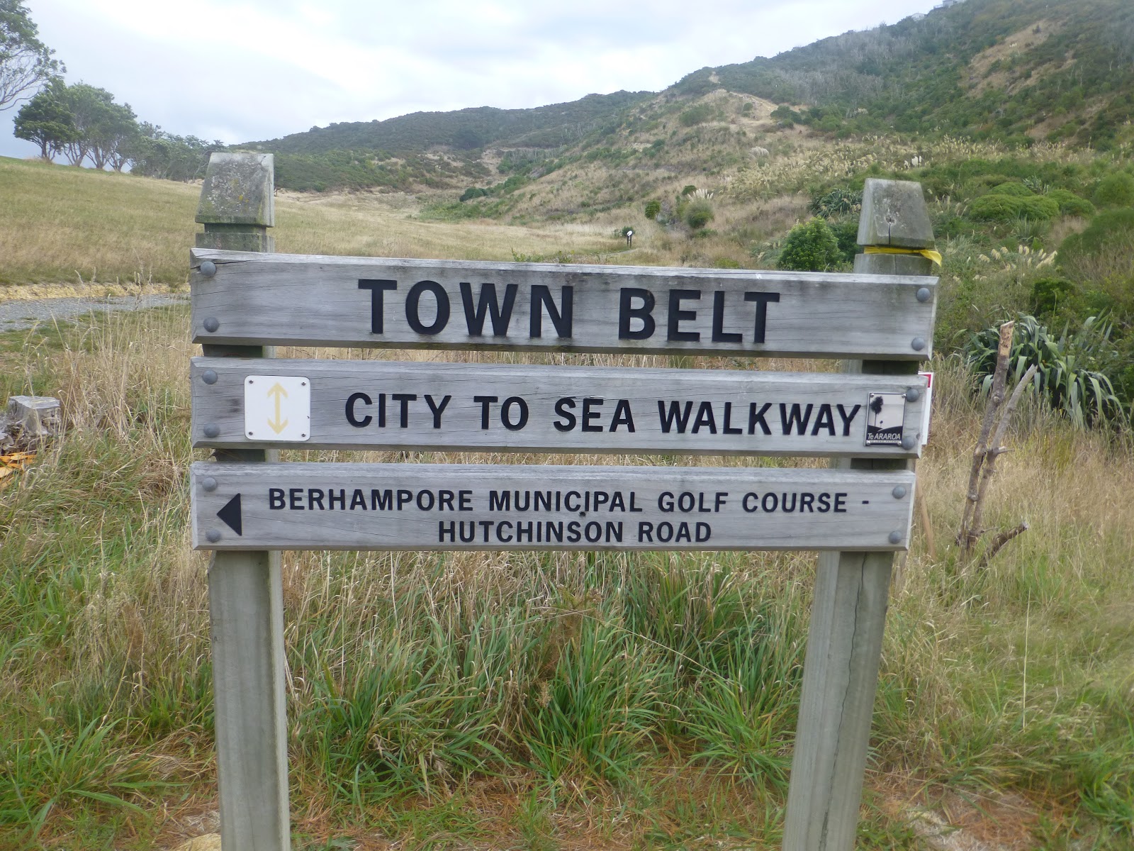
What do you get when you add the following Boulder Hill,Duck Hill,Dress Circle and Backed Beans Bend. With another 8 interesting names these add up to The Puke Ariki/Haywards Korokoro Traverse.(The Place of Leaders) It is a stunning walk that crosses the Belmont Regional Park in a almost a North/South line.
It runs from the Dry Creek entrance (near Manor Park) all the way to Cornish Street in Petone.
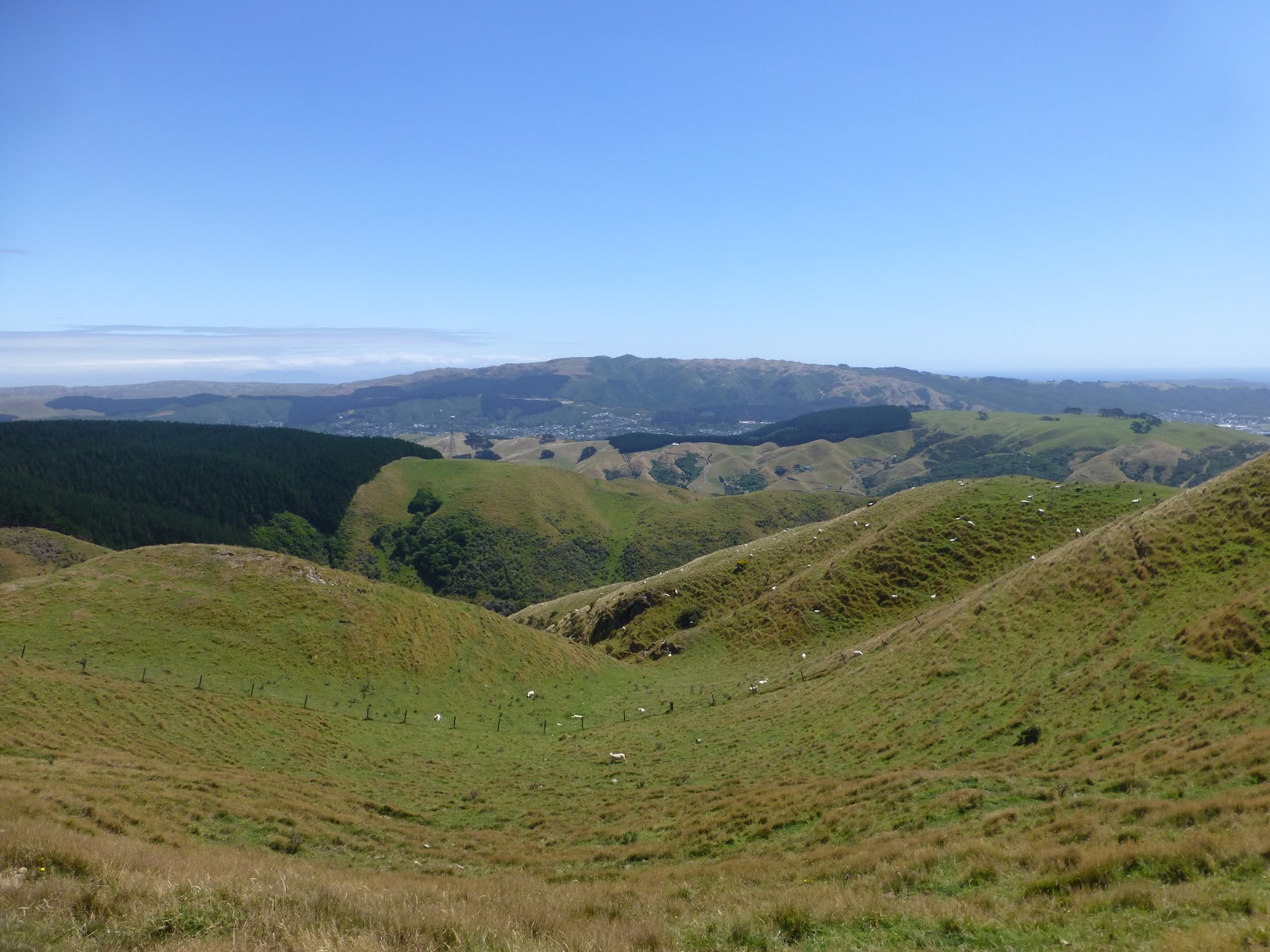
The views are absolutely breath taking and are well worth the climb of approx 200m from the Dry Creek car park. Walking through low scrub for the 1st part of the climb you come out to a grassy area where you get to see Boulder Hill and the exposed hill for the 1st time.
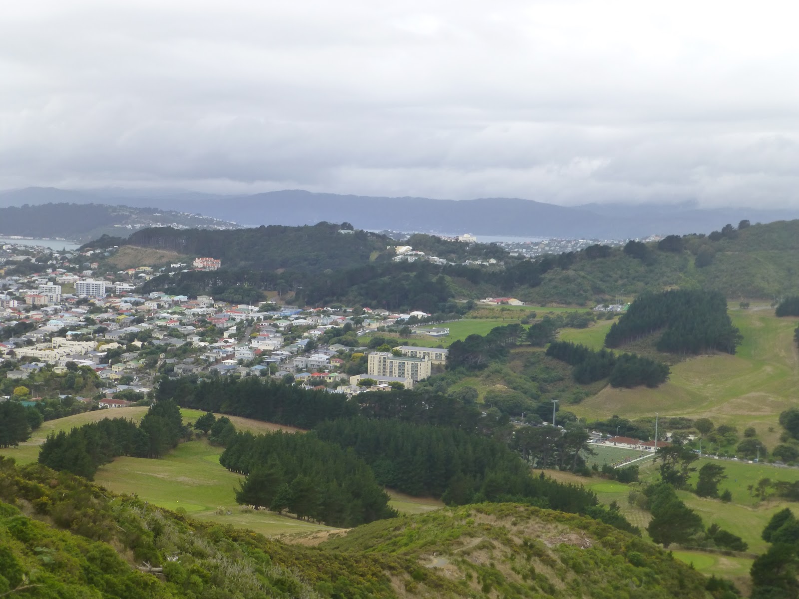
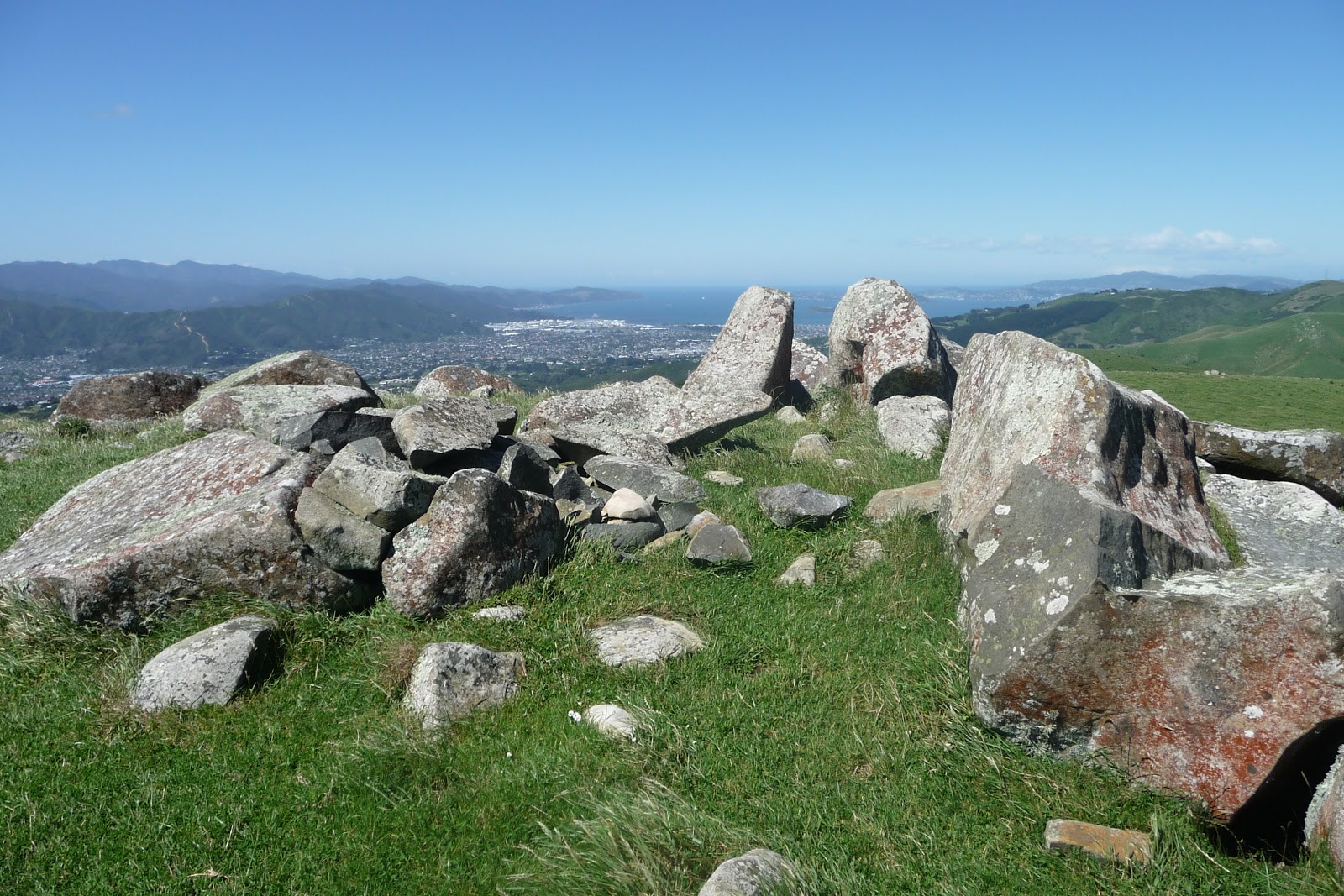
Each turn of the track gives you different views of Wellington and the Hutt Valley and with a continued climb you then cross over a fence and then you are on Boulder Hill surrounded by the boulders that gives it its name. Hang onto your hat here as if Wellington is blowing a gale this the place that you will experience the full effect of it.
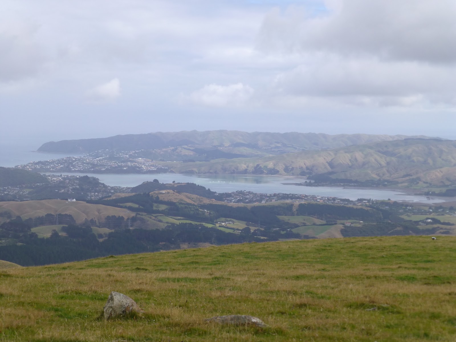
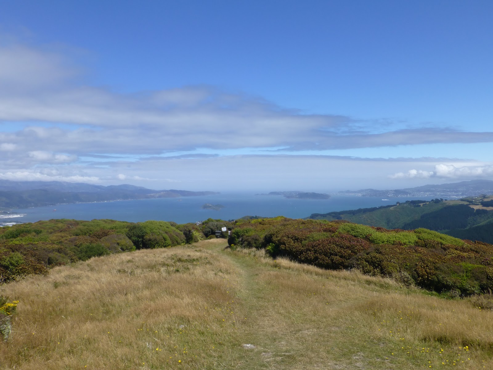
The views here give you a unbridled 360 views from The Hutt Valley to Wellington and its harbour and The East Coast with the towns of Porirua and Plimmerton.
From here if you look south you get to see the first of the 62 concrete explosives magazine buildings. These were constructed for the WW11 Pacific Campaign.It is said that from the air the buildings look like chicken sheds.
But (there as to be a but) its a long steep run down from Boulder Hill before you pick up a good gravel road called the Belmont Road. The road winds up and pass these building of which many are on private property but there are some that you can access and explore.
The road then takes you pass a gas station and continues the winding its way around until you come across some pine trees and on the left a radio mast.
From here you climb over the fence and cross the Airstrip. The track from here goes round or cross such places as Round Knob or the Dress Circle giving the continued views of the areas either side. The track at time follows the ridge line with not much room for error.
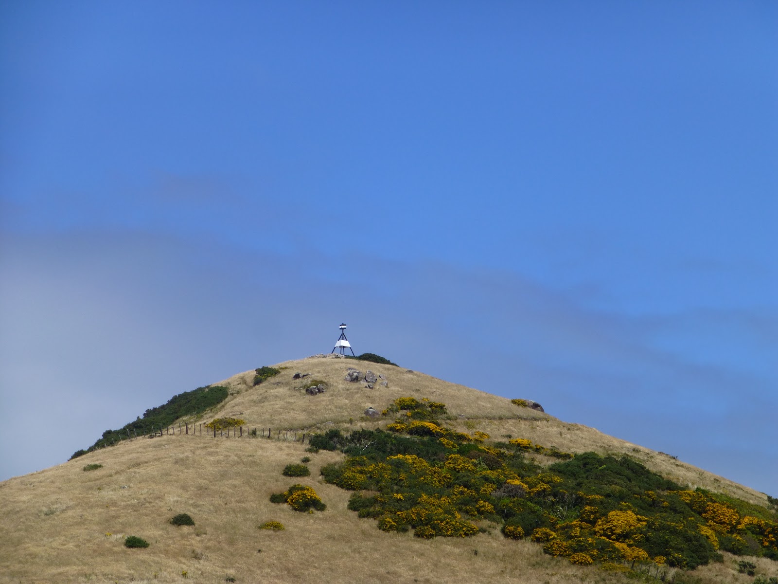
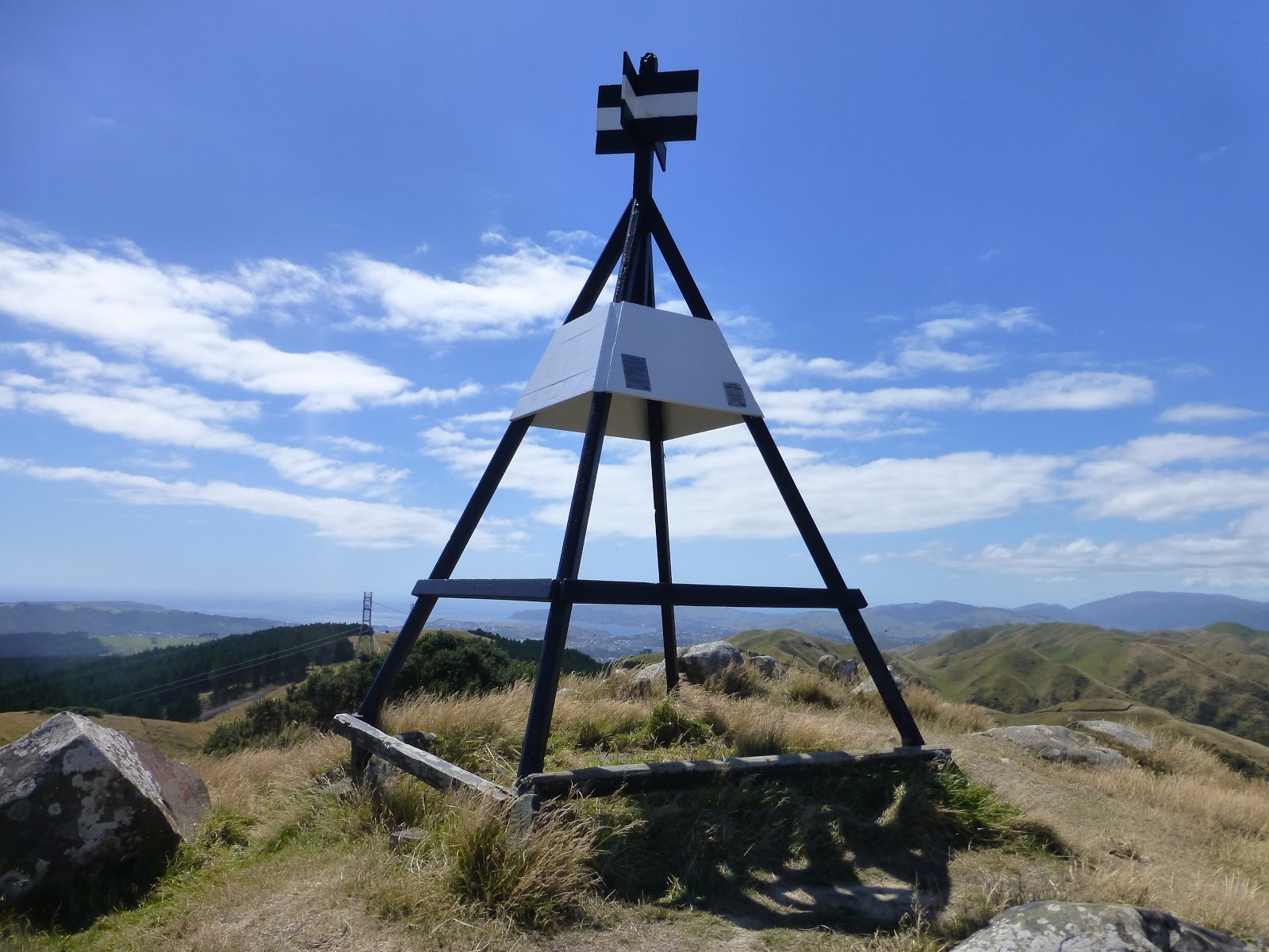
A while later you will see the Belmont Trig which at just over 400m is the highest point of the walk. Savour the views as there is nothing like it.
There are a number of options from here but if intending to complete the whole walk then looking towards Wellington there is a track which is steep in places called the Belmont Trig South. This track heads down until it meets a strangle named track called Baked Beans Bend. ( So names after when a large tin of baked beans that had a group of Scouts had exploded.)
This track follows a stream and it does involve at least 6 water crossing until you meet the track junction with Cornish Street track (right) or the Korokoro Dam track (left).
The Cornish Street track follows the stream wall the way to Cornish Street,Petone and will take around a hour.
If you are feeling fit and have the time take the track to the left and after about 20/30 minutes you will arrive at the Korokoro Dam.
The site of the dam was chosen in 1902 by The Petone Borough Council with completion in 1903. At the time the water was used by the Wollen Company. As part of the usage of the water a Small dam was built 3km from the main dam as a storage point for the mill.
The Dam was New Zealand gravity dam. It is 37metres long and is 8 metres at its highest point. In 1962 the dam stopped being used.
All along the track you will see evidence old pipe’s either appearing in the track or in the river.
You can either leave the park at the dam or head down to Cornish Street where you can access either the rail system and buses (Petone.) via Pito-one road to the footbridge to the rail station.
Brief Information:
The park covers 3500 Hectares and includes 1200 Hectares of Waitangirua Farm. It is located between Petone in the south and Manor Park to the north, which is just north of Wellington.
To the east of the park is the Hutt Valley and to the west is Porirua and the coast.
The park was opened in 1989.
There are a number of tracks that give access to the park so it can be explored in stages. The Traverse is 24km long and is a full days walk. Time is all dependant on level of fitness.
Important Information:
Ensure that you are prepared. Take plenty of water and food. Ensure that you take clothing for all weather conditions.
Let someone know where you are going and what time you are expecting to return.
Take a phone (fully charged). Most areas you will get coverage but there are some blind spots.
Getting there: Train to Manor Park then a 10 minute walk to the Dry Creek Entrance. Then at the Cornish Street entrance it is a short walk to Petone Rail Station via Pito-one road to the footbridge to the rail station.
Belmont Park Map Includes all the tracks and additional information. A copy can be picked up from
tourist information centre in Wellington.
Tracks NZ A very good site for all the tracks and maps and a break down of useful information.
Metlink Timetables Train and bus timetables
james/wildbaynz/windyhillflyingclub


