Out There in Wellington: Hikitia Crane

 The Hikitia Crane is a self propelled steam driven crane. It is reported that it is the one that is in working order.
 It was built in Scotland and has now been in Wellington for over 80 years. For the last few years it has been going through a major refit which is far of being completed.
 This work is being carried by a dedicated band of volunteers with the help of some great companies.

 It is currently located on Tarinaki Wharf, Wellington Harbour. It is not far from Te Papa, New Zealand’s national museum

 It also currently the oldest working example of its type in the world and is capable of lifting most things up to 80 Tonnes.


 There are occasions that it will be open to the public.


 The 2 links below has some further information including technical information.

Hikitia.com

Maritime New Zealand

James/ Windy Hill Flying Club.

NZ ShakeOut: Update 1


 There is now over 530,000 people and companies signed up for this event. Well done to those who have signed up, the target is 1,000,000, so if you have not now is the time. With 2 months to, go the target can be reached.
 It is important to understand what is required and to know what to do. Also it will serve as a reminder.
 The event take place at 09.26am 26th September 2012. It will be NZ biggest Earthquake drill to take place.
 This follows similar events that have occurred in other countries.
 Many of the biggest companies and government will also be taking part in this important event. Check if you company is taking part.
The most recent update is for those that have special needs including the blind and partially sighted. The link below will take you to that section.
 The main shake out web page is below:
ShakeOut     or   Getthru
 
You can sign up to receive updates and to register to take part.
For updates on the move you can sign up to the FaceBook Page or to Twitter.
NZ GetThru  FaceBook Page
NZ Getthru  Twitter Page
 Go for it folks

 Update: For a good source of information go to Geonet.You can follow on Twitter or Facebook, It is good source of the quakes in NZ with good tech info.The site also covers info on Volano’s,Landslides and Tsunami’s

james/ windy hill flying club

Makara Walkway:Views above the water

  Found this walk by accident a few years back when i had access to a car. Then it was a short visit to the village of Makara Beach  so had to wait until i had  the chance to borrow a car for the day.
 What took my breath away was the stark beauty of this small piece of the East Coast of the lower North Island. There are a  few houses that  are almost on the stony beach and  to one side a small river emptying  its water into the sea. To one side across the river are a number of batch’s nestling into the cliff with access by boat under normal conditions although it seems they can be reach by walking. Must be interesting to stay here when the weather is angry.
 Access to this area is best achieved by a vehicle from Karori, if biking take it easy as you head down the hill, its pretty steep and winding  in places.

 Take time to enjoy the drive as you pass the cemetery and then onto the village of Makara with its church and school (called The Model School). About 5 minutes late you are on the coast admiring the view.

 The walk is to the left as you look out to the sea. There is a very good map with details of the  walk and other useful information.
 The walk can be done as a circular one or as a same way return. Follow the well defined track for a while until you come across a sign. Follow the directions for the gun emplacements,this will take you up a steep slope where you will meet a few sheep. Take time to stop and admire the views. Follow the fence  and you will soon see the WWII gun emplacements which affords even more stunning views of the area and even Mana Island further north up the coast.

 You can also visit an ancient  Ngati Ira pa site on the promontory at the western end of Fisherman’s Bay.

 Once you reach Fort Opau you can explore what is left of the emplacements and maybe take a break.
 At its prime the fort had 2 6″ guns and housed around 100 men to man the area. The first gun was built late 1941 whist the 2nd was completed at the end of 1941 early 1942.

 It was decommissioned in 1943,strangely   before the war in the Pacific ended.
 From here you can either head back down the hill or follow the tack/road down to Opau Bay. This section will take you through a section of the Makara Windfarm.
 Once down at Opau Bay follow the coast keeping the sea to your left. Sections of the track still remain but overall it requires walking along a very stony/rocky beach but the effort is well worth it,
 If there is a high tide then this section may become difficult especially when you head back round Fisherman’s Bay.
 The coastal section you will come across a large selection of driftwood creating some wonderful images if you allow your imagination run wild.

 This is by no means a long or difficult walk but you will still need to be prepared for the unexpected. Warm clothing a must as well as water and food and a good set of sturdy footwear.

 The distance to the gun emplacements is approx  1.5km each way(2 hrs) or back via Opau Bay is approx 8km (3/4 hrs).
 The walk up to the Gun Emplacement’s is closed during lambing season which is generally Aug to Sept,although the coastal track is open all year round.

    Instead of heading back to Wellington  the same way, there is a interesting route not far from leaving Makara Beach. Follow the Makara Road until you come across a junction with Takakarui Gorge Road. At this point turn left and this road will take you along some wonderful valleys. Soon you will come across a junction, go straight over into Oharu Valley Road where you come out into Johnsinville. To your right you will see the radio transmitter on top of Mt Kaukau.

Please note: No dogs,camping,fires Mountain Biking or guns allowed.
 Makara beach is sheltered from the southerly winds but is very exposed to the northerlies. Care is required on any of the hill tops especially during strong winds.
 Prepare for all weather conditions,take water and food.
 Also let people where you are going.I found mobile coverage pretty good but let people know if you are running late.
 Keep any gate closed as there will be sheep around and respect any property around.

Useful Web Pages/Links.
http://www.doc.govt.nz/upload/documents/parks-and-recreation/tracks-and-walks/wellington/makara-factsheet.pdf

http://www.meridianenergy.co.nz/what-we-do/our-power-stations/wind/west-wind/

This was originally posted on 11th June 2012
James/ Windy Hill Flying Club.

: TE WIKI O TE REO MĀORI:Maori Lanquage Week

Profile picture
 This years Maori Language Week started today 23rd July and goes onto 29th July 29th. The theme this is ‘ To cherish the language’.
 
 The 1st Maori Language Week started in 1975 after the language was recognised as the official language of New Zealand. The 1st official language day was 14th September 1972.
 
 The idea of Maori Language Week is to encourage every to uunderstand the language and the culture the Maori’s have and use.
 
 It is not expected to be fluent but to have some understanding and be able to great at least in the language. The week provides a lot of information about where to find what is on,where to find courses etc and how to get involved.
 
 
 Facebook. This the official FB site.
 
 korero Maori nz A good source of info
 
James/ Windy Hill Flying Club

Out There In Wellington:View:Sculptures, Botanical Gardens

 For most people that visit Wellington, the botanical gardens is one of the place that they will visit. The trip on the cable car both ways often is the highlight.

 But within the gardens there are a number of secrets that may not get the attention that they deserve. The sculptures that dot the gardens are often overlooked.

 The main ones can be found on the Sculpture Walk that runs from above the Lady Norwood Rose Garden and completes a loop all the way back to the Rose Garden.

 There is also one that is near the Mariri Road Entrance which is near the Karori Road.


 From the Rose Garden you will see 4 plinths that follow the path up to the Herb Garden. These were designed by Regan Gentry and were 1st put on display outside Te Papa, the national museum. These were then acquired by the Botanical Gardens and have been on display since around 2010.
 The next one you will come across is the Peacemaker Sculpture. This was installed in 1991 and designed by Chris Booth.


 A short walk later you will come across the Listening and Viewing Device Sculpture. This was installed in the Gardens in 1993 and was designed by Andrew Drummond.
 Touch it or take a look from the bottom and view the sky.
 Then you will come to a interesting sculpture called Rudderstone Sculpture. On a bright day it will reflect the trees around it. Take a walk through the gap in the sculpture and see the different colour that the sculpture has to offer.
 This was designed by Denis O’Connor and installed in 1997.

 From here it is a longer walk along the track until you come across the Body to Soul Sculpture It was designed by Mary Louise Brown and installed in 1996.The Steps take you a gentle slope to a small hill with tress on the outside forming a circle.
 
 From here you head out of the trees into the open and head back down to the Rose Garden. On the way you pass the last major sculpture which is called  Inner Form which was designed by Henry Moore.  This was installed in 1988. Originally it was placed in Midland Park but was moved to its present location after it was vandalised on a number of occasions.

 The James Hector Memorial  is located near the West Entrance. This is in memorial of James Hector who contributed to the Botanical Gardens. It also marks the top triangulation point. This was opened in 2004.
 There are also a number of smaller sculptures around the gardens. All have information plaques near by.

James/ Windy Hill Flying Club.

Out There In Wellington: Peace Garden: Wellington Botanical Gdns.

For most people that visit Wellington, the botanical gardens is one of the place that they will visit. The trip on the cable car both ways often is the highlight. 

 But within the gardens there are a number of secrets that may not get the attention that they deserve. On of the secrets is the Peace Garden.
  New Zealand declared that it would become Nuclear free in 1984 and the legislation was passed in 1987.
    After the legislation was passed the anti-nuclear community  worked with the Japanese Anti-Nuclear campaigners of the time with the view to bring the Hiroshima and Nagasaki Peace flame to Wellington.
 This happened in 1994. The Peace Garden nests against a bank that is part of the Botanical Gardens Rose Garden. There is a small covered area with a seat. There is some information written in stone that gives a history surrounding the garden.
 On one side of the entrance is a piece of stone that came from Hiroshima.


 On June 25th 1994 the garden was dedicated by the Mayor of Wellington Fran Wilde and The Very Reverend Saga San, Abbot of the Toshogu Shrine, Ueno, Tokyo, Japan
James/ Windy Hill Flying Club.

Wellington Botanical Gdns: A Goldern Oldie.

 A Yellow rose plants  called Buccaneer has survived in its original state for 58 years and in the same spot. It has survived all that Wellington can offer from the cold and wet to the hot and sunny. Also it as survived all the pest and diseases that the rose world can offer.
 The Botanical has decided to replant with new stock as after all these years the plot and plant has seen better days.

The Rose was introduced to the world in 1952, this means that it appeared in the rose garden not longer after the rose was 1st introduced.
 It is classed as a Grandiflora Rose and will grow to approx 90/120 cm.

James/ Windy Hill Flying Club


Skyline Walkway :Wellington’s Walks.

 This is a stunning track and i believe one of the best that Wellington has to offer. This can be completed in stages or short loops or if feeling up to it it can be completed in one go.

  I have completed the whole track twice and about half of it on another. I have found on the best days that Wellington can produce it is stunning with some fantastic views of Wellington, its harbour and as far as Seatoun, the Miramar Peninsula and airport to the East, and to the West the Tasman Sea and at the Karori end of the track, Makara Windfarm and the South Island( if luck snow on the hills).
 On the other side i completed it with a misty/rain around and no wind at all  which gave a feeling of mystic of what you would come across at the last moment.

 The walk can be completed from either the Johsonville end of the track or from Karori. For me the best way is from Johnsonville.

 From Wellington catch the train to Johnsonville (end of the line). From here head to the Carmichael Street where you will pick up the start of the track. The walk from here is well marked and the track is well used. You will see signs to the Old Coach Road which was one of the 1st roads that connect Jville and Ohariu Valley.

 On the way up to Mnt Kau Kau will pass the Jville  Reservoir to the west and not far from here is the now disused outlet pipe from the reservoir.

 Continue along the track which will be signed posted to Mnt Kau Kau with its impressive transmitter. On the good days its a good point of view of where you will head to but on the days where visibility is not so good and if there is no wind you will hear the humming of the transmitter well before you see it.
 The transmitter was a replacement for the Mnt Victoria one which can be seen on the other side of the harbour

 The track will wind up and around some small hills but the last section to Mnt Kau Kau is short but steep.
 This is a great place to rest and take in the views,with a good viewing platform which give you the views Wellington. (strangle not so on the misty days)

 On both occasions at this point there were so few people around it was wonderful but those trail runners who came out of the mist and then disappeared into it again almost was something out of a horror film. Not sure if listening to “Calling All Angels” by the group Train made a difference.

 Take in the sounds and if lucky you may here some Tui’s having a conversation. Or on a misty day with limited vision you may find that you are being watch and there is a very good chance that you are by the herds of cows that graze in places.

 From here is one of the places where you can leave the track and head straight down to Jville.

 With the transmitter to your right you will see the ridge that you will follow. Follow the markers which takes you down the hill.

 The next section of the track heads above and around Ngaio until you come across a track to your left called Bells Track. If you wish you can take this to leave the Skyline and it will take you to Ngaio,

 Along this section of the track you will go round to the West of the hills giving you views of the valley below and splendid views of the Tasman Sea.

 The next track to take you off the Skyline will take down to Otari-Wilton Bush/Chartwell and  on to Karori.
 At this point you will head down hill slightly on a farm road which is called the Kilmister Tops. On your left you will pass a brick chimney like structure (almost like a large Pizza oven or fancy BBQ)

 Continue along the track until you end up on the Eastern side of the hill giving you views of the Karori valley.
 You will  start to loose height at this point.At Johnston’s Hill you will see Karori at which point you can also leave the track.

 The last section is not overly long. It will wind along behind some houses passing two Reservoir tanks.

 You will then enter a pine forest, which after its rained produces that wonderful smell of fresh pine.
 The track is still well signed posted and it will take you down through the pines until you end up walking through the Karori Park and Play area ending up on the Karori road. At this point you will be able to catch the # 3 bus back into Wellington.

 The track offers great views but by doing so there is very little shelter with no trees to offer protection until the pines above Karori or a few near Kilmister Tops.

 Other exit points also include Crofton Downs which follows a good motor track below the pylons.

 With a walk like this that follows a ridge line you have to be prepared for the hot days taking plenty of water, sun hat and suncream.
Warm or wet weather gear is also recommended as like any place the weather can change quickly.

 Also dogs must be kept on a lead, remove litter. Also there is no camping, fires or Mountain Biking allowed.

 Also please remember that the tack is made possible by the local land owners who have allowed access to their land. Keep to the marked tracks and close any gates that you need to open.Respect and be careful of animals that you may come across.
 Saying this, enjoy this walk because it is well worth the effort. Maximum height will be around 400 metres.

 The walk it self is approx 15Km long so depending on weather and the direction you decided to head allow around 5/7 hours.
 Let someone know where you are going and when you expect to be home, Mobile reception is good in most areas of the walk.

Click on the link for a map of the walk   Skyline Map. produced by Wellington council but it also can be picked up from the Tourist Office in Wellington.

 
Te Araroa Walkway

Also part of the track forms part of the Great New Zealand Walk Track Te Araroa Walkway  from top of the North Island to the bottom of the South Island.

Getting There: By Bus and or Train.
                          Train and Bus timetable.

 James/Windy Hill Flying Club

Wairaka WalkWay Keeping Close to the water:Walks Behond Wellington


This is classed as easy walk but it is long. It can be completed 1 way or you can loop back to your starting point.

I came across this walk by accident after looking at the map of the area for something else, it was then a matter of waiting for the right day.

That day arrived early March 2010 with a wonderful day dawning. A quick bus trip to Wellington Rail Station then a pleasant run on the train to Pukerua Bay. (Note that Muri Station is now closed).

Savour the view before you head down Pekerua Beach Road to Brendan Beach ( oddly enough the road name gives it away.) On a sunny day the views are stunning and on those odd days that are wild you can a true feeling what the West Coast can offer.

Either follow Ocean Parade or walk on the beach until the road becomes a tack. This is the last chance for a toilet break until Plimmerton .

The track follows closely to the water and is well used so easy to follow. Above you is the Raroa Reserve. Not to far along you go through a rock hole which clearly shows what nature can do with its power.
Continue along until you arrive at Wairaka Point,here you go through an strange gate made of wood/metal which seems to hangs from the rock.
Say hello to the goats if about. They may give you a good stare but they are all good.
At this point the track becomes rocky and there are areas where the track has disappeared but saying that it is still walkable.Care is required.

Along the way i came across a couple of spots where people have spent some wonderful evening enjoying the views as well as the peace and solitude.

Eventually the track ends and becomes a road.This made the rest of the walk easier. Not far from where it becomes a road is a quarry so care is needed. if walking it during the week but you should not encounter any traffic if its the weekend.

You will pass a building where someone has done some wonderful things with driftwood and wood scraps.

Continue along the coast road where you are afforded some great views of Onehunga Bay and The Titahi Bay area.(The Whitireia Park Reserve has recovered well from the scrub fire a couple of years back). Also you get a good view of Mana Island.

If you are planning to do the loop back to Pukerua Bay then just before Plimmerton School take a left turn into Motuhara Road,then a right into The Track. Taua Tapu Track starts at the end of the road. Follow this track which heads up to the hills where the views are even more stunning.You will drop back down towards the Taru Cemetery and the track follows between SH1 and the railway until you arrive back in Pukerua Bay.

If not planning to do the loop,continue along the road passing a marina until you arrive at Plimmerton Rail Station.

Just before the station you will come across a couple of cafes for a well earned drink or 2.

The main part of the coast track is not suitable for bikes.

Distance is around 17km for the loop whilst around 12km for station to station. I allowed myself around 4 hours for the 1 way walk, the loop would be around the same. Allow extra for stops or taking photo,s.

Good footwear is required plus food and water a must. Ensure warm/wet weather gear is carried as things can change quickly.
Also let someone know where you are heading and expected to return.

Originally published 24th May 2012
James/ windy hill flying club.

Red Rocks and Karori Light House: Wellington Walks


 By far, this walk from Owhiro Bay to Red Rocks (Pari-whero) along the North Islands’ South Coast must be the most popular walk in the Wellington area for familys and people of all ages, and i can understand why.

 For most people they will park their car at the visitor centre at the end of the Owhiro Bay Road which is about 2km from Owhiro Bay.
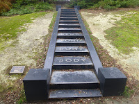
 Have a look at the Visitor Centre where there is some very good information about local shipwrecks and also the now not used quarry not far from the start of the walk.

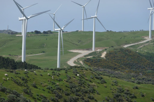
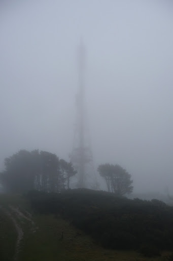
   The track itself  forms the edge of the Te Kopahau Reserve which covers the area above the coast all  the way up to the Brooklyn Wind Turbine and Happy Valley Road up to Brooklyn.

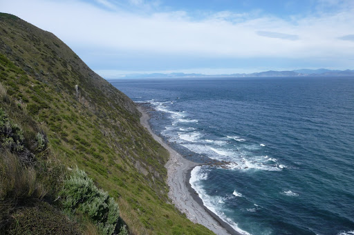
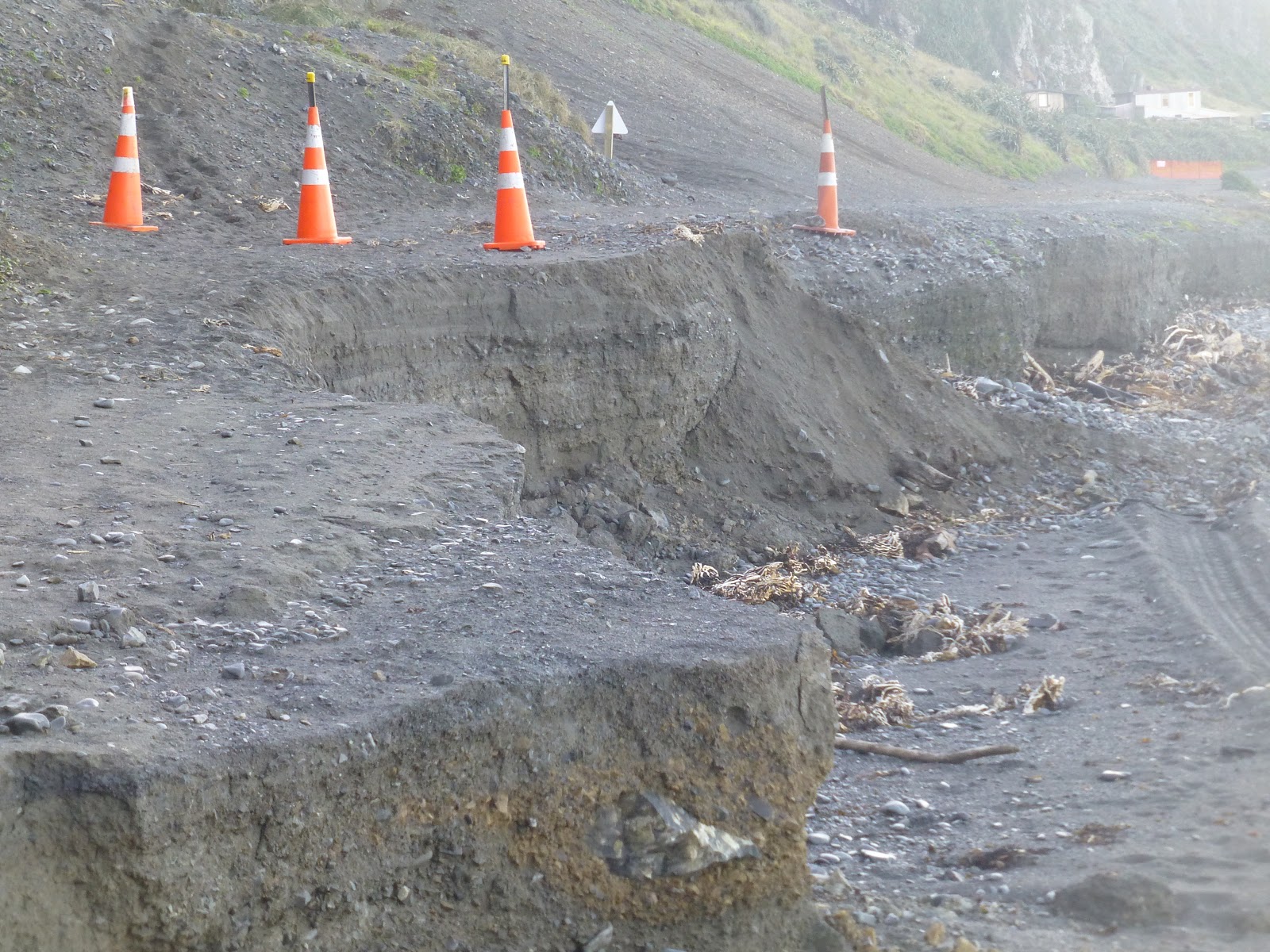
 The 1st thing that you will notice when starting the walks is the scares left on the cliffs from quarrying that was still in use a late as the 1990’s. The walking track is also used as a road for 4×4’s,trail bikes both motor and pedal power.

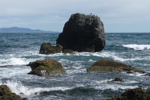
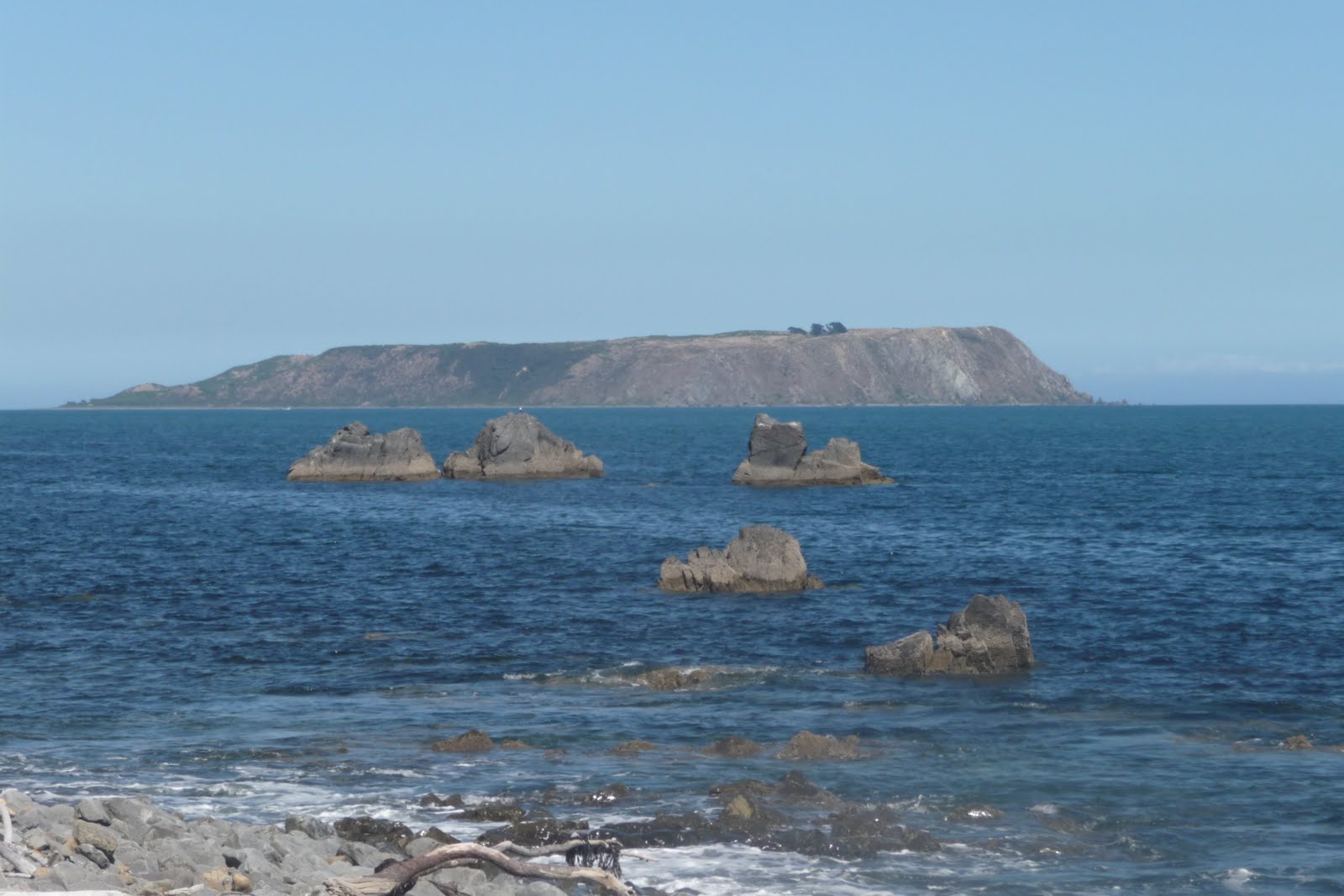
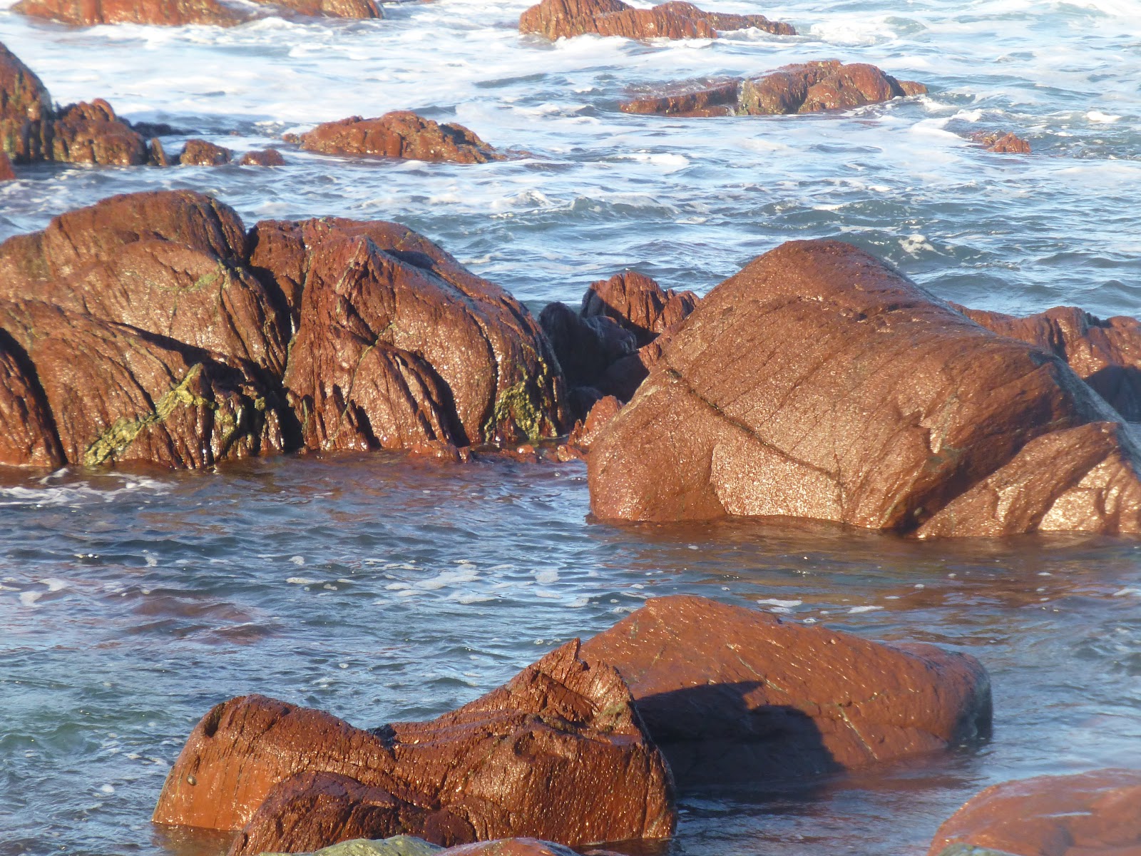
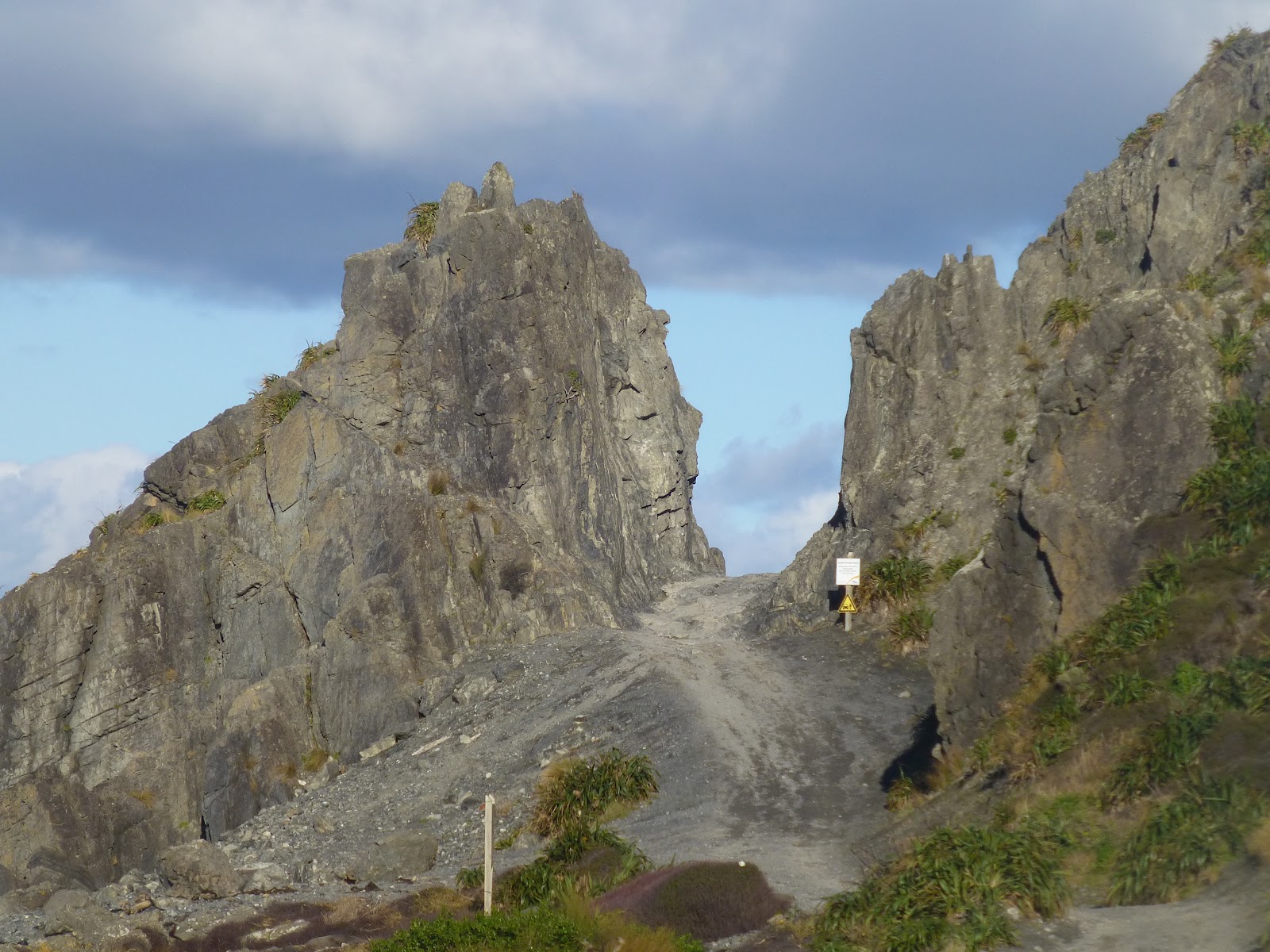
 You 1st come to the point where the Red Rocks. The rocks were formed over 200 million years ago by underwater volcanic eruptions. The rocks are pillow Lava which contain iron oxides hence the red colouring.

 This area is also classed as a area of national significance with a wealth of Maori history and interesting geology.

 The Maori stories relating to the colours include Kupe who’s had was clamped by a Paua (type of shell fish), which broke the skin and the blood stained the rocks. Another story involves Kupe’s Daughters, legend has it that they slashed themselves in grief over their fathers safety on a long voyage away.

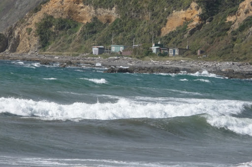
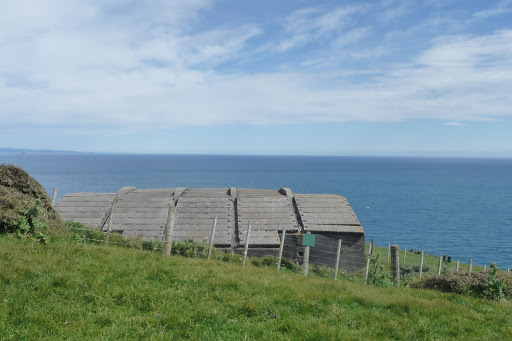
 At Red Rocks there are four baches (beach houses) that in 2002 were  registered as a Historic Area by NZ Historic Place Trust.. These were built in the early 1900’s have been maintained to the original design by the owners.


 From here there is access to the 
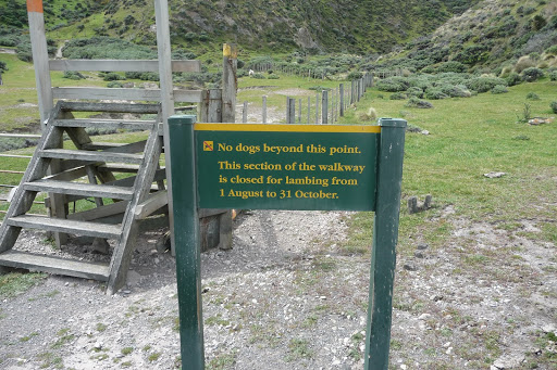
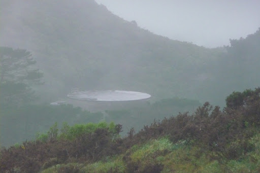
Te Kopahou Reserve. There is a good information board with a map. The tracks are well used and marked.

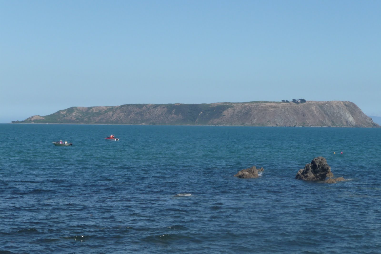
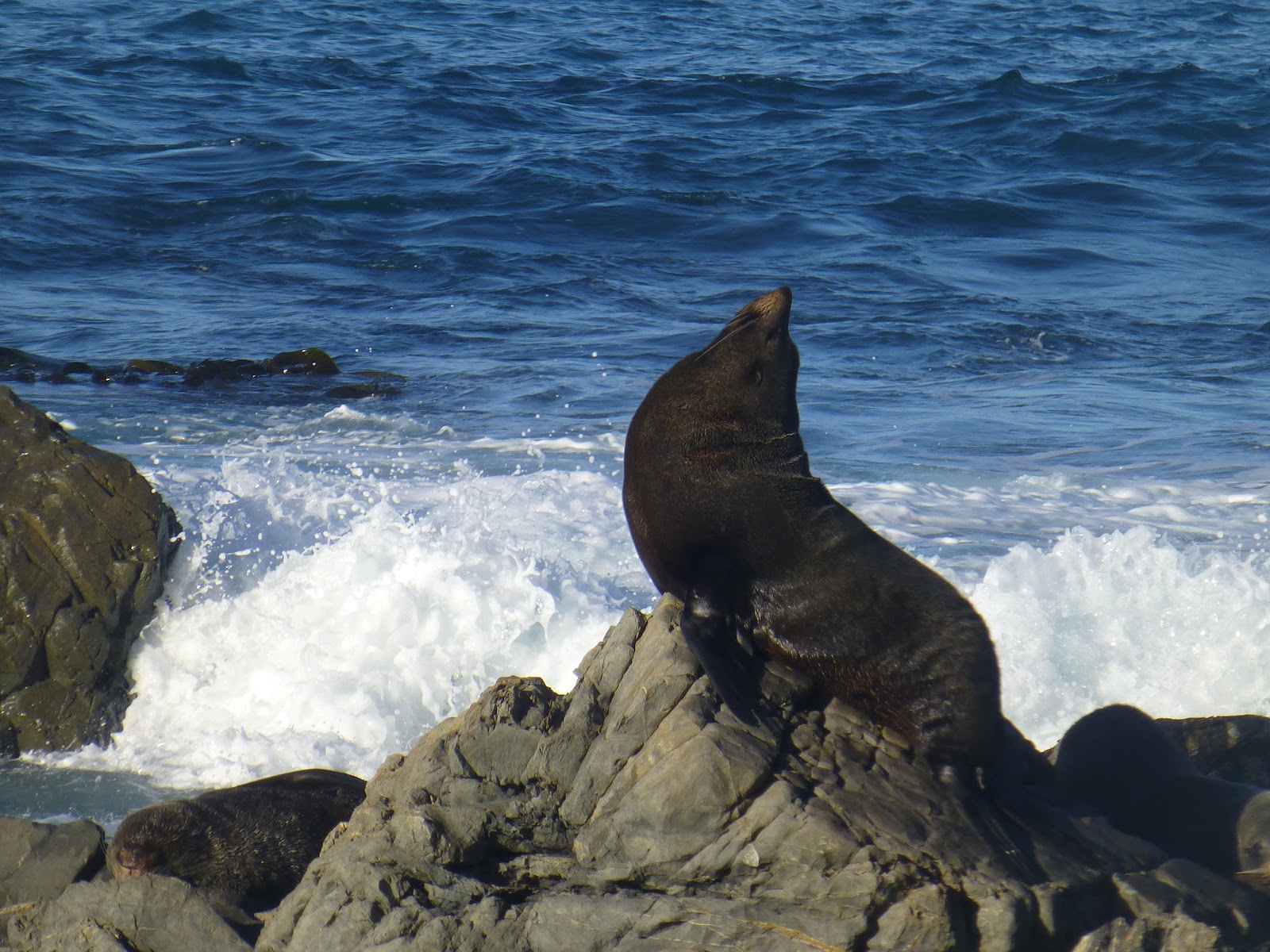
 Once you walk around Red Rocks you head to Sinclair Head and Devils Gate where you  will find the Fur Seal Colony. During May to October you will find Males who have not been lucky in finding a mate. As there are no females within their young you will find them less aggressive but bear in mind that if there are lot of people around they may become aggressive. So keep your distance.


 For most people this will be the place where most people will take a break and have rest and enjoy a picnic,whilst watching the world go by. Including boats of all sizes from the smallest fishing boats to the Ferries of the 2 Companies that sail between Wellington and Picton. After a break most people will head back.
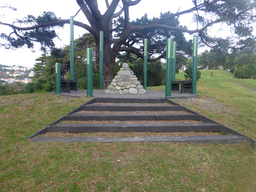
 On the top of the headland are some bunkers that formed a defensive line along the South Coast/Cook Strait.
 You will see the effects of erosion that will occur along this stretch with the road being washed away at times.

 Now let me take beyond Devils Gate and onto Karori Light House.


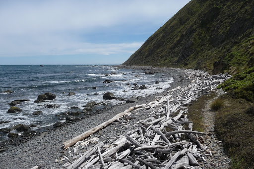
  For the 1st part of the track it is still easy to walk on but eventually become more soft shingle/sand or pebbles. This will make the work a lot more tiring,therefore walking will become slower. You will see more vehicles and motor cross bikes.

 You will come a section of Dunes that has been fenced in. This is to protect the Dunes from damaged by vehicles as its the last section of natural/wild dunes in the Wellington area.


 A short distance later you will come along Long Gully where you have a stream to cross. You will catch glimpses of the Light House in the distance.
 You will cross another gully with some Bache’s set back. From this point you will have about another 40minutes to go.


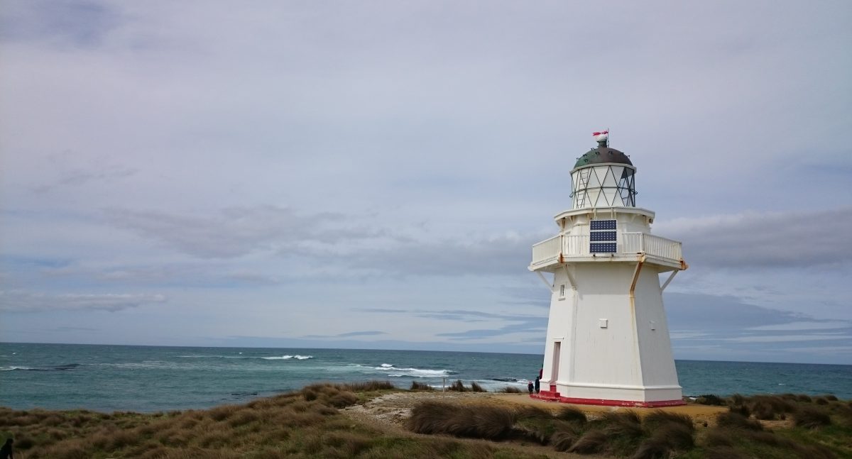
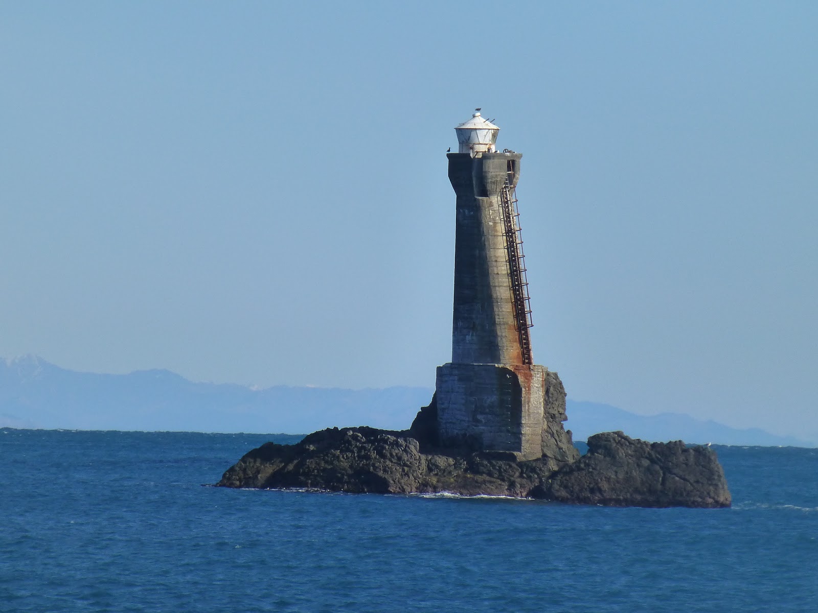
 When you arrive it will be well worth it.Here you will see the Karori Lighthouse and great views of the South Island.
 Yes it does look like it is on a slant, it was built that way with 1 side at a angle where the ladder is and it stands at 39′ high. It was decided to build a Lighthouse at Karori Rock after the loss of a Steamer boat,  The Penguin. It was turned on in October 1915 and was in use until 1996 when it was replace by a new light on the main land on Tongue Point.

 As with Sinclair Head you will find a Fur Seal Colony. So take care whilst they are about.


 General Information:  Distance from Owhiro car park to Sinclair Head approx 4km. Allow around 2/2.5
                                      hrs to complete both ways.
                                      Distance from Sinclair Head to Karori Head Approx 7km. Allow at least 7hrs
                                      from Owhiro car park for both ways. Total approx 11km each way.

                                      Take water and something to eat and be prepared for the change in the weather
                                      and have some good walks shoes if going to Karori Rocks.

                                      Be aware of vehicles when on the section between Sinclair Head as they
                                      will not stop when crossing the softer sand.

Getting There:              By car to Owhiro Bay.
                                       Bus. There is limited service during the week to Owhrio Bay #29,  with no service
                                       at weekends. The nearest regular service from Wellington is the # 1 to Island Bay
                                       from Wellington.  Bus Timetable

Friends-of-Owhiro-Stream/

james/ windy hill flying club.                      


.phone .label {font-size:14px;}

.