Out There and Beyond: Petone’s Artesian Water

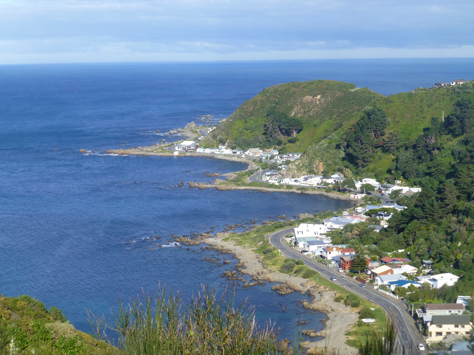
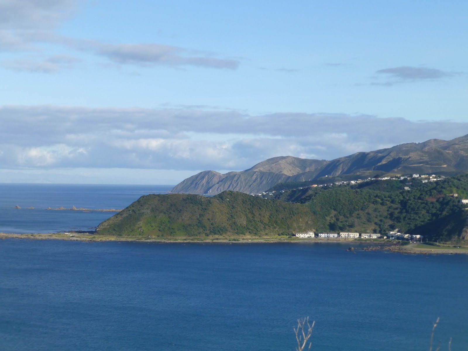
  Petone (Pito-one) was where the 1st  attempt to colonise  the area was made.
 Originally  people of the area used the water from the Hutt River for a number of years.Later, Artesian Water was discovered which provide much better and purer water.

Now days the residents are supplied treated  Artesian water, also free untreated Artesian water is available from The Spring of Life ( Te Puna Wai) which is located in Buick Street with the junction of Jackson Street, the main street of Petone.

 The water is free of micro organisms and  organic substances. This is possible because it is filtered over the time it takes to arrive at this point.
 Every day when passing The Spring of Life you will see people filling up water containers,with many traveling long distances to get there.

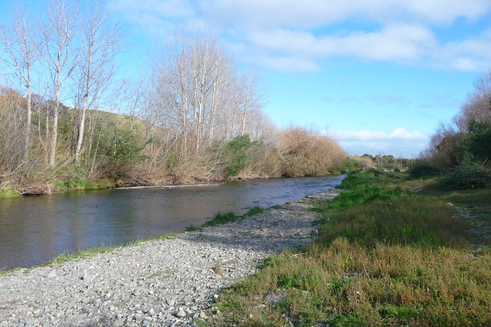
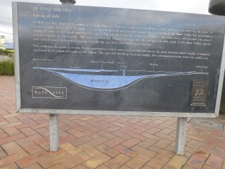
 Water from the Hutt Valley River works its way through layers of sand and  gravel which in turn are surrounded by layers of silt and clay. The water starts at Taita Gorge north of the Hutt Valley.
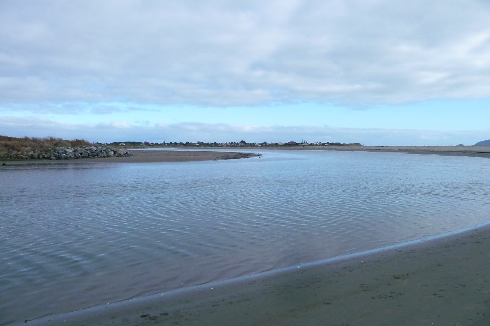
 Over a number of years the water will travel through  sand and gravel before it reaches Petone and the Spring of Life. From here it will continue into the Harbour  at Wellington before finishing it journey at the mouth of the harbour where its meets the Cook Straits.

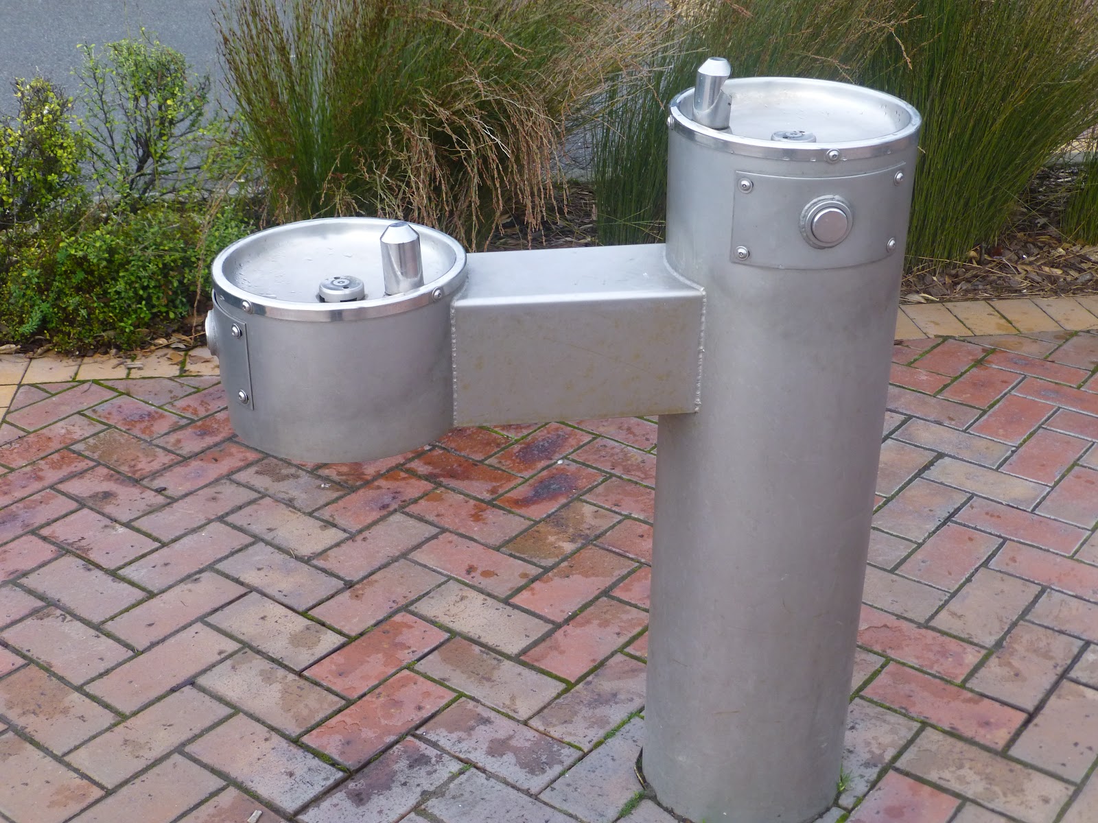
 So if every out near Petone don’t forget to take some water containers and give it a try. Even if you forget there is a small drinking fountain on the site.

 There is a very food information sign that will give some good information about the history Artesian Water.

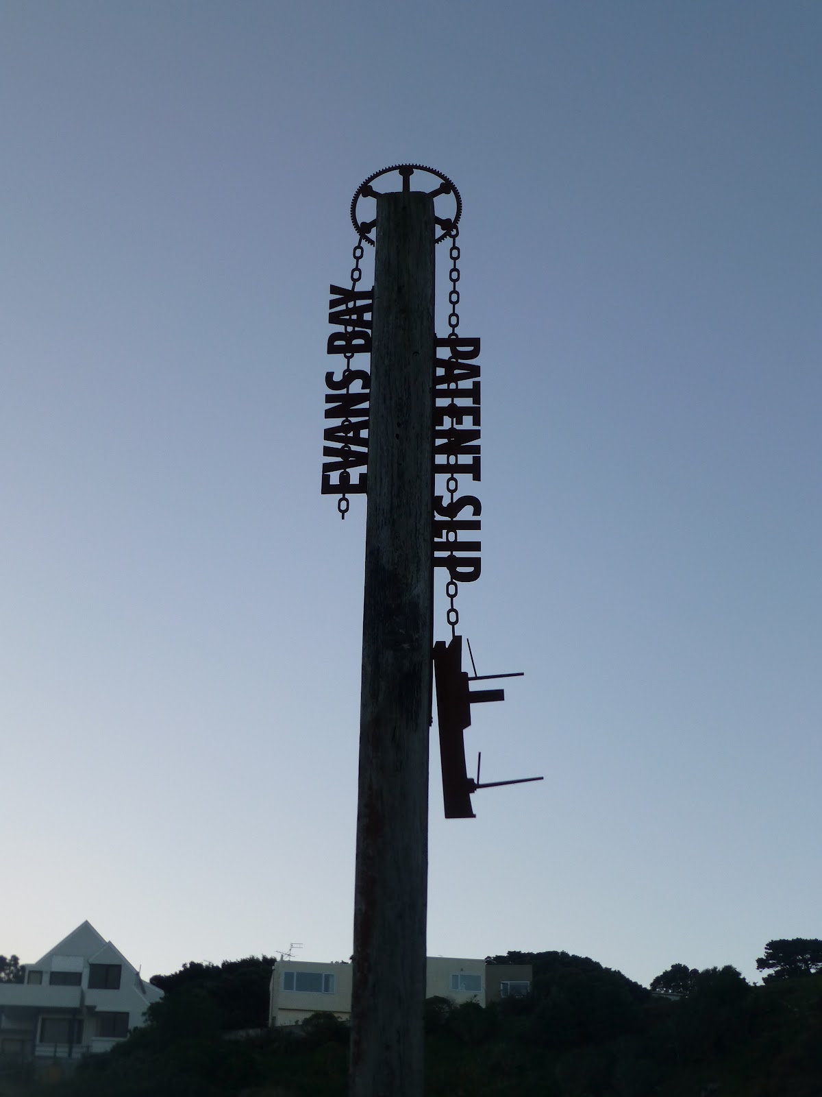
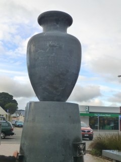
 The fountain was designed by Louise Purvis and was commission in 2003/

Petone’s Artesian Water Fountain

James/ Windy Hill Flying Club.

Wellington Walks: Eastern Walkway.


 The Eastern Walkway is one of the shortest walks that is in the Wellington area but it does gives you some good views and a couple of interesting places of interest at either end of the walk.

 You can start at either end of the walk and can be completed as a circular walk.The main place that most people will start from is Tarakena Bay, located between Moa Point and Palmer Bay on the Breaker Bay Road.


 From Tarakena Bay, take a short climb up to the Ataturk Memorial. He you will find the memorial to Mustafa Kemal Ataturk,the president of modern Turkey. At 2pm each ANZAC day a service of remembrance is held here.


The foreshore at Palmers Head was named (1975) as Wahine Memorial Park in memory of the sinking of the ferry Whaine on April 10th 1968
 Follow the road until it carries to the left, at this point follow up to the right where a short climb will take you to the ridge. Here follow the track as it works it way in and out of the trees and scrub giving you some great views across to the Cook Straits and across the Wellington Harbour entrance to the Pencarrow Lighthouses.


 After a while you will come to Breaker Bay. Located above the track is Beacon Hill Signal Station, It has been in operation since 1864 and operates 24/7. From here the staff controls the shipping in and out of Wellington Harbour. The views from here explains why the spot was chosen.  Access to the site is restricted and is not open to the public.


  As you head round under the Station you gently head down through the tree until you arrive at the main road. To your left is Seatoun and to the right takes you along the Breaker Bay road back to Palmers Head.

 Across the road you will see some more steps. These will take you to the Fort Dorset Conservation Reserve. He you will see the remains of old military gun battery. The views from here are stunning,giving a great view from Wellington all the way round along the south coast.

If starting from Seatoun you have the option,once you reach the Ataturk Memorial, you can head back along the road and then take a left. From here turn into Bowers Crescent followed by a left into Birkhall. You will come across a track that will take you through Rangitatau Historic Reserve.
 You will pass some airport electronic masts. Then you will come to some military bunkers above Moa Point giving you views of Lyall Bay and surrounding area.


 Additional Information:  Distance 2.5km each way
                                          Number 11 bus from Wellington to Seatoun then a 10 minute walk to start.
                                          Dogs allowed on leads only
                                          No Mountain Bikes
                                          Some of the tracks have been improved with further work expected.

Eastern Walkway Map     Downloadable Map.

 James/ Windy Hill Flying Club

New Zealand Shake Out 2012 Update 2: Are You Part of It

750,000
  

Congratulation New Zealand, 750,000 have now signed up for New Zealand’s Shake Out which will take place at  9.26am on Wednesday 26 September [9:26-26:9].

 Take a look at the following web sites which will give you all the information that you will need to know. If you have not signed up please do. It is important that every possible is aware of what to do, how to prepare and all other useful information.

Shakeout New Zealand: Main web page
Getthru: Government which covers all the main disasters that nature can produce.
Whats the Plan: Planning for a earthquake.

Social Media Sites. Sign up to these for update news and stories as well as reminders.

Facebook: Getthru Site.
Twitter.com  NZ Getthru.


James/Windy Hill Flying Club

Out There in Wellington: Words Along the Water Front

 A small selection of Words in Stone found along the Wellington Water Front and links to water and the water front.
Barbara Anderson b.1926
Fiona Kidman B.1940
Katherine Mansfield B.1923 D.1923
Robin Hyde B.1906 D.1923
Alistair Te Ariki B.1925 D.2009
Bill Manhire B.1946
Patricia Grace B.1937
Maurice Gee B.1931
Vincent O’Sullivan B.1937
Lauris Edmond B.1924 D.2000
Denis Glover B.1912 D.1980
Eileen Duggen B.1894 D.1972
 Wellington Writers Walk also includes Writers Words on wooden seats along the same route. Some can be seen without to much effort whilst others require some finding.
 It is a very good way to look beyond head height. So look above and below one’s feet.
 Happy exploring. The walk opens new areas of the waterfront.
Wellington Water Front.   Web page with details of all things Wellington Water Front.

Although Strictly part of the Wellington Writers Walk i thought it would be worth adding it. Made for the World Cup Rugby 2011 held in NZ by Cipre Stephane. It is located at the NZ rugby office further along the water front near the Westpac Stadium.
Update 10th August 2013
Updated 30th July 2012
Originally Posted 26th June 2012
WildbayNZ/WindyHillFlyingClub.

Waikanae Riverbank/Scientific Reserve.Walks Beyond Wellington

 This track is well made and follows Waikanae river from the bridge at SH1 just before you enter Waikanae from Wellington, all the way to the coast at Waikanae and the Waikanae Reserve.
 There is a track either side of the river, with 2 places where you can cross.Both bridges are close to either end of the walk.

  There are a number of entry/exit points along the track with most on the Northern Side. The track is well maintained and good underfoot with the Southern side having track’s wide enough for 4WD.

 There are some places where a track will lead down to the river where you will find the water can be shallow enough for a paddle during the summer. During and after high levels of rain care will be required and to be safe it would not be suitable to enter the water.

 This is a good easy walk for the family as its on the flat. The tracks are also great for cycling with plenty of room for both bikes and walkers.
 Don’t be surprised  that you will also come across runners with or without prams and horses.Along the banks you may come across those trying there luck with a fishing rod or a family having a quite picnic, whilst enjoying the quiet. 

  Along both sides of the river you will come across sections of the bank that has been cleared or being cleared over a number of years and have been replanted or completely new planting.

 After about 5km the area opens up into a park where you will come across the second bridge just before the Waikanae reserve.

 If you are on the Northern side of the river you can either continue along the track that follows the river. You will see some houses to your right. The tracks follows round some of the marsh land and then after about 15/20 minutes you will see the main point where the river meets the sea. You then climb over some sand dunes and in front of you is the beach and the Kapiti Island to your left.

 For the Scientific Reserve: At the wooden bridge keep to the Southern side of the river.There is a clearly marked walking/cycling track as you exit Makora Rd and cross Otaihanga Road. The roads can be  quiet and there are signs that  show the Kapiti cycling route. You enter the Waikanae Estuary Scientific Reserve off Hana Udy Place.You will find a number of tracks that you through the reserve.


Waikanae Reserve and area  Google Map

Waikanae Reserve Information.  Good info on the reserve.

Waikanae-Estuary Care Group. Local group that looks after the Waikanae Estuary.

Waikanaie to Otaki Walk  

Queeb Elizabeth Park and Area

 If feeling that you wish to go further the reserve boarders onto the main coastal beach. Head South and you will end  in Paraparaumu and a well earned rest.

Information:   Distance  approx 10km for the round trip for river walk.
                        Getting there. Train from Wellington to Waikanane
                         From Waikanae station to Waikanae Beach  No 280 bus.
                         From Waikanane to Paraparaumu via beach. Approx 4km.
                         From/to Paraparaumu. Train from Wellington.
                         From Paraparaumu Station to Paraparaumu Beach. Buses 260,261,262

James/ Windy Hill Flying Club

Lyall Bay:Kite Surfers Sharing the Bay

 What is good about Lyall Bay is that recently the beach has become popular with Kit Surfers and Wind Surfers. On many a good blustery day/evening when the conditions are right you will a good group of Kite and Winder Surfers out in the water.

 I’m amazed how good they are racing along the water with many doing some great jumps into the air and then landing as though its a walk in the park.

 A short while ago a sign was installed in the dunes near the Western End of the beach near Queens Drive. The sign indicates to them the area where they are allowed to launch and also the area where they are allowed to enjoy there hobby.

 
It is great to see that they are allowed to enjoy what Lyall Bay has to offer and that they know where they are allowed. 

 The times that i have seen them down there they have pretty much kept to the area that is designated on the sign.
 The sign gives some good information on the do’s and dont’s, and where else within Wellington and surrounding areas where they can Kite Surf.Hopefully this will not put them off from coming down.

 If you see any out then take a few moments and be amazed by the skill.  

Thank you to Michelle for reminding me that the sign was there.

James/ Windy Hill Flying Club

Lyall Bay: Reopening of The Coolest Little Op Shop. Wellington

Wellington’s Cat Protection League
 The good news is that Wellingtons Coolest Little Pop Up Op Shop has reopened today 11th August at its new and i must say a better shop.
 It was originally located next to Centennial Cafe  in Kingsford Smith Street. The shop was at that location for almost a year and was in 2 20″ containers.
 Due to the owners of the site wanted to redevelop the site they had no choice to move.
 They were lucky to find a new site. The site is Unit 14 of the main building where Real Surf is located. The new site has so much going for it. It has access to toilets, its under cover for those cold,wet southerly’s or even a clear day when the wind is a coming from the south and you are getting a sand blast. The other main reason is that there is more room for them to display the items on sale. Oh,  the views of the beach and the Cook Straits are amazing.
 Give them a visit as there are many things on offer, or is you have something that you do not need then consider dropping it in to them. 
 The opening hours are Sat 10.00 to 16.00 and Sun 10.00 to 15.00. There is plenty of parking. Once you have taken a look then take a stroll down  to the beach (weather permitting)
 

James/Windy Hill Flying Club

Out There and Beyond, Wellington: Evans Bay Slip.

  The 1st Slip was completed in 1873, with its opening on 2nd May.
  A number of additional buildings were built to accommodate the associated work and workers.
  The 2nd slip was completed in 1922.

 A pier was also built which is still there although closed because it has become unsafe.

 As resent as 1985 the 2nd slip was was in use whilst the 1st one was closed in 1969 when the 2nd one came into use.
  In 1990 Wellington Council aquired the site with the area being broken up into sections. With help from The Maritime Archaeological Association of NZ (MAANZ)  and the  area became a heritage site in 2006.
 MAANZ completed 2 surveys of the area including an  underwater survey.

 The Slip is classed as a historic site both nationally and internationally.

 The slip’s have been restored,although the road goes over a section of the tracks you will be able to see the tracks either side of the road so you will  be able to follow the direction from land to water.

 Location:  The Evans Bay Slip is located at Greta Point which can be found on the Western side of Evans Bay. It can be easily reached by car with parking near by, or the #24 bus stops near by Monday to Friday. Alternativly a good walk from the area to Wellington is a great way to see the Slip and the other bays.

James/Windy Hill Flying Club.
Orginally Posted 25th June 2012 

Out There and Beyond, Wellington: Massey Memorial.


 I was aware that the Massey Memorial exsisted after doing  2 walks around from Miramar Wharf to Moa Point via Seatoun.
 It sits hidden from view from the road below and from the departing ferries that pass it many times  during the day and night,although you might  sneak a glimse of the  white granite or marble  through the trees.
 It sits above Point Halswell on the head of the Miramar Peninsula which is on the Eastern side of Evans Bay . Sitting almost below it on the rocks is a small working Light House for all boats either heading into Wellington Harbour or round to Evans Bay Marina.
 Between the gaps in the trees you can see Soames Island sitting in the harbour, Mount Victoria with its transmitter sitting proudley on top or across the water to Eastbourne and the hills behond.
 Its the place to be on a good day to either see a sunrise or sunset.
 It takes its name from a NZ primeminister of New Zealand called William Massey who was the country’s PM from 1912 to 1925. He died in 1925 whilst still in office. His wife Christina Massey is also buried on the site.

 The govenment at the time passed a bill allowing it to be built on the 0.8 hectere site. The sited had been used during WW1 for defence purposes but after the war had been left to become delerect.
 Using what was already there the designers turned the fort into what is there now with the gun pit being used as a vault.
  The rest of the site was completed in 1930 and has not changed much since then.The dome at the end overlooking the water was orginally the gun pit.
 The memorial was made with Coromandel Granite at its base with the rest being Kairuru Marble,
 Getting there: Unless you intend to walk around to it the best was is to use a car. Coming from the Miramar Wharf you will pass through Shelly Bay and then about 100metres after that you will see a few parking places over looking the water. Opposite the parking is a small white sign next to some steps. Climb the steps and you will walk along a  gentle track until you arrive at the Memorial.
 The memoral is to your left and a little way to your right is a small tack that takes you up towards a old telgraph post where you will get some further views of the area.
Orginally Posted 26th June 2012
James/ Windy Hill Flying Club.

NZ Getthru:Preparation for Natural Disasters

Get Ready Get Thru Logo

Get Ready Get Thru Logo


   With the resent volcanic activity from Mt Tongariro on the North Island it is a good time to have a plan in the event that you are caught up in the activities that a nature can cause either directly or indirectly.

  Although nature can be unpredictable there are still many plans that can be in place that may make life easier for you/family and loved ones.

  There are a number of ways the information will get out there. The main ones being Radio and TV stations.
These will often include conditions of roads and transport around the area.

Social Media like Facebook and Twitter (mobile). Although these can be affected by the availability of mobile towers. You will be able to sign up to the AA, NZGetthru, Civil Defence.
 Remember, be prepared for the unexpected and have a plan.
Below are some links to the main sites that will give uptdate information plus links to the pages to the main subjects.Also links to their FB and Twitter sites.

Getthru Volcano Page
Getthru Main Page
Civil Defence NZ
Shake Out NZ

James/Windy Hill Flying Club