Wellington Walks: City to Sea

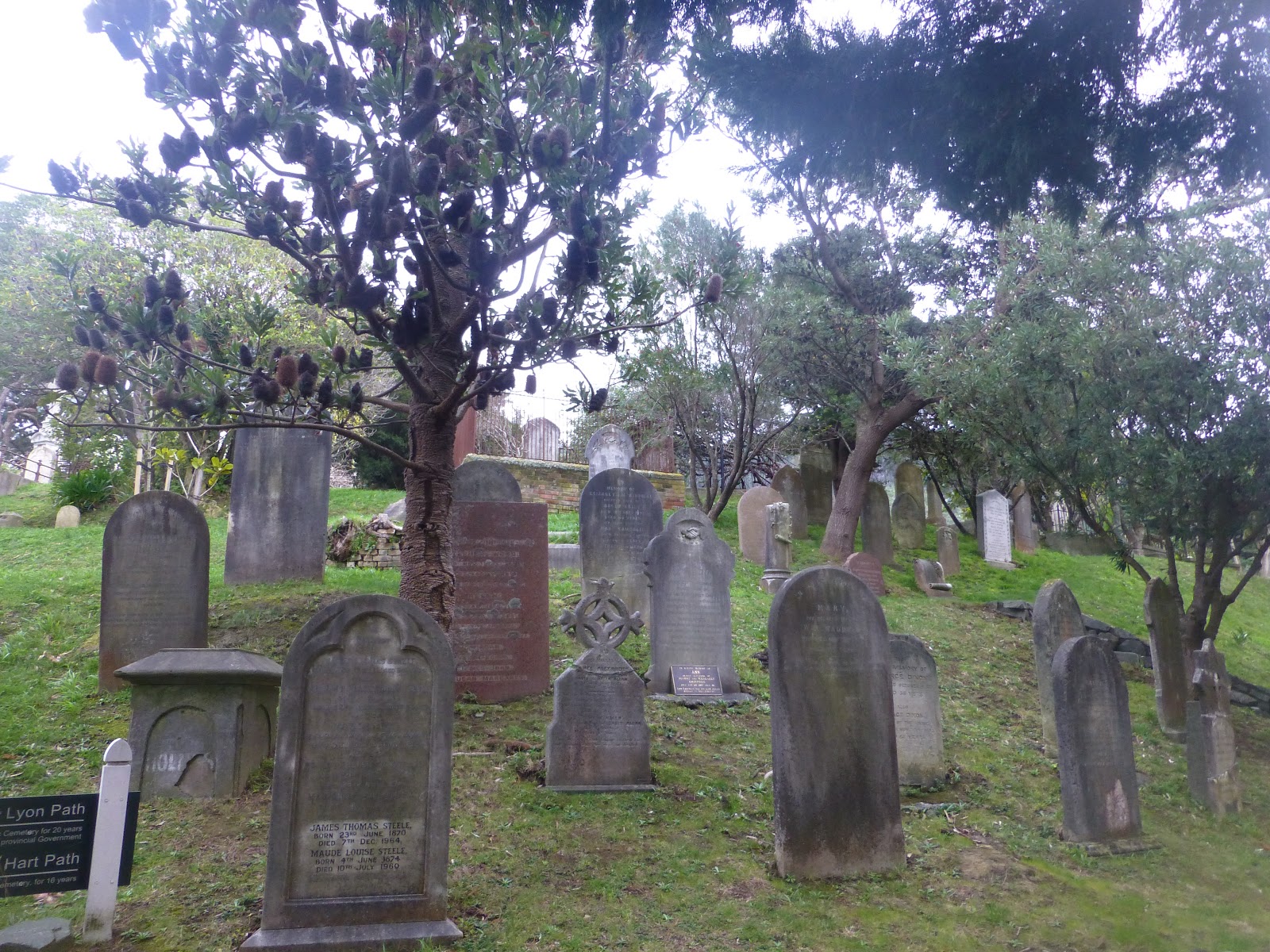
 A interesting walk that takes you from the Bolton Street Cemetery ending up at Island Bay on the South Coast of the North Island.
 The beauty of the walk that is that it will take you through some of the older parts of Wellington with some beautiful old houses and some of the parks that for the Town Belt.

t.
 From the quiet of the Cemetery you weave your way up through the Botanical Gardens experiencing the different plants that are on show, depending on time of year you glimpse something in flower or smell a scented plant.

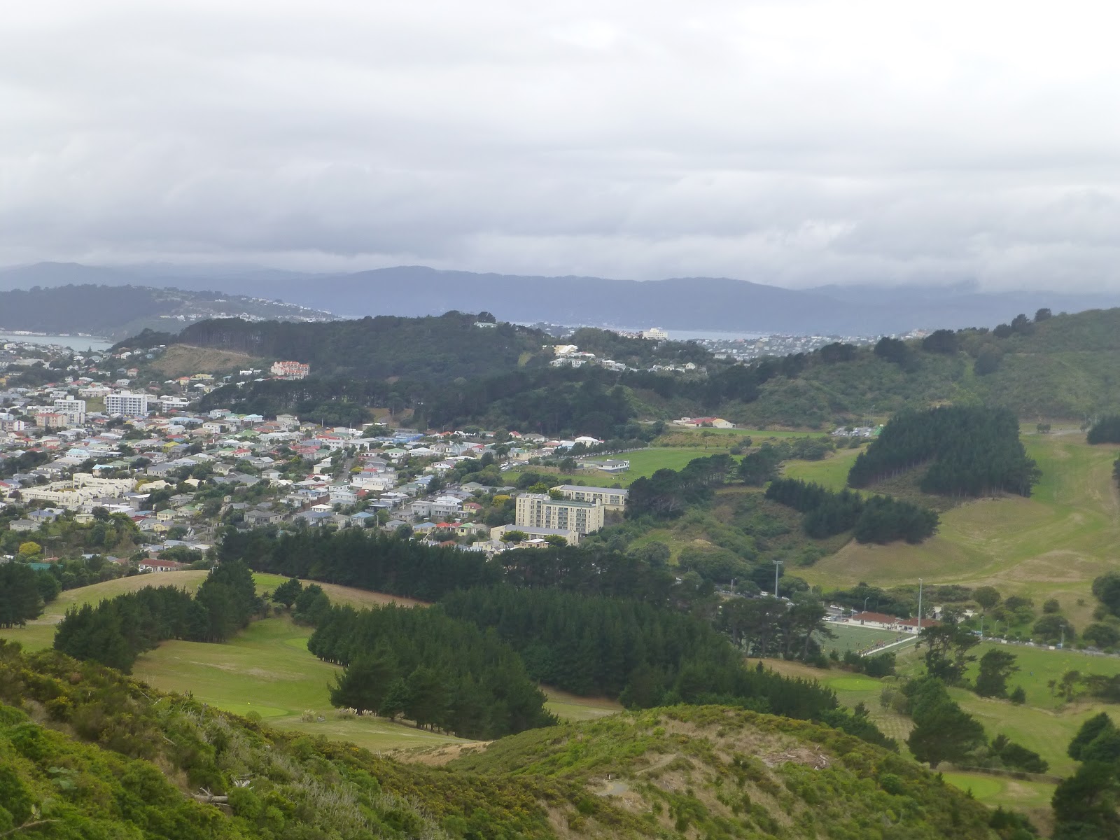
 At the top of Botanical gardens it will afford you views of the capital and its harbour. From the cable car  you down through Kelburn Park and  through Te Aro.

 The first major park is Central Park which over the last few years has had some improvements to it. You slowly climb up following the stream until you come out of the park onto the Brooklyn Road.
 Take a look at the Community Gardens after the short climb from Epuni Street.

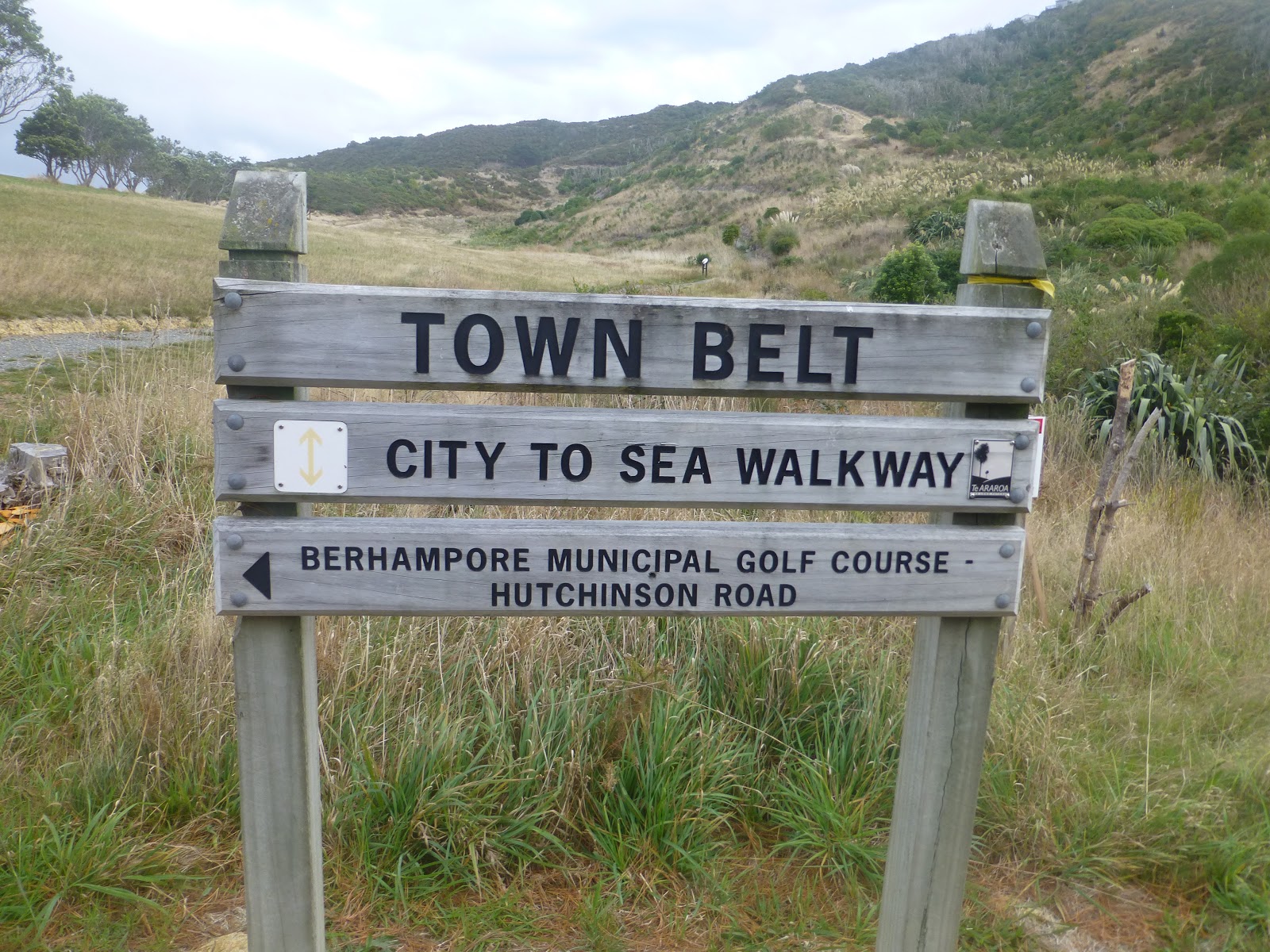
 Crossing the road will take you to the edge of Nairn Street park and onto Prince of Wales Park. The track continues along the town belt Passing through Macalister Park. You become aware of the Scottish connection with the hall that is painted with Scottish Dancers.

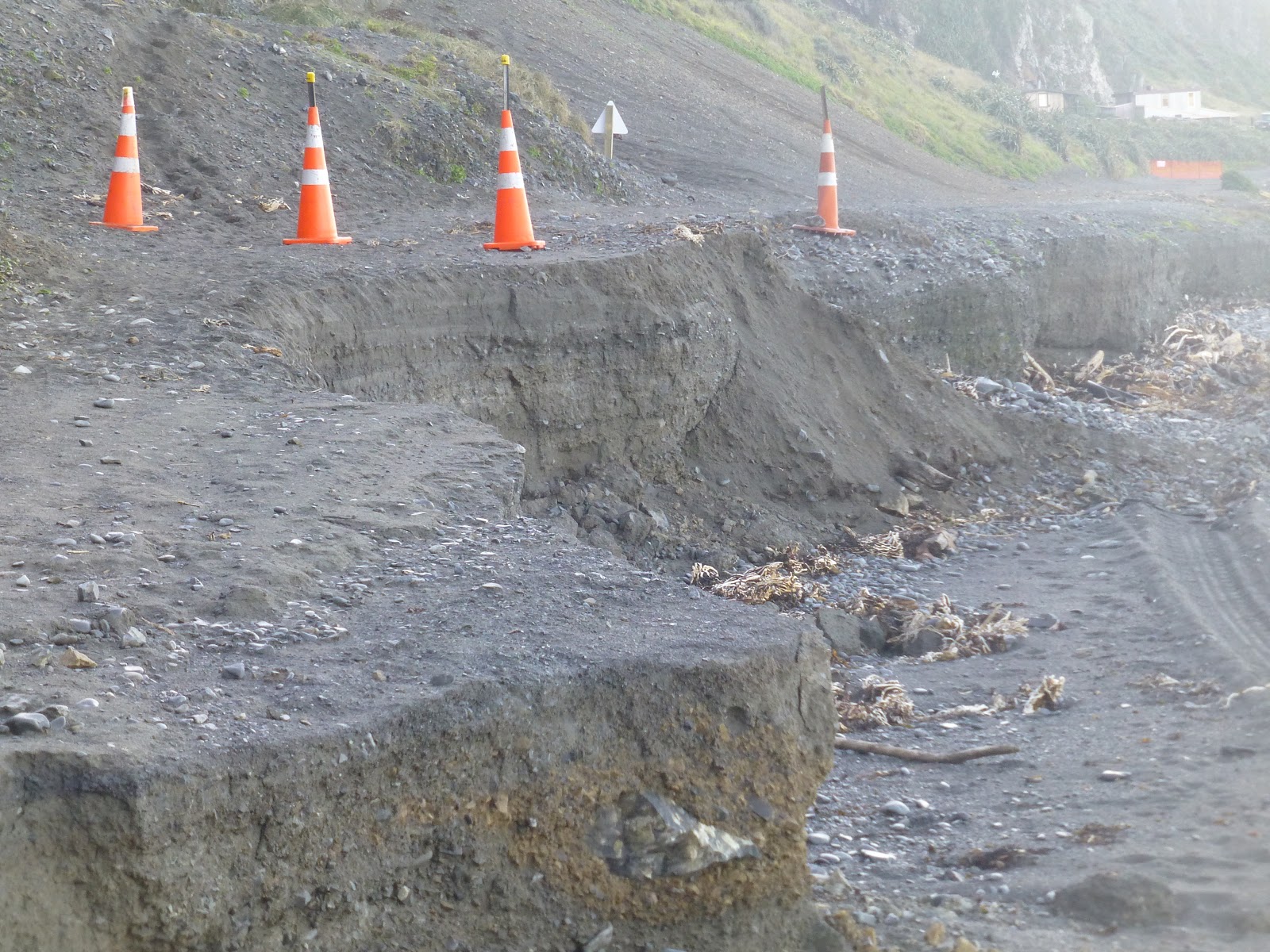
 Macalister Park then becomes Berhampore Golf Course with their fairways and manicured greens. So take of the golf balls and if you see some one about to take a shot then wait until completed.The track take you around the edge of the course but there is one interesting sight of a small low bridge. The area was dry at the time but clearly could form a small area of wet land.

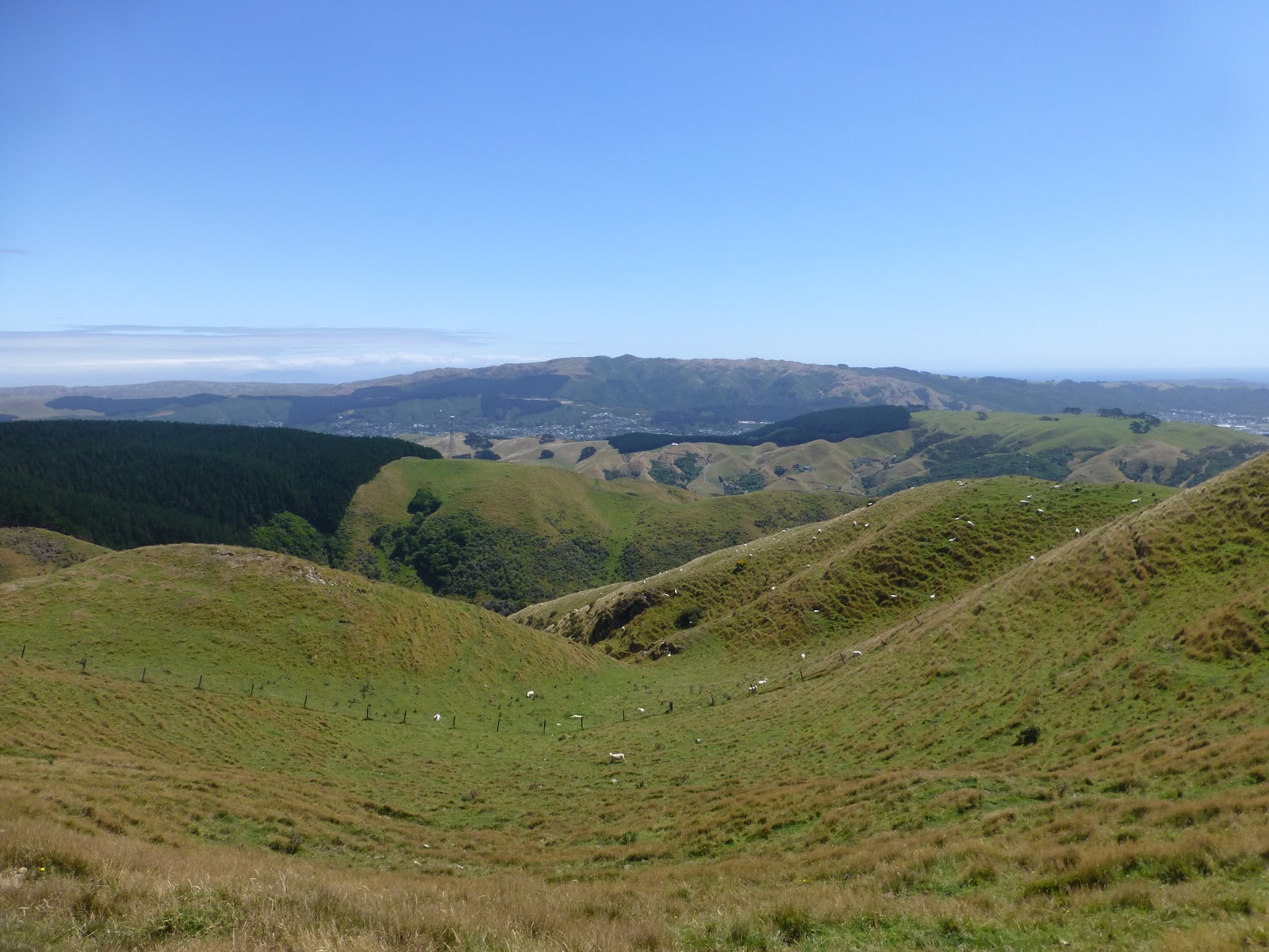
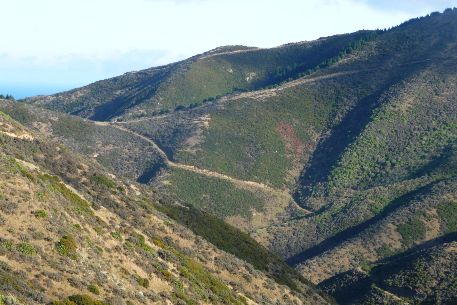
 Following the track it will climb up towards the Tawatawa Ridge. Here there has been a lot of work to make the tracks wider and the climb a little easier. Also a lot of replanting has taken place. In the distance is a section that has some goats in. Yes the goats are being used to keep the area clear of vegetation.

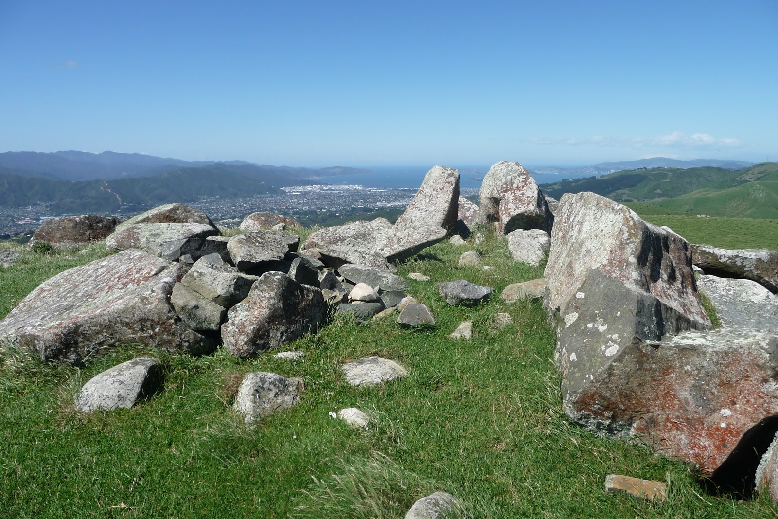
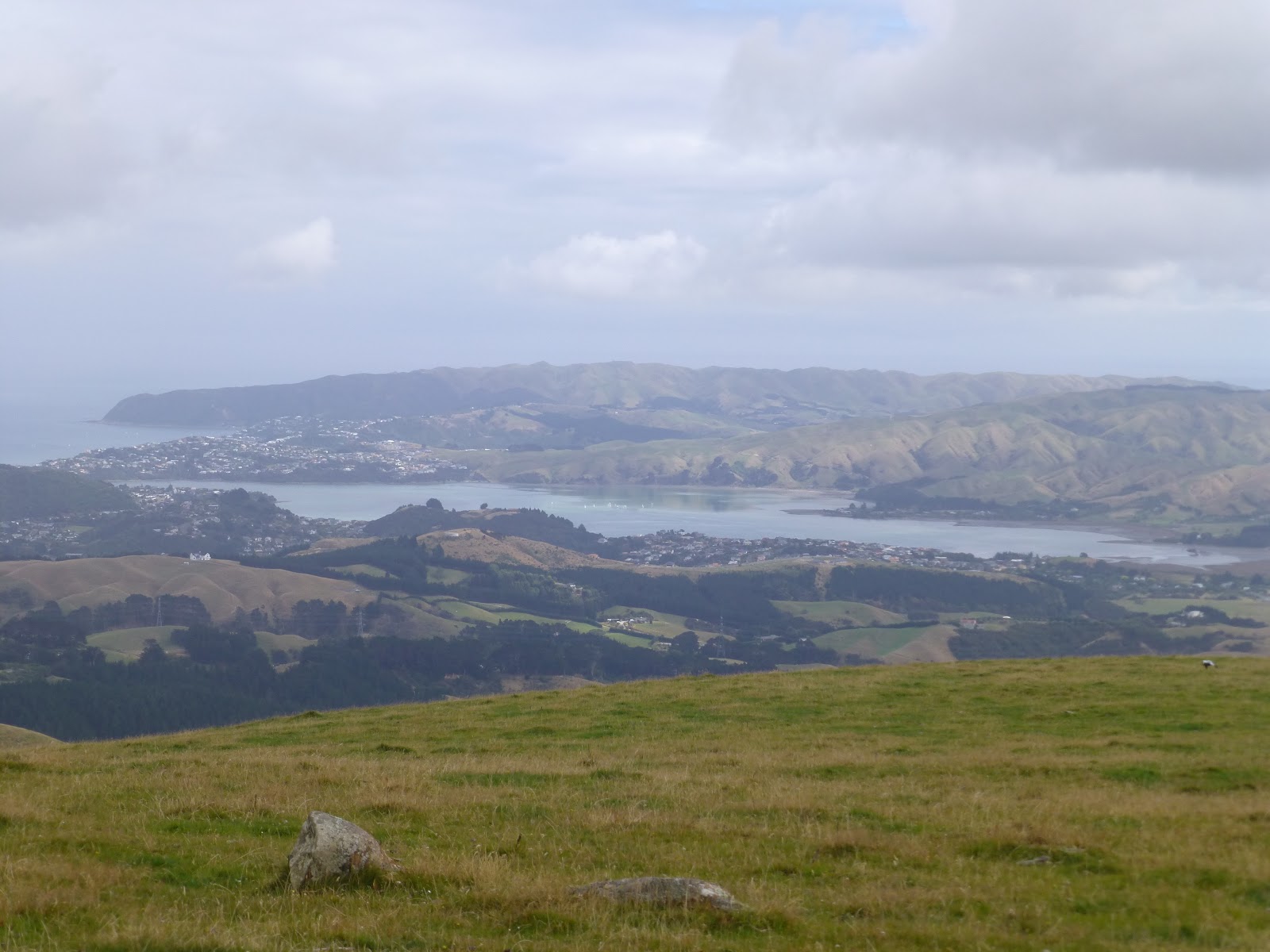
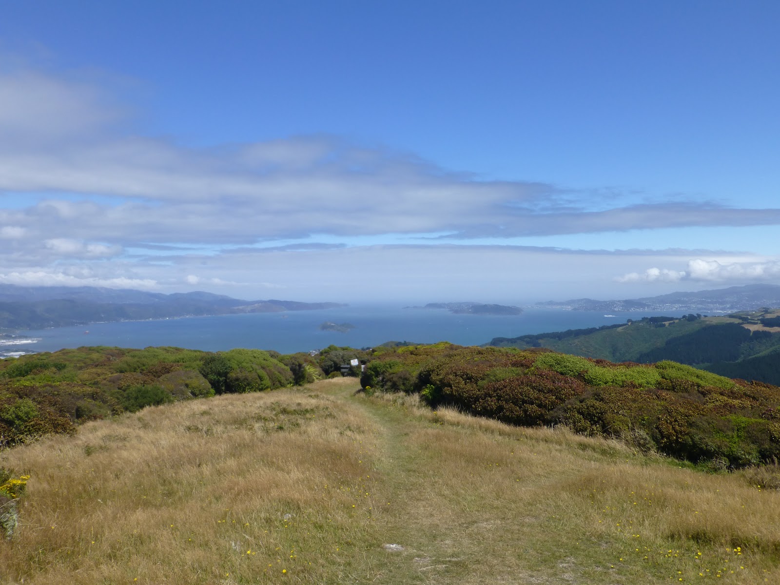
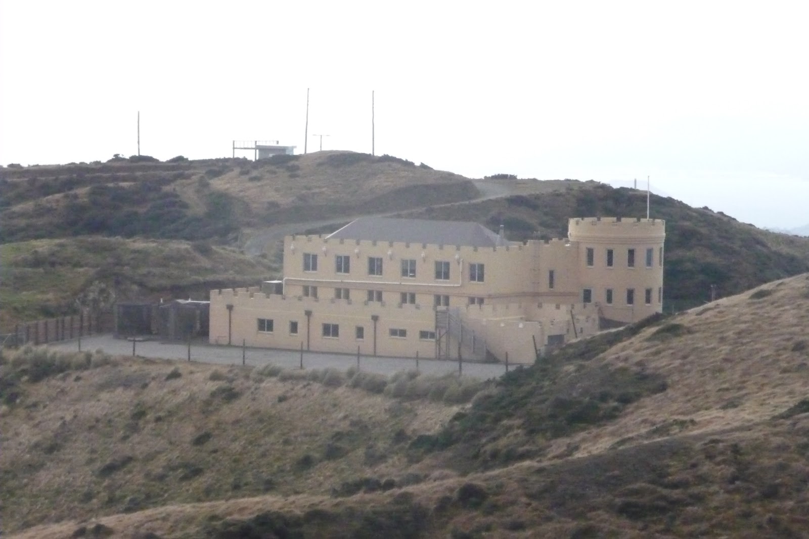
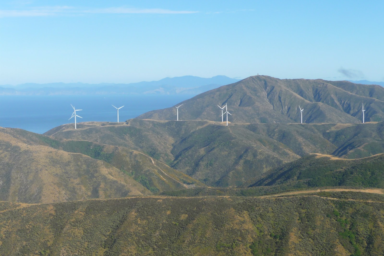
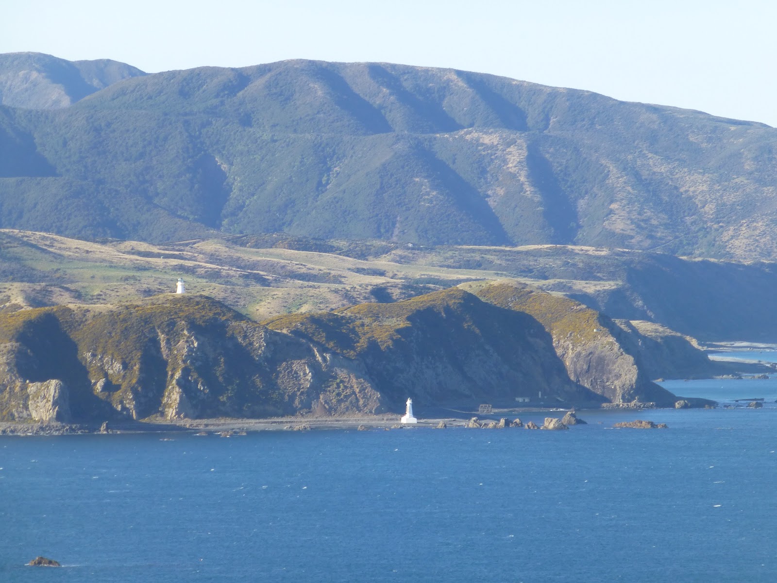
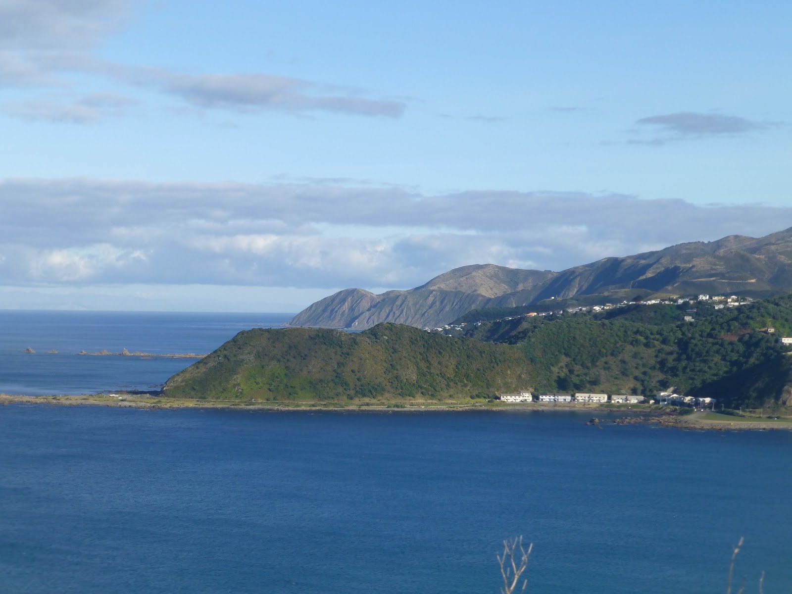
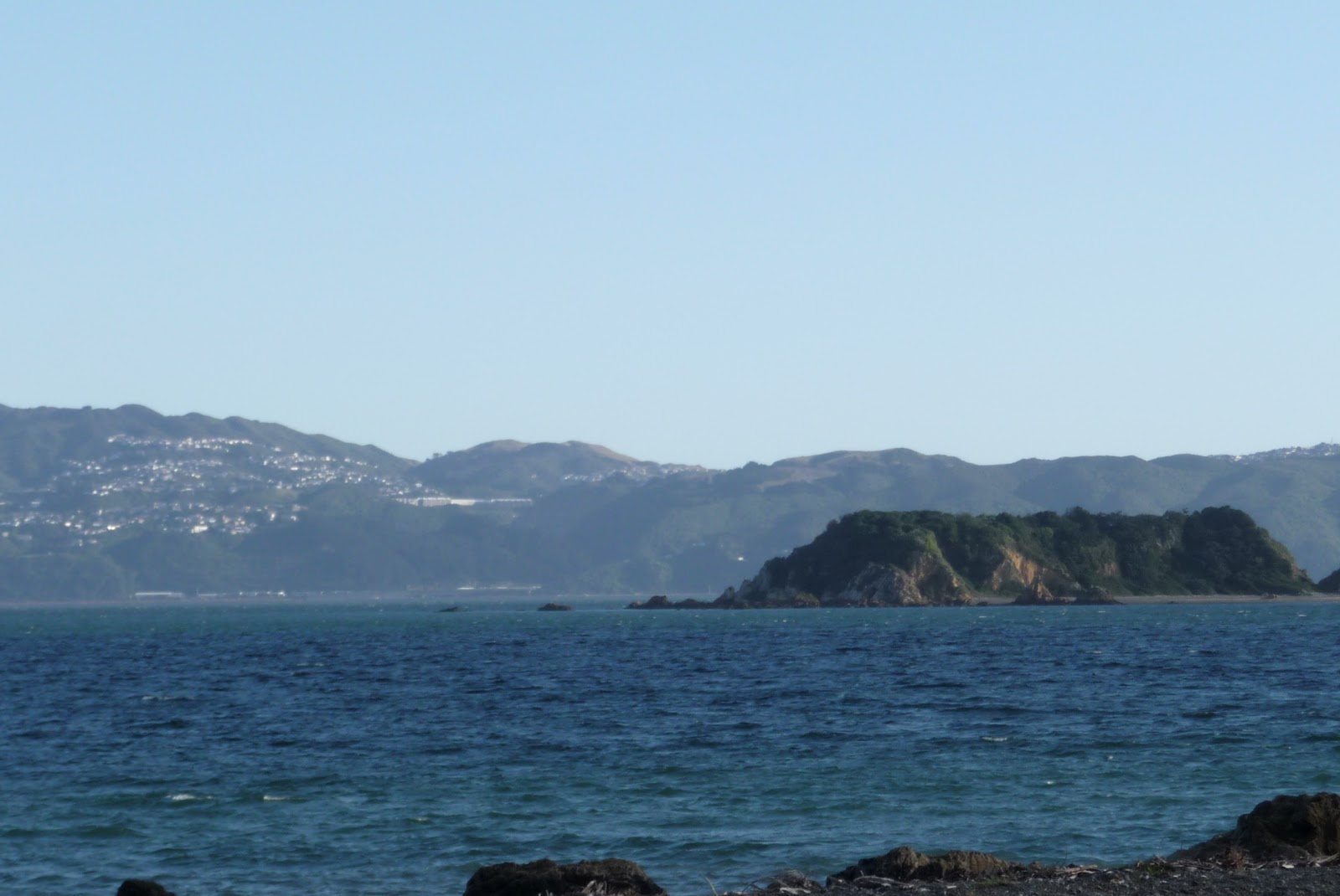
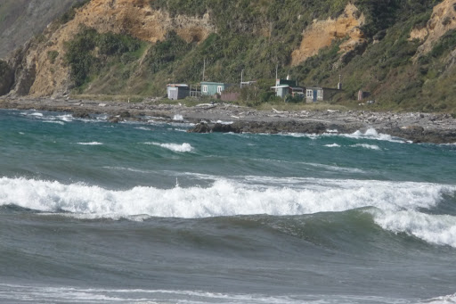
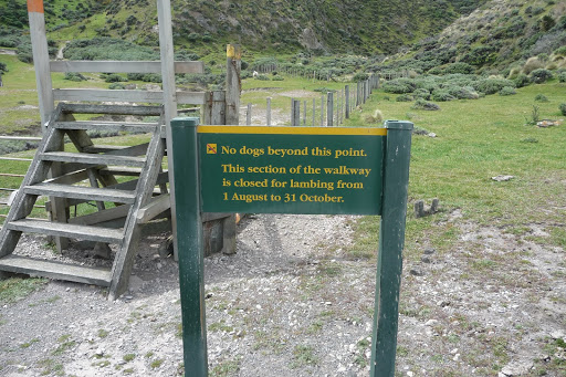
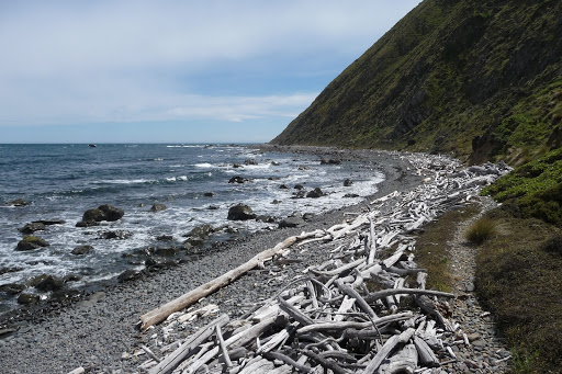
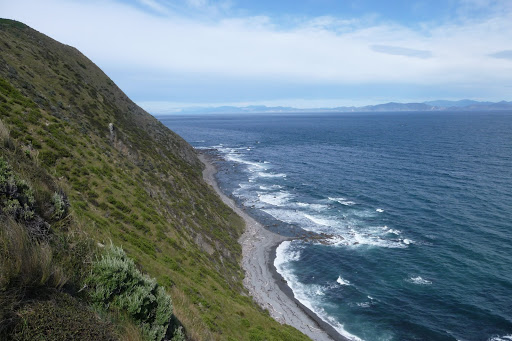
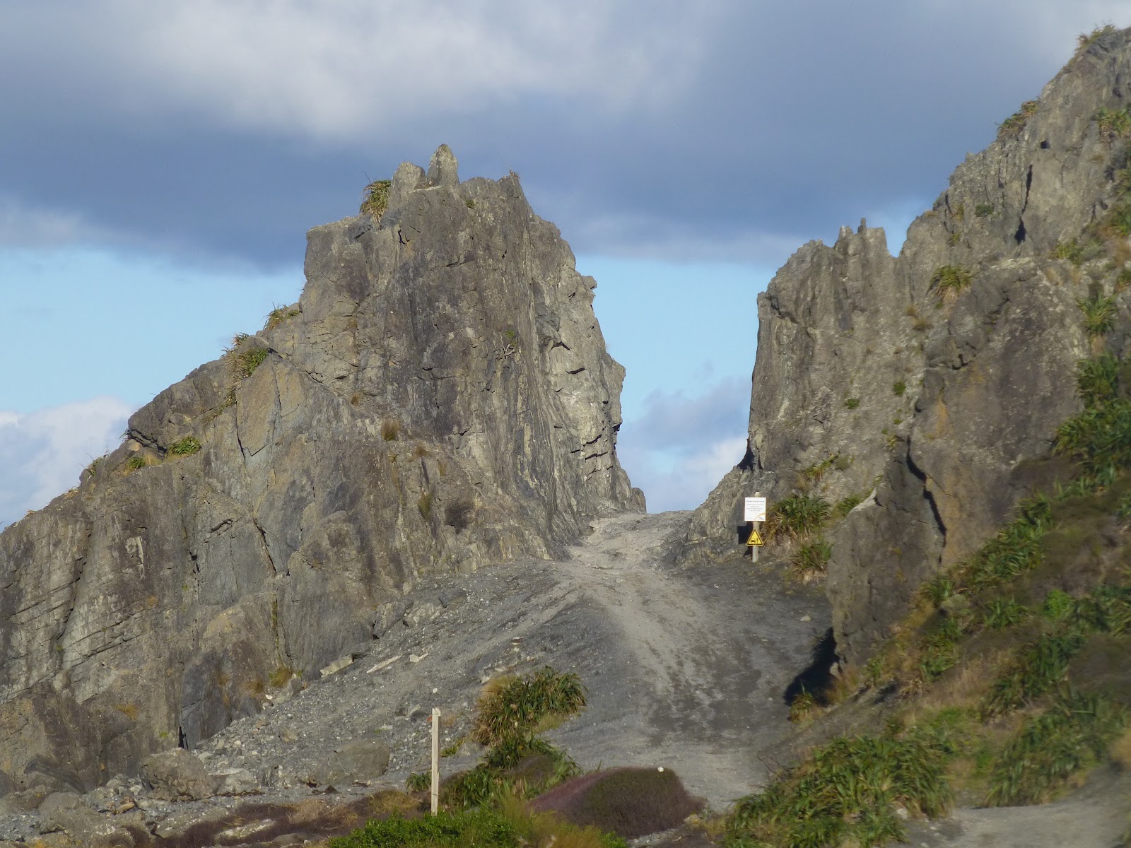
 When you get to the top of the ridge you then get a sense of the area. With Happy Valley to one side, The Coast and Cook Straits dead ahead and the Te Kopahau Reserve,

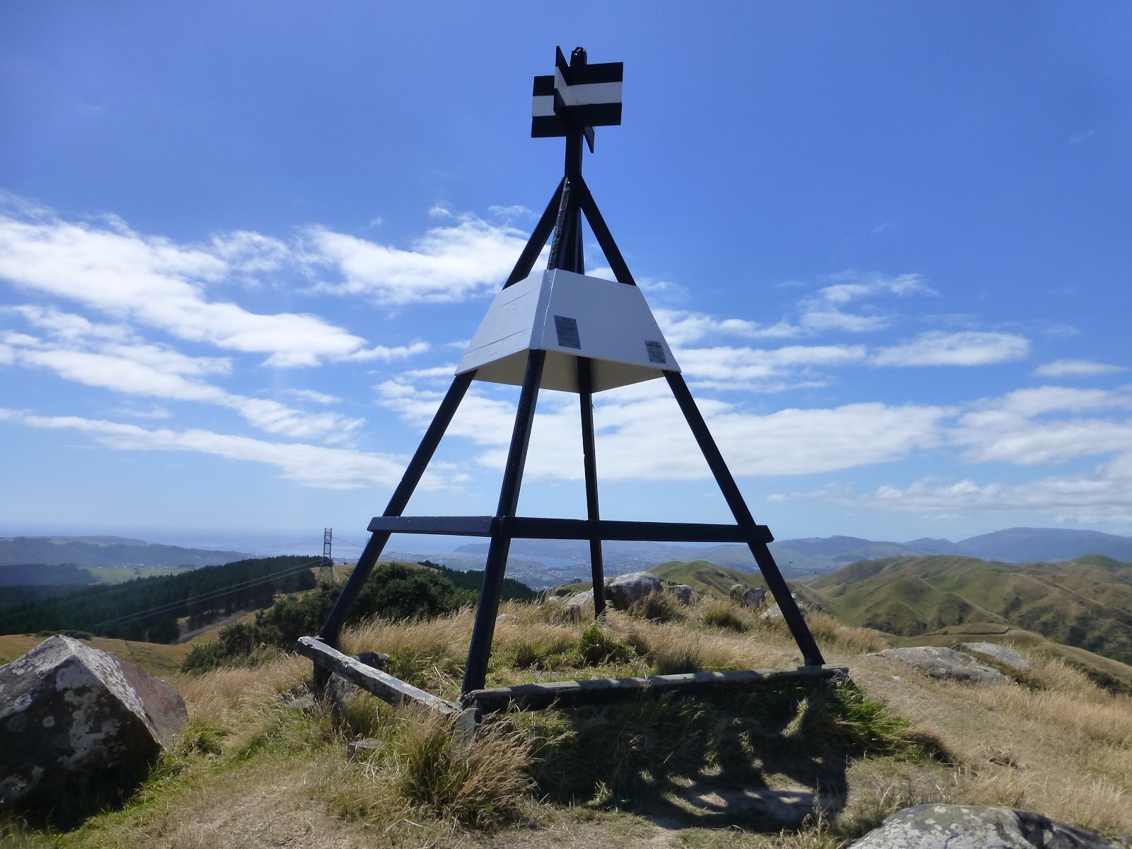
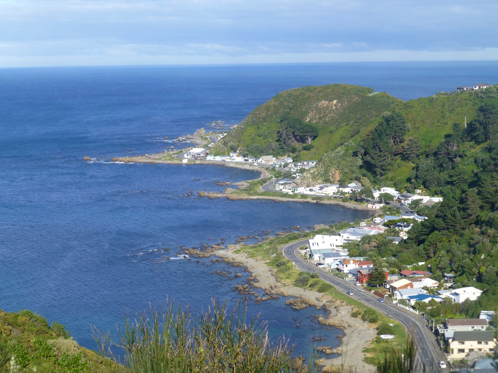
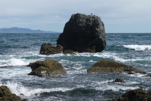
 A very short climb to the top and the highest point of the walk(approc 200m) yoy get to see fully Island Bay,Owhrio Bay. Both Bays you can finish the walk at.


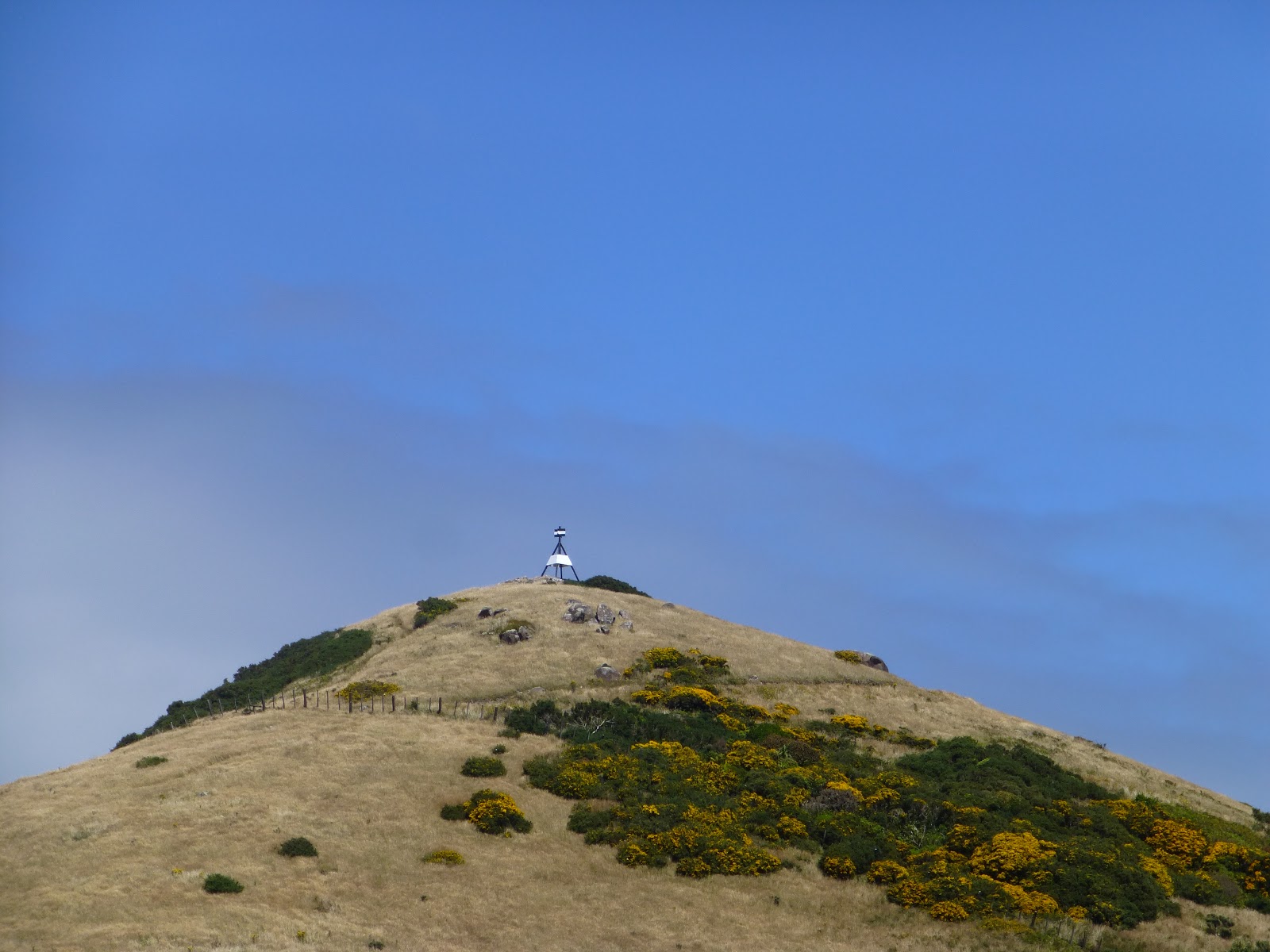
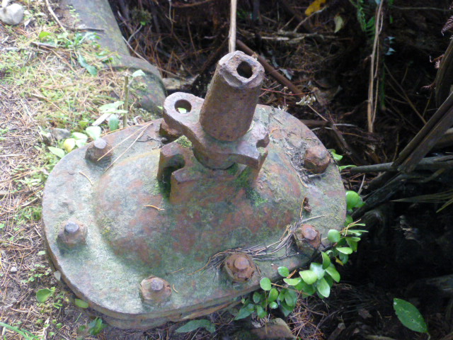
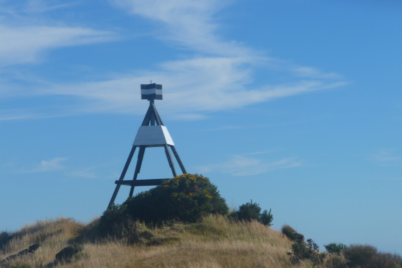
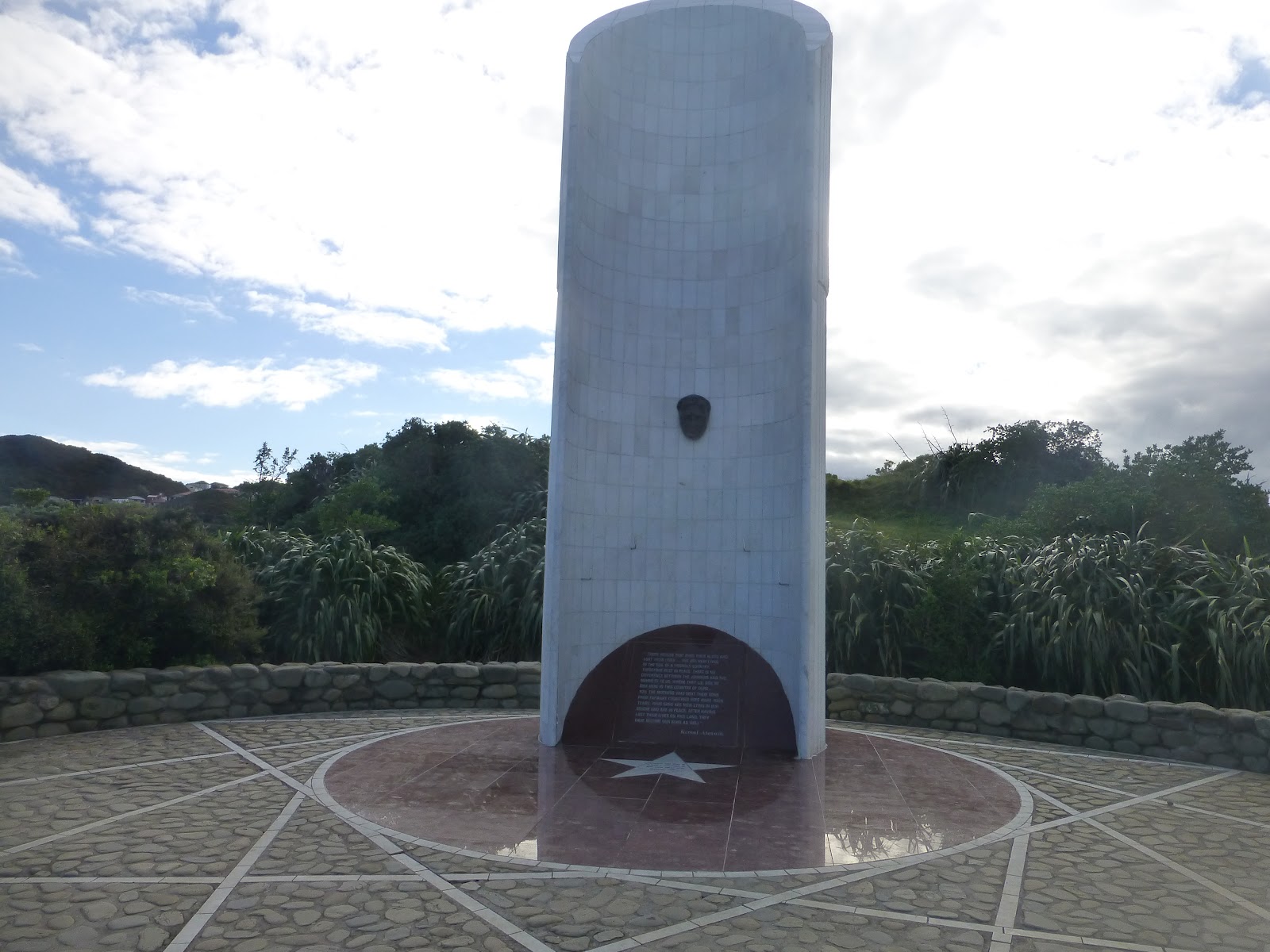
 There are two points of interest at the top. One a large metal pipe that is used to tie up horses and a Statue. The Statue appears to be a Folly as those we did meet on the walk could not give any onfo to us about it. Also there is no information about its history attached to it.

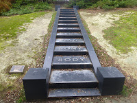
 Follow the ridge down made easy by some impressive woodern steps until you arrive at the end of Frobisher Street.


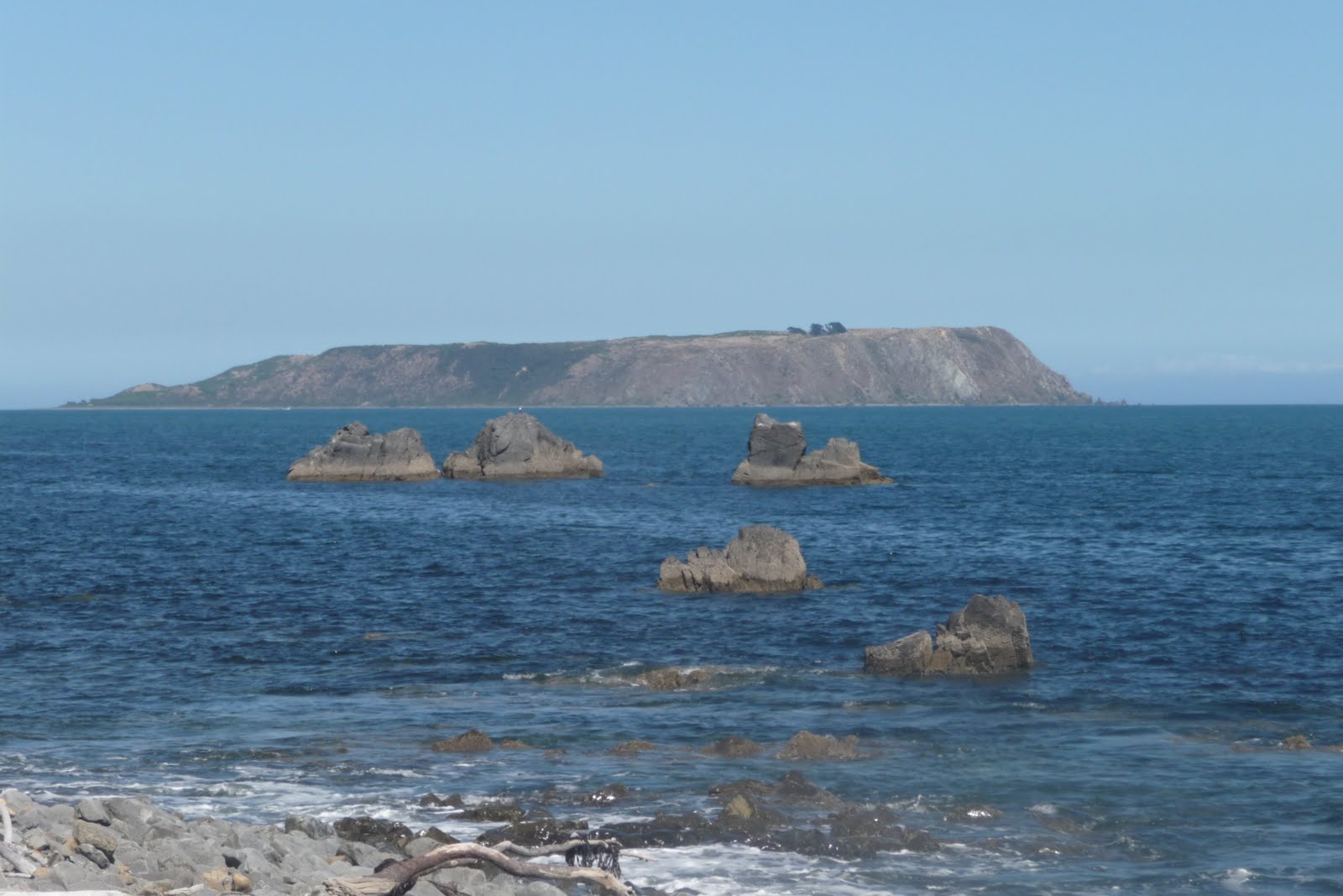
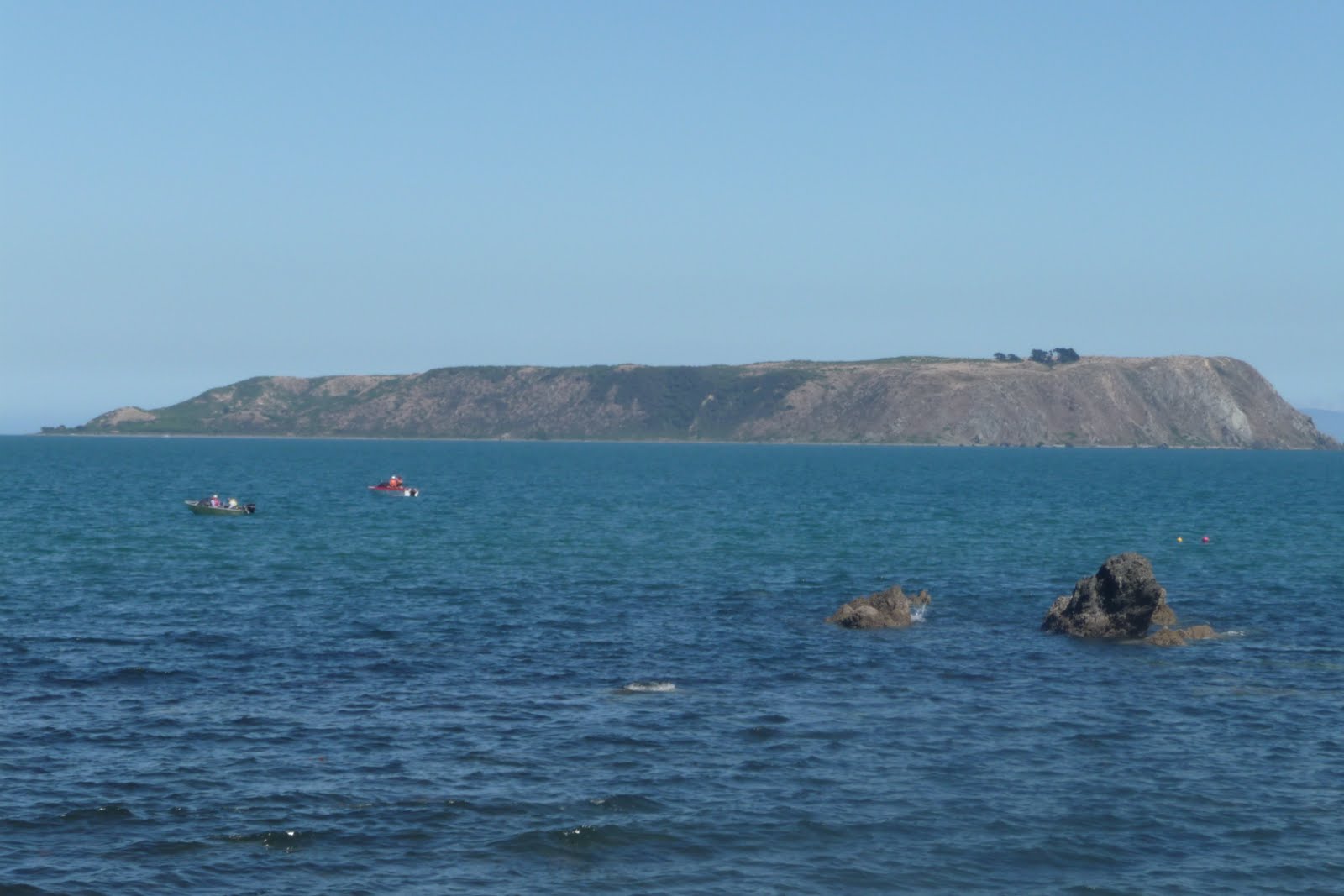
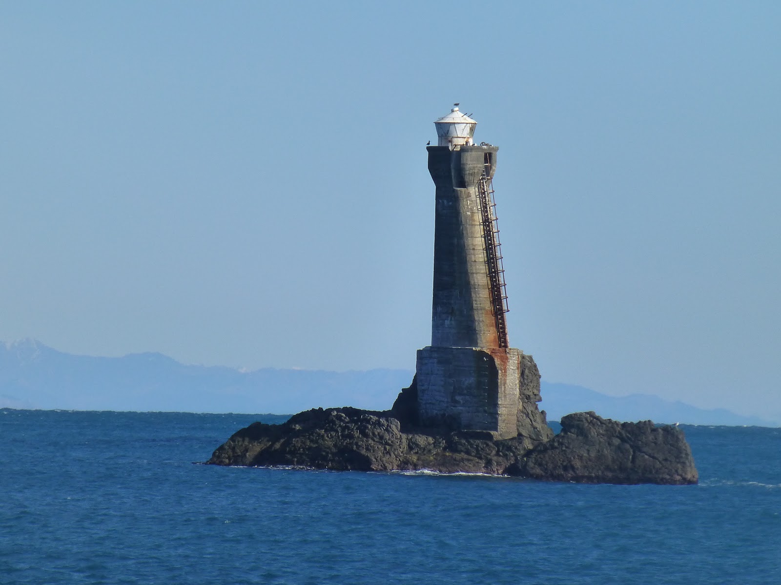
 Follow the road and witha short climb to the top of the Oku Street Reserve. Here you get to see the Island that gives Island Bay its name.

 The walk ends in Shortland Park. Here you then either can pick up your lift home or catch the #1 bus back into Wellington.

 If you are feeling up to it there is nothing to stop you heading back into Wellington along the Southern Walk Way. You are able to see this across the valley.

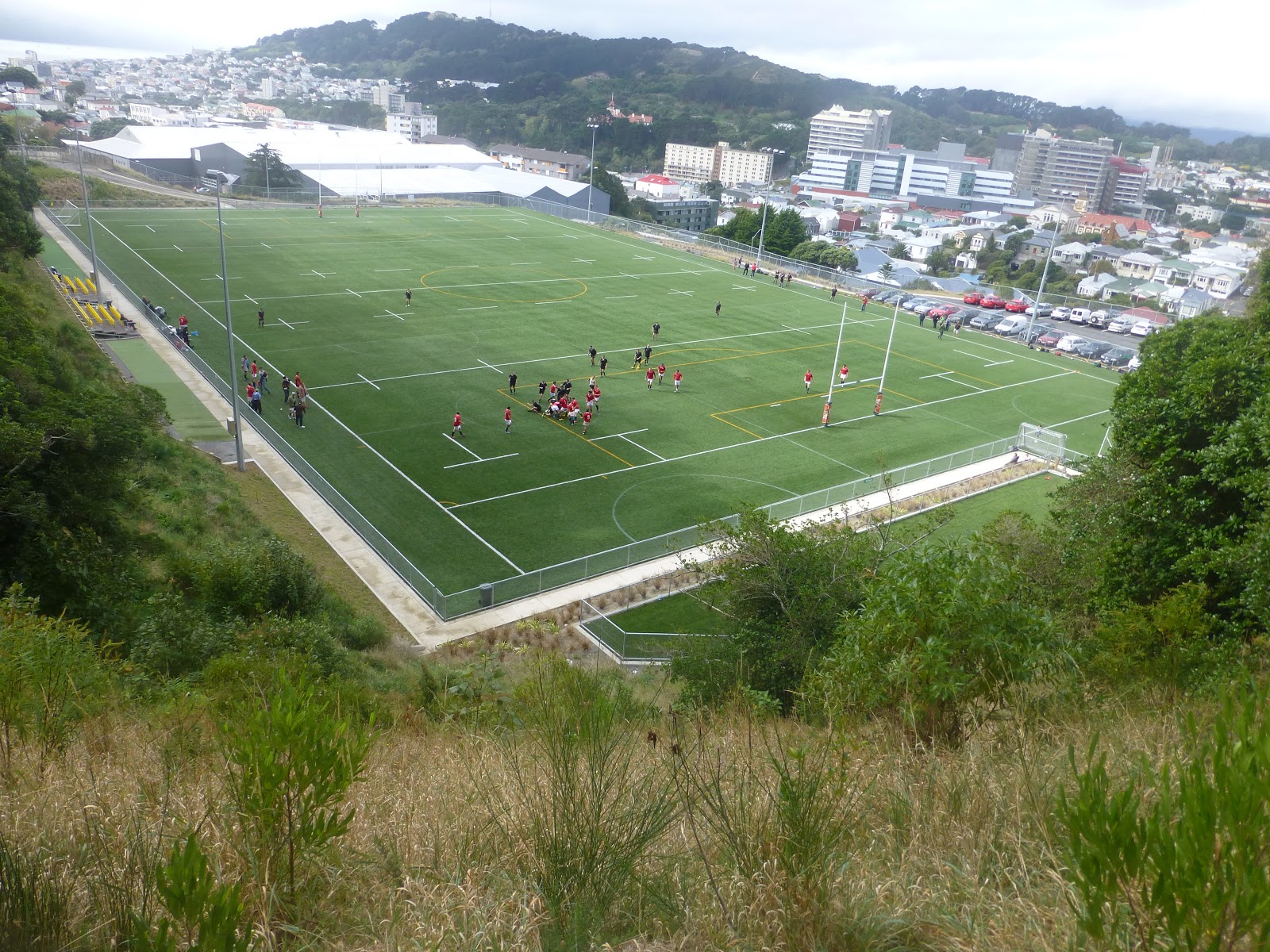
 Along the walk you will get to see sports fields that seem to crop up in the most unexpected places.


 A good but easy walk that is just over 13km. You are able to do sections of the walk if you wish.

City to Sea Map.

Southern Walk Way.

james/wildbaynz/windyhillflyingclub.

Wellington Walks: Belmont Regional Park.Puke Ariki Traverse

 What do you get when you add the following  Boulder Hill,Duck Hill,Dress Circle and Backed Beans Bend. With another 8  interesting names these add up to The Puke Ariki/Haywards Korokoro Traverse.(The Place of Leaders) It is a stunning walk that crosses the Belmont Regional Park in a almost a North/South line.
 It runs from the Dry Creek entrance (near Manor Park) all the way to Cornish Street in Petone.

 The views are absolutely breath taking and are well worth the climb of approx 200m from the Dry Creek car park. Walking through low scrub for the 1st part of the climb you come out to a grassy area where you get to see Boulder Hill and the exposed hill  for the 1st time.


 Each turn of the track gives you different views of Wellington and the Hutt Valley and with a continued  climb you then cross over a fence and then you are  on Boulder Hill surrounded by the boulders that gives it its name. Hang onto your hat here as if Wellington is blowing a gale this the place that you will experience the full effect of it.


 The views here give you a unbridled 360 views from The Hutt Valley to Wellington and its harbour and The East Coast with the towns of Porirua and Plimmerton.
 From here if you look south you get to see the first of the 62 concrete explosives magazine buildings. These were constructed for the WW11 Pacific Campaign.It is said that from the air the buildings look like chicken sheds.


 But (there as to be a but) its a long steep run down from Boulder Hill before you pick up a good gravel road called the Belmont Road. The road winds up and pass these building of which many are on private property but there are some that you can access and explore.
 The road then takes you pass a gas station and continues the winding its way around until you come across some pine trees and on the left a radio mast.
 From here you climb over the fence and cross the Airstrip. The track from here goes round or cross such places as Round Knob or the Dress Circle giving the continued views of the areas either side. The track at time follows the ridge line with not much room for error.

A while later you will see the Belmont Trig which at just over 400m is the highest point of the walk. Savour the views as there is nothing like it.


 There are a number of options from here but if intending to complete the whole walk then looking towards Wellington there is a track which is steep in places called the Belmont Trig South. This track heads down until it meets a strangle named track called Baked Beans Bend. ( So names after when a large tin of baked beans that had a group of Scouts had exploded.)


 This track follows a stream and it does involve at least 6 water crossing until you meet the track junction with Cornish Street track (right) or the Korokoro Dam track (left).


 The Cornish Street track follows the stream wall the way to Cornish Street,Petone and will take around a hour.
 If you are feeling fit and have the time take the track to the left and after about 20/30 minutes you will arrive at the Korokoro Dam.
 The site of the dam was chosen in 1902 by The Petone Borough Council with completion in 1903. At the time the water was used by the Wollen Company. As part of the usage of the water a Small dam was built 3km from the main dam as a storage point for the mill.


 The Dam was New Zealand gravity dam. It is 37metres long and is 8 metres at its highest point. In 1962 the dam stopped being used.
 All along the track you will see evidence old pipe’s either appearing in the track or in the river.


 You can either leave the park at the dam or head down to Cornish Street where you can access either the rail system and buses (Petone.) via Pito-one road to the footbridge to the rail station.

Brief Information:

 The park covers 3500 Hectares and includes 1200 Hectares of Waitangirua Farm. It is located between Petone in the south and Manor Park to the north, which is just north of Wellington.
 To the east of the park is the Hutt Valley and to the west is Porirua and the coast.
 The park was opened in 1989.

 There are a number of tracks that give access to the park so it can be explored in stages. The Traverse is 24km long and is a full days walk. Time is all dependant on level of fitness.

Important Information:

 Ensure that you are prepared. Take plenty of water and food. Ensure that you take clothing for all weather conditions.
 Let someone know where you are going and what time you are expecting to return.
 Take a phone (fully charged). Most areas you will get coverage but there are some blind spots.

Getting there: Train to Manor Park then a 10 minute walk to the Dry Creek Entrance. Then at the Cornish Street entrance it is a short walk to Petone Rail Station via Pito-one road to the footbridge to the rail station.

  Belmont Park Map   Includes all the tracks and additional information. A copy can be picked up from
                                     tourist information centre in Wellington.

Tracks NZ  A very good site for all the tracks and maps and a break down of useful information.

Metlink Timetables  Train and bus timetables

james/wildbaynz/windyhillflyingclub

Wellington Walks: Te Kopahou Reserve

 This is a large reserve that sits South West of Wellington. Its main boundaries is the South Coast from Sinclair Head/Red Rocks through to Owhiro Bay, Happy Valley Road to the Landfill Road to the East, and Hawkins Hill in the North.

 Within this area there are a number of walks of different lengths and grading. All can be interlinked giving the walker/rider a great variety of choices.

 I have broken the walks into a 3 areas.

Tip Track:  This also starts from the Happy Valley Road. The start is a metal gate that is located to the left to the main landfill road. Here you will find a good information sign of the walk and other points of interest and general information.
 The track is hard underfoot for most of the distance but does have loose rock on top.

 The track is just short of 4km. It makes height very quickly, working its way up through a mixture of scrub like plants. For the best part of the view from the track is the Southern Landfill and Gullies area. Also you get a good view of one of the major landmarks in Wellington. The Brooklyn Wind Turbine. It can be see from most of Wellington and the views from here gives some of the great views of Wellington and the South Coast. On a good day you can see the ranges of the South Island.
 As you twist and turn along the hill you will also glimpse a large building on the ridge above called the Castle.

You will cane across a tack on your left at about the half way stage another track called Spooky Gully. This track is about 1.5km. It joins the Tip Tack with the Red Rocks Track. Don’t let the distance deceive you. Although i have not walked it i have viewed it from both sides. It is steep in both directions. So be warned.
 With about 1.5km to go you will arrive on to a ridge that gives you some great views of the reserve.
 Within sight of the top you will come across a signed junction. Here you have a some choices depending on what you would like to do.
 Carry onto the top of the ridge. Here you can follow the tarmac road to the Wind Turbine and then down to Brooklyn, take the Red Rocks Track to your left. Lastly at the top take a left which will take you towards the Radar Building. This area is covered later.

 Red Rocks:  From the top of the ridge to Red Rocks it is more or less down hill, and it will in most places follow the ridge line before dropping down to Red Rocks.
 It is a little over 6km long and for most is good underfoot. There will be places that it can get soft underfoot and in the narrow places ruts are formed from the use of bikes on the track.
 The views from here are very impressive of the south coast and the Cook Straits.


 To your right you will see to the bottom of one of the valleys that winds its ways down to the coast. Also you will see another track called Radome named after the Aircraft Radar where it starts. This a very steep track in places.

James/ Windy Hill Flying Club

Wellington Walks: Eastern Walkway.


 The Eastern Walkway is one of the shortest walks that is in the Wellington area but it does gives you some good views and a couple of interesting places of interest at either end of the walk.

 You can start at either end of the walk and can be completed as a circular walk.The main place that most people will start from is Tarakena Bay, located between Moa Point and Palmer Bay on the Breaker Bay Road.


 From Tarakena Bay, take a short climb up to the Ataturk Memorial. He you will find the memorial to Mustafa Kemal Ataturk,the president of modern Turkey. At 2pm each ANZAC day a service of remembrance is held here.


The foreshore at Palmers Head was named (1975) as Wahine Memorial Park in memory of the sinking of the ferry Whaine on April 10th 1968
 Follow the road until it carries to the left, at this point follow up to the right where a short climb will take you to the ridge. Here follow the track as it works it way in and out of the trees and scrub giving you some great views across to the Cook Straits and across the Wellington Harbour entrance to the Pencarrow Lighthouses.


 After a while you will come to Breaker Bay. Located above the track is Beacon Hill Signal Station, It has been in operation since 1864 and operates 24/7. From here the staff controls the shipping in and out of Wellington Harbour. The views from here explains why the spot was chosen.  Access to the site is restricted and is not open to the public.


  As you head round under the Station you gently head down through the tree until you arrive at the main road. To your left is Seatoun and to the right takes you along the Breaker Bay road back to Palmers Head.

 Across the road you will see some more steps. These will take you to the Fort Dorset Conservation Reserve. He you will see the remains of old military gun battery. The views from here are stunning,giving a great view from Wellington all the way round along the south coast.

If starting from Seatoun you have the option,once you reach the Ataturk Memorial, you can head back along the road and then take a left. From here turn into Bowers Crescent followed by a left into Birkhall. You will come across a track that will take you through Rangitatau Historic Reserve.
 You will pass some airport electronic masts. Then you will come to some military bunkers above Moa Point giving you views of Lyall Bay and surrounding area.


 Additional Information:  Distance 2.5km each way
                                          Number 11 bus from Wellington to Seatoun then a 10 minute walk to start.
                                          Dogs allowed on leads only
                                          No Mountain Bikes
                                          Some of the tracks have been improved with further work expected.

Eastern Walkway Map     Downloadable Map.

 James/ Windy Hill Flying Club

Wellington Walks: East Harbour Ridge.

.ExternalClass .ecxhmmessage P {padding:0px;} .ExternalClass body.ecxhmmessage {font-size:10pt;font-family:Tahoma;}

This walk covers 3 main walks that follow the ridge above Eastbourne and the main East Harbour Regional Park.
The beauty of this area you can chose to do each sections as and when it suits you or any combination as you chose.
I chose to do this one mid week when the weather was cool but pleasant.Choosing to start at the furthest point of the walk I hoped off the bus at the Eastbourne Bus Barn depot, with a quick look across Wellington Harbor I head up the Bus Barn Track as it zig zag’s up the track stopping at times to admire the views and take some photo’s.

At the top of the track there is a lookout with some great views straight across to Seatoun and Somes Island.

A short track down you come across a junction. Straight on takes you to Butterfly Creek Picnic Area- a great area for the family to get away from the normal noise that is every day life.
After a look at the area i head back up and followed the track that follows Butterfly Creek,which criss crossing the creek in places.
 It had been raining a few days before hand so a little damp underfoot but this did not make the track difficult to walk.
 The track then slowly winds it way up until you reach another lookout. Another great views open up here and if you are lucky and have a good clear day you could see the South Island.

 Take a breather before deciding where you want to head to. There are 2 tracks that take you back down to Eastbourne Village. The 2 tracks are Murital Park Track or Mackenzie Track.

 For me that was to easy so i decided the 3rd option The Hawtrey Track. Not as well used when i joined it but clearly marked,
 Here you get lost in the trees with glimpse’s of the harbour but never really getting  a full picture. At times the track climbs over,round but never under, tree roots. The highest point is 343m but its never all down hill from here, as just as you think you have started the down hill, round the next corner or tree is another climb. Then at last you come out at the next main tracks. The first is the Kereru Track or after a short walk you come across Korimako Track, both bring you down to Days Bay. Both are steep in places so take care.
As with earlier and decided on the next option- to continue along the Main Ridge Track. Now there i was having a quiet rest having a bite to eat and something to drink a couple of track runners went passed as though they were on a stroll. How depressing.
 So not to be out done,feeling refreshed i head back onto the track. Walking the ups and downs of the track i enjoyed the quiet of the area but about 30 minutes later the same two runners passed me again and even worse not out of breath.

The final track options gives you 3 choices, Ferry Road Track, Kaitawa Track or head up to Lowry Trig above Wainuiomata where there are other track options,

I choice The Kaitawa Track with its steep descent down to York Bay.
The whole area is a great place for walking, with its different views, plant and animal life and a very quiet place to enjoy.
As you climb up or down you are likely to see areas of gorse which is helping to nurse the native plants as it would have been many years ago. Higher up is a mixture of Birch,Conifers and other Broad leaf trees. If lucky you may come across Orchids.
Listen out for the native birds having animated conversations with each other.I would very much recommend this area for the walks it has to offer.
 Getting There: If using a car there is plenty of parking but this may restrict how far you can go.
                           I used the bus service from Wellington that gave me the options to go as far as i felt
                           The 3 main bus routes that travel along the Eastbourne Road are 81,83,85.
                           Weekday services off more choice but the Weekend service is still good.
                           There are a number of bus stops along the road.
  Allow plenty of time to complete the walk/s but don’t completed more than you are capable of.  Be prepared for changeable weather and ensure that you carry food and water. Also tell someone where you are going and take a phone in case.
Further Information:
Maps can be picked up from Tourist office in Wellington and from the DOC office .
 EastHarbour and ButterFly Creek  Gives a good history of the area and a access to a map.

 Metlink Bus Timetable.  Also covers train timetables as well.


Orginally Posted 4th July 2012
James/ Windy Hill Flying Club

Makara Walkway:Views above the water

  Found this walk by accident a few years back when i had access to a car. Then it was a short visit to the village of Makara Beach  so had to wait until i had  the chance to borrow a car for the day.
 What took my breath away was the stark beauty of this small piece of the East Coast of the lower North Island. There are a  few houses that  are almost on the stony beach and  to one side a small river emptying  its water into the sea. To one side across the river are a number of batch’s nestling into the cliff with access by boat under normal conditions although it seems they can be reach by walking. Must be interesting to stay here when the weather is angry.
 Access to this area is best achieved by a vehicle from Karori, if biking take it easy as you head down the hill, its pretty steep and winding  in places.

 Take time to enjoy the drive as you pass the cemetery and then onto the village of Makara with its church and school (called The Model School). About 5 minutes late you are on the coast admiring the view.

 The walk is to the left as you look out to the sea. There is a very good map with details of the  walk and other useful information.
 The walk can be done as a circular one or as a same way return. Follow the well defined track for a while until you come across a sign. Follow the directions for the gun emplacements,this will take you up a steep slope where you will meet a few sheep. Take time to stop and admire the views. Follow the fence  and you will soon see the WWII gun emplacements which affords even more stunning views of the area and even Mana Island further north up the coast.

 You can also visit an ancient  Ngati Ira pa site on the promontory at the western end of Fisherman’s Bay.

 Once you reach Fort Opau you can explore what is left of the emplacements and maybe take a break.
 At its prime the fort had 2 6″ guns and housed around 100 men to man the area. The first gun was built late 1941 whist the 2nd was completed at the end of 1941 early 1942.

 It was decommissioned in 1943,strangely   before the war in the Pacific ended.
 From here you can either head back down the hill or follow the tack/road down to Opau Bay. This section will take you through a section of the Makara Windfarm.
 Once down at Opau Bay follow the coast keeping the sea to your left. Sections of the track still remain but overall it requires walking along a very stony/rocky beach but the effort is well worth it,
 If there is a high tide then this section may become difficult especially when you head back round Fisherman’s Bay.
 The coastal section you will come across a large selection of driftwood creating some wonderful images if you allow your imagination run wild.

 This is by no means a long or difficult walk but you will still need to be prepared for the unexpected. Warm clothing a must as well as water and food and a good set of sturdy footwear.

 The distance to the gun emplacements is approx  1.5km each way(2 hrs) or back via Opau Bay is approx 8km (3/4 hrs).
 The walk up to the Gun Emplacement’s is closed during lambing season which is generally Aug to Sept,although the coastal track is open all year round.

    Instead of heading back to Wellington  the same way, there is a interesting route not far from leaving Makara Beach. Follow the Makara Road until you come across a junction with Takakarui Gorge Road. At this point turn left and this road will take you along some wonderful valleys. Soon you will come across a junction, go straight over into Oharu Valley Road where you come out into Johnsinville. To your right you will see the radio transmitter on top of Mt Kaukau.

Please note: No dogs,camping,fires Mountain Biking or guns allowed.
 Makara beach is sheltered from the southerly winds but is very exposed to the northerlies. Care is required on any of the hill tops especially during strong winds.
 Prepare for all weather conditions,take water and food.
 Also let people where you are going.I found mobile coverage pretty good but let people know if you are running late.
 Keep any gate closed as there will be sheep around and respect any property around.

Useful Web Pages/Links.
http://www.doc.govt.nz/upload/documents/parks-and-recreation/tracks-and-walks/wellington/makara-factsheet.pdf

http://www.meridianenergy.co.nz/what-we-do/our-power-stations/wind/west-wind/

This was originally posted on 11th June 2012
James/ Windy Hill Flying Club.

Wairaka WalkWay Keeping Close to the water:Walks Behond Wellington


This is classed as easy walk but it is long. It can be completed 1 way or you can loop back to your starting point.

I came across this walk by accident after looking at the map of the area for something else, it was then a matter of waiting for the right day.

That day arrived early March 2010 with a wonderful day dawning. A quick bus trip to Wellington Rail Station then a pleasant run on the train to Pukerua Bay. (Note that Muri Station is now closed).

Savour the view before you head down Pekerua Beach Road to Brendan Beach ( oddly enough the road name gives it away.) On a sunny day the views are stunning and on those odd days that are wild you can a true feeling what the West Coast can offer.

Either follow Ocean Parade or walk on the beach until the road becomes a tack. This is the last chance for a toilet break until Plimmerton .

The track follows closely to the water and is well used so easy to follow. Above you is the Raroa Reserve. Not to far along you go through a rock hole which clearly shows what nature can do with its power.
Continue along until you arrive at Wairaka Point,here you go through an strange gate made of wood/metal which seems to hangs from the rock.
Say hello to the goats if about. They may give you a good stare but they are all good.
At this point the track becomes rocky and there are areas where the track has disappeared but saying that it is still walkable.Care is required.

Along the way i came across a couple of spots where people have spent some wonderful evening enjoying the views as well as the peace and solitude.

Eventually the track ends and becomes a road.This made the rest of the walk easier. Not far from where it becomes a road is a quarry so care is needed. if walking it during the week but you should not encounter any traffic if its the weekend.

You will pass a building where someone has done some wonderful things with driftwood and wood scraps.

Continue along the coast road where you are afforded some great views of Onehunga Bay and The Titahi Bay area.(The Whitireia Park Reserve has recovered well from the scrub fire a couple of years back). Also you get a good view of Mana Island.

If you are planning to do the loop back to Pukerua Bay then just before Plimmerton School take a left turn into Motuhara Road,then a right into The Track. Taua Tapu Track starts at the end of the road. Follow this track which heads up to the hills where the views are even more stunning.You will drop back down towards the Taru Cemetery and the track follows between SH1 and the railway until you arrive back in Pukerua Bay.

If not planning to do the loop,continue along the road passing a marina until you arrive at Plimmerton Rail Station.

Just before the station you will come across a couple of cafes for a well earned drink or 2.

The main part of the coast track is not suitable for bikes.

Distance is around 17km for the loop whilst around 12km for station to station. I allowed myself around 4 hours for the 1 way walk, the loop would be around the same. Allow extra for stops or taking photo,s.

Good footwear is required plus food and water a must. Ensure warm/wet weather gear is carried as things can change quickly.
Also let someone know where you are heading and expected to return.

Originally published 24th May 2012
James/ windy hill flying club.

Red Rocks and Karori Light House: Wellington Walks


 By far, this walk from Owhiro Bay to Red Rocks (Pari-whero) along the North Islands’ South Coast must be the most popular walk in the Wellington area for familys and people of all ages, and i can understand why.

 For most people they will park their car at the visitor centre at the end of the Owhiro Bay Road which is about 2km from Owhiro Bay.
 Have a look at the Visitor Centre where there is some very good information about local shipwrecks and also the now not used quarry not far from the start of the walk.

   The track itself  forms the edge of the Te Kopahau Reserve which covers the area above the coast all  the way up to the Brooklyn Wind Turbine and Happy Valley Road up to Brooklyn.

 The 1st thing that you will notice when starting the walks is the scares left on the cliffs from quarrying that was still in use a late as the 1990’s. The walking track is also used as a road for 4×4’s,trail bikes both motor and pedal power.

 You 1st come to the point where the Red Rocks. The rocks were formed over 200 million years ago by underwater volcanic eruptions. The rocks are pillow Lava which contain iron oxides hence the red colouring.

 This area is also classed as a area of national significance with a wealth of Maori history and interesting geology.

 The Maori stories relating to the colours include Kupe who’s had was clamped by a Paua (type of shell fish), which broke the skin and the blood stained the rocks. Another story involves Kupe’s Daughters, legend has it that they slashed themselves in grief over their fathers safety on a long voyage away.

 At Red Rocks there are four baches (beach houses) that in 2002 were  registered as a Historic Area by NZ Historic Place Trust.. These were built in the early 1900’s have been maintained to the original design by the owners.


 From here there is access to the Te Kopahou Reserve. There is a good information board with a map. The tracks are well used and marked.

 Once you walk around Red Rocks you head to Sinclair Head and Devils Gate where you  will find the Fur Seal Colony. During May to October you will find Males who have not been lucky in finding a mate. As there are no females within their young you will find them less aggressive but bear in mind that if there are lot of people around they may become aggressive. So keep your distance.


 For most people this will be the place where most people will take a break and have rest and enjoy a picnic,whilst watching the world go by. Including boats of all sizes from the smallest fishing boats to the Ferries of the 2 Companies that sail between Wellington and Picton. After a break most people will head back.
 On the top of the headland are some bunkers that formed a defensive line along the South Coast/Cook Strait.
 You will see the effects of erosion that will occur along this stretch with the road being washed away at times.

 Now let me take beyond Devils Gate and onto Karori Light House.


  For the 1st part of the track it is still easy to walk on but eventually become more soft shingle/sand or pebbles. This will make the work a lot more tiring,therefore walking will become slower. You will see more vehicles and motor cross bikes.

 You will come a section of Dunes that has been fenced in. This is to protect the Dunes from damaged by vehicles as its the last section of natural/wild dunes in the Wellington area.


 A short distance later you will come along Long Gully where you have a stream to cross. You will catch glimpses of the Light House in the distance.
 You will cross another gully with some Bache’s set back. From this point you will have about another 40minutes to go.


 When you arrive it will be well worth it.Here you will see the Karori Lighthouse and great views of the South Island.
 Yes it does look like it is on a slant, it was built that way with 1 side at a angle where the ladder is and it stands at 39′ high. It was decided to build a Lighthouse at Karori Rock after the loss of a Steamer boat,  The Penguin. It was turned on in October 1915 and was in use until 1996 when it was replace by a new light on the main land on Tongue Point.

 As with Sinclair Head you will find a Fur Seal Colony. So take care whilst they are about.


 General Information:  Distance from Owhiro car park to Sinclair Head approx 4km. Allow around 2/2.5
                                      hrs to complete both ways.
                                      Distance from Sinclair Head to Karori Head Approx 7km. Allow at least 7hrs
                                      from Owhiro car park for both ways. Total approx 11km each way.

                                      Take water and something to eat and be prepared for the change in the weather
                                      and have some good walks shoes if going to Karori Rocks.

                                      Be aware of vehicles when on the section between Sinclair Head as they
                                      will not stop when crossing the softer sand.

Getting There:              By car to Owhiro Bay.
                                       Bus. There is limited service during the week to Owhrio Bay #29,  with no service
                                       at weekends. The nearest regular service from Wellington is the # 1 to Island Bay
                                       from Wellington.  Bus Timetable

Friends-of-Owhiro-Stream/

james/ windy hill flying club.                      


.phone .label {font-size:14px;}

.