
This is a stunning track and i believe one of the best that Wellington has to offer. This can be completed in stages or short loops or if feeling up to it it can be completed in one go.
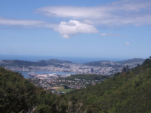
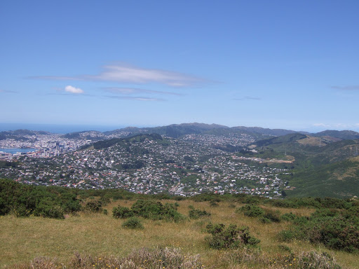
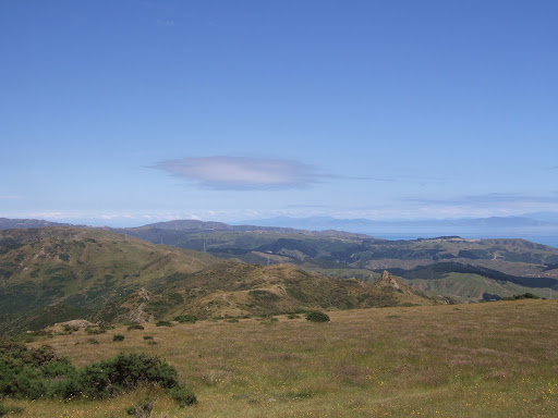
I have completed the whole track twice and about half of it on another. I have found on the best days that Wellington can produce it is stunning with some fantastic views of Wellington, its harbour and as far as Seatoun, the Miramar Peninsula and airport to the East, and to the West the Tasman Sea and at the Karori end of the track, Makara Windfarm and the South Island( if luck snow on the hills).
On the other side i completed it with a misty/rain around and no wind at all which gave a feeling of mystic of what you would come across at the last moment.
The walk can be completed from either the Johsonville end of the track or from Karori. For me the best way is from Johnsonville.
From Wellington catch the train to Johnsonville (end of the line). From here head to the Carmichael Street where you will pick up the start of the track. The walk from here is well marked and the track is well used. You will see signs to the Old Coach Road which was one of the 1st roads that connect Jville and Ohariu Valley.
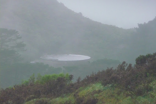
On the way up to Mnt Kau Kau will pass the Jville Reservoir to the west and not far from here is the now disused outlet pipe from the reservoir.
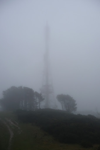
Continue along the track which will be signed posted to Mnt Kau Kau with its impressive transmitter. On the good days its a good point of view of where you will head to but on the days where visibility is not so good and if there is no wind you will hear the humming of the transmitter well before you see it.
The transmitter was a replacement for the Mnt Victoria one which can be seen on the other side of the harbour
The track will wind up and around some small hills but the last section to Mnt Kau Kau is short but steep.
This is a great place to rest and take in the views,with a good viewing platform which give you the views Wellington. (strangle not so on the misty days)

On both occasions at this point there were so few people around it was wonderful but those trail runners who came out of the mist and then disappeared into it again almost was something out of a horror film. Not sure if listening to “Calling All Angels” by the group Train made a difference.
Take in the sounds and if lucky you may here some Tui’s having a conversation. Or on a misty day with limited vision you may find that you are being watch and there is a very good chance that you are by the herds of cows that graze in places.

From here is one of the places where you can leave the track and head straight down to Jville.
With the transmitter to your right you will see the ridge that you will follow. Follow the markers which takes you down the hill.

The next section of the track heads above and around Ngaio until you come across a track to your left called Bells Track. If you wish you can take this to leave the Skyline and it will take you to Ngaio,
Along this section of the track you will go round to the West of the hills giving you views of the valley below and splendid views of the Tasman Sea.
The next track to take you off the Skyline will take down to Otari-Wilton Bush/Chartwell and on to Karori.
At this point you will head down hill slightly on a farm road which is called the Kilmister Tops. On your left you will pass a brick chimney like structure (almost like a large Pizza oven or fancy BBQ)

Continue along the track until you end up on the Eastern side of the hill giving you views of the Karori valley.
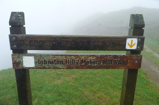
You will start to loose height at this point.At Johnston’s Hill you will see Karori at which point you can also leave the track.

The last section is not overly long. It will wind along behind some houses passing two Reservoir tanks.
You will then enter a pine forest, which after its rained produces that wonderful smell of fresh pine.
The track is still well signed posted and it will take you down through the pines until you end up walking through the Karori Park and Play area ending up on the Karori road. At this point you will be able to catch the # 3 bus back into Wellington.

The track offers great views but by doing so there is very little shelter with no trees to offer protection until the pines above Karori or a few near Kilmister Tops.
Other exit points also include Crofton Downs which follows a good motor track below the pylons.
With a walk like this that follows a ridge line you have to be prepared for the hot days taking plenty of water, sun hat and suncream.
Warm or wet weather gear is also recommended as like any place the weather can change quickly.
Also dogs must be kept on a lead, remove litter. Also there is no camping, fires or Mountain Biking allowed.

Also please remember that the tack is made possible by the local land owners who have allowed access to their land. Keep to the marked tracks and close any gates that you need to open.Respect and be careful of animals that you may come across.
Saying this, enjoy this walk because it is well worth the effort. Maximum height will be around 400 metres.
The walk it self is approx 15Km long so depending on weather and the direction you decided to head allow around 5/7 hours.
Let someone know where you are going and when you expect to be home, Mobile reception is good in most areas of the walk.


Also part of the track forms part of the Great New Zealand Walk Track Te Araroa Walkway from top of the North Island to the bottom of the South Island.
Getting There: By Bus and or Train.
Train and Bus timetable.
James/Windy Hill Flying Club
