This is a large reserve that sits South West of Wellington. Its main boundaries is the South Coast from Sinclair Head/Red Rocks through to Owhiro Bay, Happy Valley Road to the Landfill Road to the East, and Hawkins Hill in the North.
Within this area there are a number of walks of different lengths and grading. All can be interlinked giving the walker/rider a great variety of choices.
I have broken the walks into a 3 areas.
Tip Track: This also starts from the Happy Valley Road. The start is a metal gate that is located to the left to the main landfill road. Here you will find a good information sign of the walk and other points of interest and general information.
The track is hard underfoot for most of the distance but does have loose rock on top.

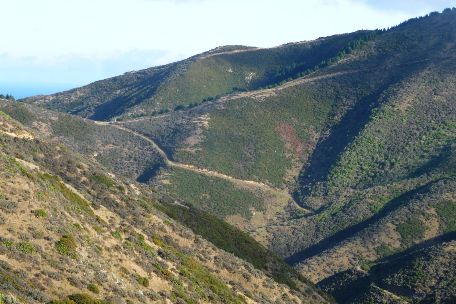
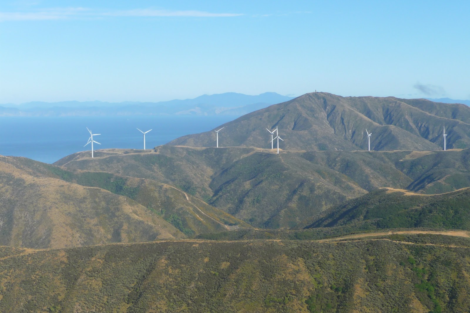
The track is just short of 4km. It makes height very quickly, working its way up through a mixture of scrub like plants. For the best part of the view from the track is the Southern Landfill and Gullies area. Also you get a good view of one of the major landmarks in Wellington. The Brooklyn Wind Turbine. It can be see from most of Wellington and the views from here gives some of the great views of Wellington and the South Coast. On a good day you can see the ranges of the South Island.
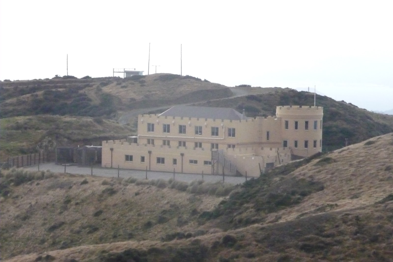
As you twist and turn along the hill you will also glimpse a large building on the ridge above called the Castle.
You will cane across a tack on your left at about the half way stage another track called Spooky Gully. This track is about 1.5km. It joins the Tip Tack with the Red Rocks Track. Don’t let the distance deceive you. Although i have not walked it i have viewed it from both sides. It is steep in both directions. So be warned.
With about 1.5km to go you will arrive on to a ridge that gives you some great views of the reserve.
Within sight of the top you will come across a signed junction. Here you have a some choices depending on what you would like to do.
Carry onto the top of the ridge. Here you can follow the tarmac road to the Wind Turbine and then down to Brooklyn, take the Red Rocks Track to your left. Lastly at the top take a left which will take you towards the Radar Building. This area is covered later.
Red Rocks: From the top of the ridge to Red Rocks it is more or less down hill, and it will in most places follow the ridge line before dropping down to Red Rocks.
It is a little over 6km long and for most is good underfoot. There will be places that it can get soft underfoot and in the narrow places ruts are formed from the use of bikes on the track.
The views from here are very impressive of the south coast and the Cook Straits.


To your right you will see to the bottom of one of the valleys that winds its ways down to the coast. Also you will see another track called Radome named after the Aircraft Radar where it starts. This a very steep track in places.

At over half way you will see a sign for the Waipapa Loop. This will take you down to the valley below and then back to the Red Rock Track. This track can be used to join up with the Te Kopahou/Bunker Track. The sections at either end are steep so not to be completed lightly.
Not long after the junction you will make a short steep climb up. Here you will see the Cook Straits in its glory (on a good day) and below you the coastal track from Owhiro Bay.

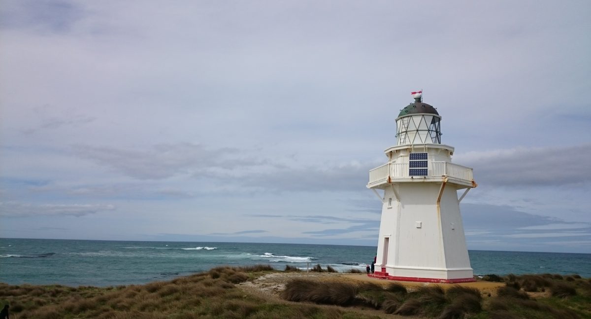
This will be a good place to catch a breath and take in the views. The last section downhill is steep. You will the come out onto the coastal track. The track exits in between some Bach’s. To your right is a short walk to Red Rocks/Sinclair Head and the seal sanctuary.
From here you can walk along the coastal road to Owhiro Bay and onto Happy Valley and Island Bay.
Te Kopahou/Bunker Track: This is the longest of the walks in the area.It is about approx 9km.From the Radom take the right track. The first part up to the highest point at Te Kopahou it is very straight forward with a good base underfoot.
You afforded good views of the whole reserve to your left and the Cook Straits in the distance, also to your right you will see the Makara Wind Farm and below Long Gully.
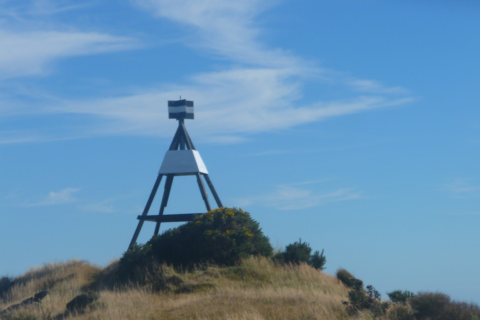
It is a very gentle down hill until you arrive at a Trig Point. Down to your right you will a road. This is part of Long Gully and is private property. To the left you will see a track. At this point it starts to become steeper although good underfoot.

In front of you at some distance you will catch a glimpse of the WW2 Observation Post Bunkers. It will become deceiving When you thing you are there you come across a steep down section. At the bottom a quick short climb will bring you to the best views that the area has to offer.


Here you will have the best views on offer. Take time to enjoy. To get down to the Red Rocks track head back down the short climb that you have climbed. To your right are some yellow markers. This will take you down a gully with a stream. Take care has its damp and steep.
At last you will arrive at some Bach’s. You will then have a short walk to Sinclair Head to your right or head back to Owhiro Bay.
Overall this is a wonderful area for walks and mountain biking. The views are simple stunning and overall you will not come across to many people making the walks so much more pleasant.
The area is exposed so go prepared. Warm and waterproof clothing required, water and something to eat a must as well as good footwear.
Accessing the area: The only parking area that is available 24/7 is the car park at Owhiro Bay. The wind turbine at Brooklyn is available from 8 to 5 during the winter and 8 to 8 during the summer.
Accessing the area from the Turbine is via the road until you arrive at “The Castle”. The distance is approx 3km.

Buses: # 7 from Wellington to Brooklyn. A 3km walk is then required to reach the Wind Turbine.
# 1 to Island Bay followed by a 40 minute walk to get to Owhiro Bay.
Give yourself time to completed what ever route/s you are planning to do and let someone know where you are going. Mobile phone coverage is good in most places.

James/ Windy Hill Flying Club
